
Weekly Severe Weather Outlook Expands From Texas Oklahoma Kansas Into Missouri Illinois and Midwest So Residents Should Watch This Escalating Storm Pattern Closely
UNITED STATES — A new week-long severe weather outlook is signaling a gradually intensifying storm pattern across the central United States, beginning with limited activity late this week and building toward a potentially more significant threat early next week.
The evolving setup shows a classic west-to-east progression, with the southern Plains serving as the starting point before storms expand into the Midwest and surrounding regions.
Thursday Through Saturday Start Quiet but Gradually Improve for Storms
The early part of the period, from Thursday through Saturday, is expected to feature:
- Limited moisture across much of the Plains
- Storms that are more isolated and less organized
- A focus on hail-producing storms rather than widespread severe weather
States impacted during this phase include:
- Texas
- Oklahoma
- Kansas
- Parts of Nebraska
While severe storms are possible, the lack of deep moisture will keep activity somewhat restricted. However, each day shows gradual improvement in conditions, signaling a transition toward a more active pattern.
Sunday Begins Transition to More Dangerous Setup
By Sunday, the environment begins to change more noticeably.
Key signals include:
- Increasing moisture return from the Gulf
- Better instability developing across the Plains
- Stronger storm organization potential
Areas at risk expand across:
- Oklahoma
- Kansas
- North Texas
- Into parts of Missouri and Arkansas
Any storms that develop during this phase could carry all severe hazards, including hail, damaging winds, and tornado potential.
Monday Expands Risk Into Midwest and Corn Belt
Monday appears to build on Sunday’s setup, with even more favorable conditions developing.
The storm zone expands into:
- Missouri
- Illinois
- Iowa
- Eastern Kansas
- Arkansas
Key changes include:
- A larger warm sector developing
- Increased atmospheric energy
- Greater coverage of storms
This suggests a higher ceiling for severe weather, including stronger and more widespread storms across the Midwest corridor.
Tuesday Shows Highest Potential Across Multiple States
Tuesday stands out as the most concerning day in this outlook.
The data indicates:
- Peak atmospheric dynamics aligning
- Strong jet stream support overhead
- Broad severe weather coverage possible
States most at risk include:
- Texas
- Oklahoma
- Kansas
- Missouri
- Illinois
- Arkansas
- Mississippi
This day carries the highest potential for a significant severe weather event, with all hazards possible and storms potentially becoming more organized and impactful.
Wednesday Remains Uncertain but Could Extend Threat
Looking ahead to Wednesday, uncertainty increases, but there is a notable concern:
- If the upper-level trough slows down
- Storm activity could continue or redevelop
- Additional severe weather rounds may occur
This could extend the multi-day threat even further across parts of the Midwest and central U.S.
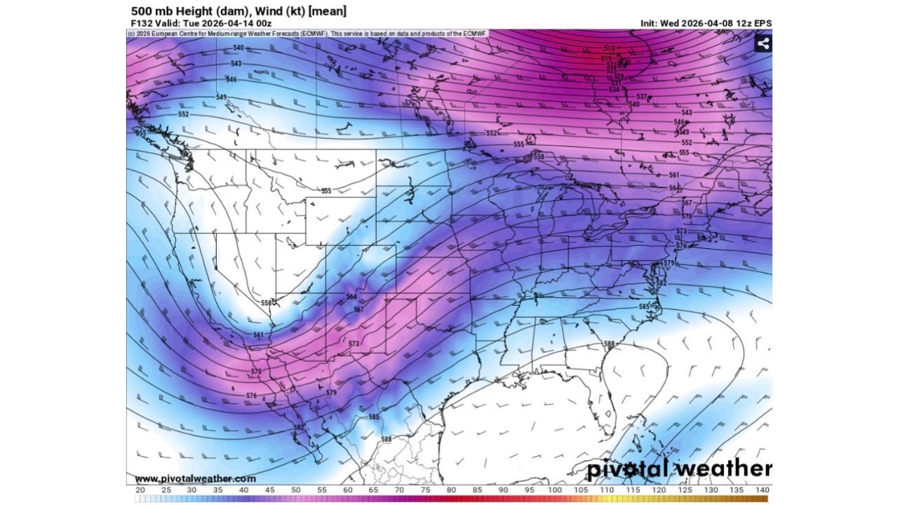
What Is Driving This Pattern
The overall setup is being driven by:
- A strong upper-level trough moving out of the western United States
- Increasing jet stream energy across the Plains and Midwest
- Gradual moisture return from the Gulf of Mexico
This combination supports a multi-day severe weather environment, where conditions improve over time rather than peaking all at once.
Areas to Watch Closely
The highest overall concern through this period spans:
- Texas
- Oklahoma
- Kansas
- Missouri
- Illinois
- Arkansas
- Iowa
These regions could experience multiple rounds of storms, increasing cumulative impacts.
Final Outlook
This developing pattern highlights a building severe weather threat that peaks early next week, especially across the southern Plains into the Midwest.
While the early days remain more limited, the transition into Sunday through Tuesday signals a much more active and potentially dangerous setup.
Residents across these states should begin monitoring updates now as this system evolves.
Stay with WaldronNews.com for continued updates as this multi-day severe weather pattern develops and expands across the country.