
Wyoming High Wind Watch Issued as Southeast Wyoming Braces for 60–65 MPH Gusts Late Monday Night Into Tuesday Afternoon
WYOMING — After a brief lull, dangerous high winds are expected to return to southeast Wyoming late Monday night and continue through Tuesday, prompting the National Weather Service to issue a High Wind Watch for multiple wind-prone areas. Forecast guidance shows wind gusts reaching 60 to 65 miles per hour, creating hazardous travel conditions and the potential for localized impacts.
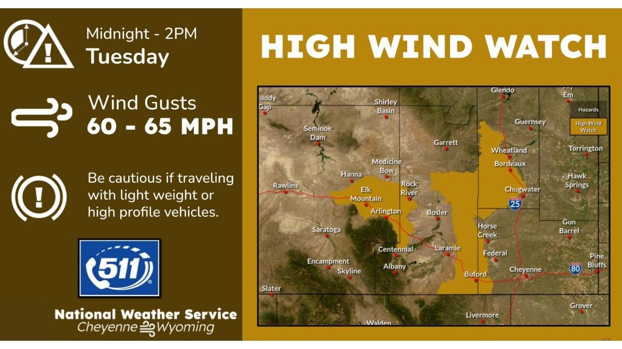
High Wind Watch Timing and Coverage
According to the National Weather Service office in Cheyenne, the High Wind Watch is in effect from around midnight Monday night through 2 p.m. Tuesday. The watch includes well-known wind corridors and surrounding communities across southeast Wyoming, where strong pressure gradients and terrain effects often amplify wind speeds.
Areas highlighted include locations near and along:
- Interstate 25, including the Cheyenne area
- Interstate 80 between Laramie and surrounding high plains
- Wind-prone zones near Wheatland, Chugwater, Arlington, Elk Mountain, and Bordeaux
Why Winds Will Be So Strong
This wind event is being driven by a strong upper-level disturbance and tightening surface pressure gradient, a common setup for southeast Wyoming. As colder air aloft moves across the region, downslope winds will accelerate through gaps and passes, especially during the overnight and morning hours.
Winds are expected to increase rapidly late Monday night, peak Tuesday morning, and remain strong into early afternoon before gradually easing.
Travel Impacts and Safety Concerns
Wind gusts in the 60–65 mph range can be especially dangerous for:
- Lightweight vehicles
- High-profile vehicles, including semis, campers, and trailers
- Travel along east-west routes such as I-80
Blowing debris, difficult steering conditions, and sudden crosswinds are all possible. Travelers are urged to check road conditions through 511 and be prepared for sudden travel restrictions if winds intensify.
What a High Wind Watch Means
A High Wind Watch indicates that conditions are favorable for high winds, but the exact strength and coverage are still being refined. If confidence increases, the watch may be upgraded to a High Wind Warning.
Residents should use this time to:
- Secure loose outdoor objects
- Plan travel carefully, especially Tuesday morning
- Monitor updated forecasts and alerts
What to Expect Next
Forecasters will continue to evaluate wind trends overnight. Even a small change in wind direction or atmospheric mixing could determine how widespread the strongest gusts become.
Residents across southeast Wyoming should stay alert for possible upgrades or additional advisories as the event draws closer.
Stay with Waldron News for continued updates, travel advisories, and the latest information on this developing high-wind event across Wyoming.