
Winter Storm Potential Emerges for North Carolina, South Carolina, Virginia, and Tennessee as Forecast Models Signal Colder January Pattern
UNITED STATES — Long-range weather models are beginning to hint at a possible winter storm setup across parts of the Southeast, including North Carolina, South Carolina, Virginia, and Tennessee, as a colder pattern gradually takes shape heading into mid-January.
Meteorologists stress that this system remains well outside the reliable forecast window, often referred to as the “fantasy range.” While the early signals are notable, experts caution that no specific snowfall totals or storm tracks should be taken as a forecast at this stage.
What the Early Models Are Showing
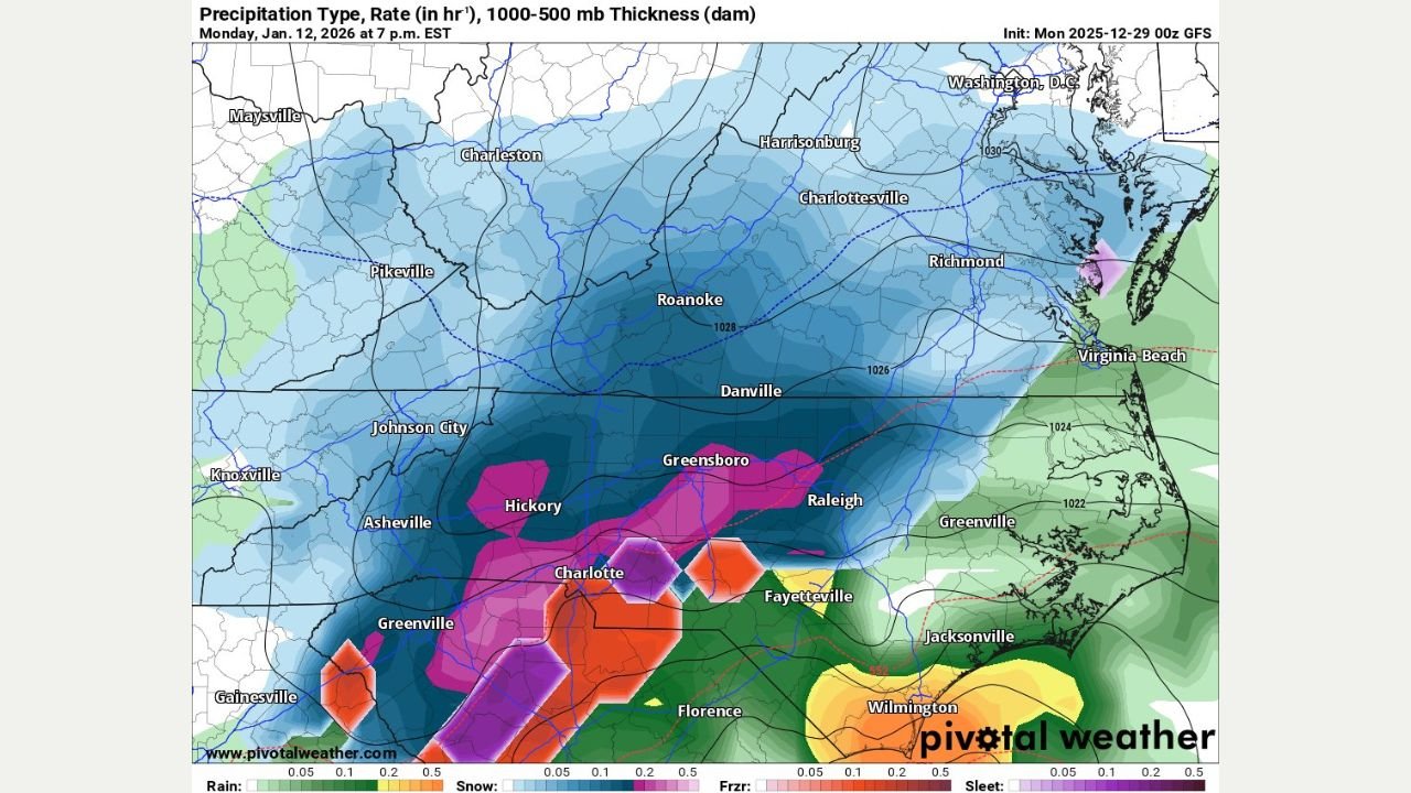
Current model guidance suggests a developing low-pressure system interacting with colder air across the Southeast sometime between January 7 and January 12. Several simulations show:
- Cold air pressing southward into Tennessee and Virginia
- A moisture-rich system tracking across the Carolinas
- Potential overlap of cold air and precipitation — a key ingredient for winter weather
At this range, model maps primarily serve as pattern indicators, not outcome guarantees.
Why Forecasters Are Urging Caution
Weather experts are pushing back strongly against exaggerated snowfall graphics circulating on social media. At this distance:
- Small shifts in temperature could mean rain instead of snow
- A slight track change could move impacts hundreds of miles
- Model output can change dramatically from run to run
Forecasters emphasize that these images are not forecasts, but rather tools used to monitor whether a favorable pattern is developing.
Why the Setup Is Still Worth Watching
Despite the uncertainty, meteorologists note that the overall atmospheric pattern is trending colder, increasing the potential — not certainty — for a winter storm somewhere in the region.
A strong jet stream, colder air availability, and increasing storm energy are ingredients that often precede significant winter systems in the Southeast, even if the final outcome remains unclear.
What Residents Should Do Now
At this point, no action is required, but residents across:
- North Carolina
- South Carolina
- Virginia
- Tennessee
should stay aware of updates as the forecast window shortens. Reliable details typically emerge within 5–7 days of any potential event.
What Comes Next
Meteorologists expect much clearer guidance later this week as models move closer to the event window. If the signal remains consistent, confidence will increase — or fade — accordingly.
Until then, experts advise ignoring viral snow maps and relying on official National Weather Service updates and trusted local forecasts.
Stay with WaldronNews.com for verified weather updates, clear explanations, and no-hype forecasting as this developing winter pattern evolves.