
Florida, Georgia and South Carolina Face Marginal Storm Risk Sunday as Cold Front Sweeps the East Coast After Historic Midwest Outbreak
JACKSONVILLE, Florida — After two days of tornado outbreaks, embedded QLCS tornadoes, and 70 mph winds tearing across the Midwest, the storm system responsible for all of it is pushing east — and by Sunday April 19, the trailing cold front will sweep down the East Coast, bringing a marginal severe weather risk to Florida, Georgia, and South Carolina while the rest of the country finally gets a break.
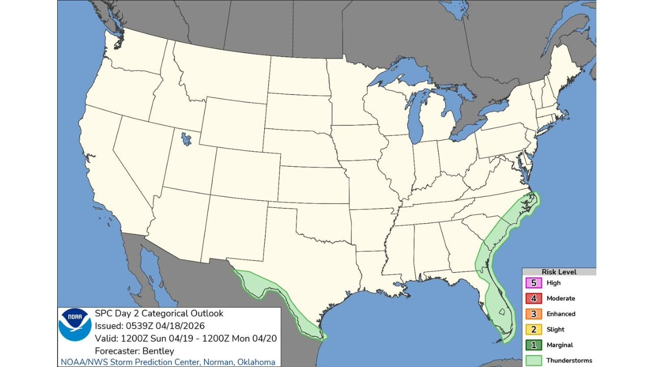
The Day 2 Categorical Outlook issued just after midnight Saturday shows two separate areas of storm risk for Sunday — a marginal risk zone running along the entire East Coast from the Carolinas south through Florida, and a separate thunderstorm area across far southern Texas along the Gulf Coast. The massive outbreak zone across the Midwest that dominated the weather map for two straight days is completely clear — Sunday is a dramatically quieter day for most of the country.
Areas Watching Storm Chances Sunday
- Florida: Jacksonville, Daytona Beach, Orlando, Tampa, Fort Myers — the entire Florida Peninsula east coast and interior watching for storm activity as the cold front sweeps through Sunday
- Florida: Miami and South Florida on the southern end of the marginal risk zone as the front pushes into the peninsula through Sunday afternoon
- Georgia: Savannah, Brunswick — coastal Georgia communities on the northern edge of the marginal risk area
- South Carolina: Charleston, Hilton Head, Myrtle Beach — the Carolina coast watching for storm activity as the front pushes through Sunday
- North Carolina: Outer Banks and coastal communities on the far northern fringe of the storm risk zone
- Texas: Far south Texas along the Gulf Coast watching a separate area of thunderstorm development unrelated to the main East Coast front
What Marginal Risk Means for Florida and the Carolinas
A marginal risk — the lowest level on the severe weather scale — does not mean the weather Sunday is dangerous in the way the past two days were across Iowa, Illinois, and Wisconsin. But it does mean isolated severe storms are possible, and communities along the Florida coast and Carolina coastline should be aware.
- Isolated strong to marginally severe thunderstorms possible as the cold front sweeps through Sunday — primarily during the afternoon hours
- Gusty winds and lightning the main threats with any storms that develop — damaging wind gusts to 40 to 50 mph possible with the stronger cells
- Brief heavy rain — the front is moving through a moisture-rich environment along the coast, meaning rainfall rates could be locally high with stronger storm cells
- Marine impacts — any severe storm activity along the Florida and Carolina coastlines will create dangerous conditions for boaters and beachgoers Sunday afternoon
The Bigger Picture — After the Outbreak
Sunday’s quiet map across the Midwest and Plains represents a dramatic contrast to what the region endured Friday and Saturday. The cold front responsible for tornado warnings from Iowa to Illinois, embedded QLCS tornadoes through Bloomington and Decatur, and severe thunderstorm warnings across Indiana and Tennessee has now fully pushed east and south.
Behind the front, cold and dry air settles across the Midwest and Central Plains — giving communities from Des Moines to Chicago to Nashville their first truly quiet weather day after an exhausting severe weather stretch. Temperatures behind the front will be noticeably cooler Sunday across the Midwest, with the cold air mass that produced snow in Colorado now spreading east.
The East Coast receives the final chapter of this system Sunday as the front sweeps through — a much weaker and less organized threat than what the Midwest experienced, but still worth awareness for Florida and Carolina residents heading into Sunday.
What Florida and Carolina Residents Should Know for Sunday
- Afternoon is the primary storm window Sunday — morning hours look relatively quiet as the front approaches, with storm chances increasing through the afternoon
- Beach and outdoor plans — have a backup plan and know your nearest shelter location if storms develop along the coast Sunday afternoon
- Boaters and marine interests — stay off the water Sunday afternoon if storm activity develops along the Florida or Carolina coastlines
- Florida Peninsula interior — Orlando and Tampa area residents watch for storm activity pushing west across the peninsula through Sunday evening
- Not a tornado outbreak day — Sunday’s risk is marginal and isolated, a very different situation from the multi-day outbreak that just concluded across the Midwest
The worst of this two-day severe weather stretch is behind us for most of the country. Florida, Georgia, and South Carolina get a minor closing chapter Sunday before the atmosphere finally settles down heading into the early part of next week.
WaldronNews.com will continue tracking Sunday’s storm chances across Florida and the Carolinas and provide full coverage as the post-outbreak weather pattern evolves through the weekend.