
Missouri, Illinois, and Kentucky See Mid-January Weather Shift as Severe Storm Threat Trends Lower and Warmer Pattern Builds
MISSOURI — A noticeable mid-January weather pattern change is taking shape across parts of the central United States, with updated forecast data showing a downgrade in severe weather potential while warmer air spreads northward into Missouri, Illinois, Kentucky, and surrounding states later next week.
Recent model guidance indicates that while a storm system is still expected to move across the Plains and Midwest, key ingredients needed for widespread severe weather appear less favorable than earlier projections, particularly due to declining moisture availability.
Forecast Models Show Reduced Severe Storm Risk
Updated model runs, including late-day guidance, show a less aggressive setup for severe thunderstorms across Missouri, Illinois, and Kentucky as the system evolves. While earlier projections hinted at a stronger severe weather signal, moisture trends have weakened, limiting instability across the region.
Forecasters note that severe potential remains conditional, meaning any stronger storms would depend on a last-minute surge in Gulf moisture — something that has not consistently appeared in recent data.
This shift does not eliminate storm chances entirely, but it does suggest a lower overall risk compared to earlier expectations.
Jet Stream Pattern Favors Warmer Air Intrusion
Upper-air analysis shows a strong jet stream lifting northward, allowing milder air from the southern Plains and Gulf region to push into the Midwest and Ohio Valley. This pattern supports above-normal temperatures across Missouri, Illinois, Kentucky, and nearby states heading into mid-January.
Temperature projections show highs rising into the 40s and 50s in several areas, a notable change from earlier colder outlooks. This warming trend is also consistent with broader model signals pointing toward a temporary breakdown of the colder winter pattern.
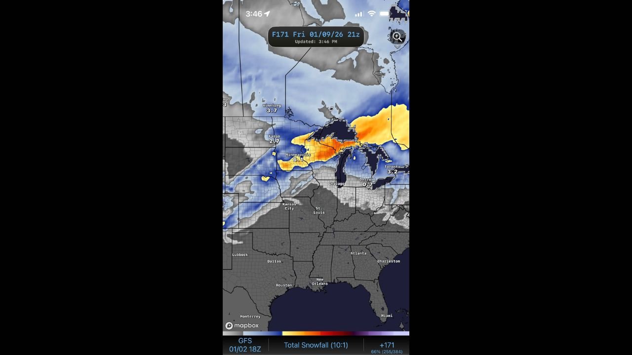
Snowfall Focus Shifts North of the Warm Sector
With warmer air expanding northward, snowfall potential becomes more confined to the northern tier, including parts of the Upper Midwest and Great Lakes. Forecast snowfall maps show limited accumulation across Missouri, Illinois, and Kentucky, with precipitation more likely falling as rain.
This transition further reduces the likelihood of winter weather impacts across the central Midwest during this period.
Still Early, but Pattern Change Looks Meaningful
Meteorologists caution that forecast confidence is still evolving, especially with systems several days out. However, the consistency of the warming signal and moisture reduction across multiple runs suggests this pattern change is becoming more established.
Even if details shift slightly, a noticeable weather transition appears likely, replacing colder conditions with a milder, more spring-like feel for a short window.
What to Watch Going Forward
• Any late increase in Gulf moisture
• Track of the main storm system
• Strength and placement of the jet stream
• Temperature trends late next week
Small adjustments could still influence local impacts, but current data supports a calmer outcome than previously feared.
Stay with WaldronNews.com for continued updates as forecast confidence increases and new data becomes available.