
Ohio Valley and Mississippi Valley Brace for Widespread Temperature Record Swings as 67 Records Face Possible Breaks Friday
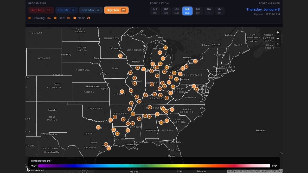
UNITED STATES — An unusually volatile winter weather pattern is setting up across the central and eastern United States, placing large portions of the Ohio Valley and Mississippi Valley at risk for widespread temperature records on Friday. Forecast data shows 67 temperature records could be tied or broken, with some locations experiencing record-cold daytime highs, while nearby areas challenge record warm temperatures within the same 24-hour period.
The highest concentration of potential records is centered across multiple Midwestern and Southern states, making this one of the most geographically expansive temperature record threats of the winter season so far.
States Most Impacted by the Record Threat
Based on the clustering of forecast record indicators, the core impact zone includes:
- Illinois
- Indiana
- Ohio
- Kentucky
- Tennessee
- Missouri
- Arkansas
- Mississippi
- Louisiana
Additional record challenges extend into parts of:
- Wisconsin
- Michigan
- Pennsylvania
- West Virginia
These areas sit along a sharp temperature boundary that is allowing drastically different air masses to influence conditions over short distances.
Record Cold Highs and Record Warm Temperatures in the Same Region
One of the most unusual aspects of this setup is the overlap of record-breaking low maximum temperatures and record high temperatures in the same general region.
- Some cities may fail to warm significantly during the day, setting record-cold daytime highs
- Nearby locations could surge well above normal, contesting record warm readings
- Temperature swings of 20 to 30 degrees are possible across short distances
This type of contrast is uncommon for January and highlights how amplified the current jet stream pattern has become.
Why This Pattern Is Developing
Forecast data shows a strong clash between:
- Cold air pressing south and east from the northern Plains and Upper Midwest
- Warm, moisture-rich air pushing north from the Gulf of Mexico
As this boundary shifts eastward, it creates a narrow corridor where temperature records are vulnerable on both ends of the spectrum. Slight changes in cloud cover, wind direction, or timing could determine whether a location ends up unusually cold or surprisingly warm.
What Residents Should Expect
While winter storms and snowfall are not the primary concern with this setup, the rapid temperature fluctuations may still have real-world impacts, including:
- Increased energy demand due to unstable heating needs
- Travel challenges caused by sudden temperature changes
- Stress on infrastructure not accustomed to abrupt winter warmups
Residents should remain weather-aware, especially those planning outdoor activities or long-distance travel across multiple states.
What Comes Next
Although this record-setting pattern is expected to peak Friday, forecast models suggest continued temperature variability into the following days. The overall setup remains active, meaning additional swings—though likely less extreme—are still possible as January progresses.
WaldronNews.com will continue monitoring this developing weather pattern and provide updates as new forecast data becomes available.