
Marginal Severe Storm Risk Expands Across Southern Plains as SPC Flags Thunderstorm Threat From Texas Into Oklahoma
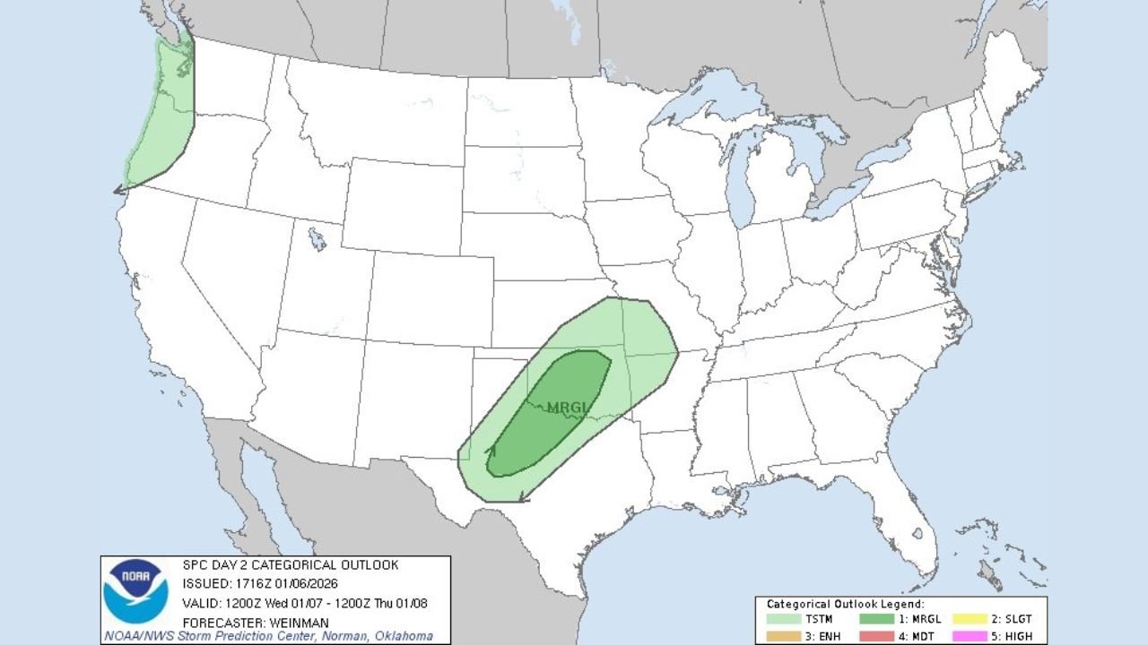
UNITED STATES — The Storm Prediction Center (SPC) has issued an updated Day 2 Severe Weather Outlook, placing parts of the southern Plains under a Marginal Risk for severe thunderstorms as an active weather pattern begins to develop late Wednesday into early Thursday.
According to the outlook issued Wednesday morning, the risk zone stretches from portions of Texas northward into Oklahoma, signaling the potential for isolated strong storms capable of producing damaging wind gusts and small hail.
What a Marginal Risk Means
A Marginal Risk (Level 1 of 5) indicates that severe weather is possible, but storms are expected to remain isolated rather than widespread. While not every location will see storms, any storm that does develop could briefly turn strong, especially during peak heating or along advancing boundaries.
Areas Most Likely to Be Impacted
Based on the latest SPC map, the highest concern is focused on:
- Central and southern Oklahoma
- North and central Texas
- Portions of the southern Plains extending northeastward
The core shaded area highlights where storm coverage and intensity may be slightly higher, though impacts will vary by location.
Primary Threats Identified
Forecasters say the main hazards associated with this setup include:
- Damaging straight-line wind gusts
- Small hail
- Brief heavy downpours
- Localized lightning hazards
At this time, the risk for tornadoes remains very low, but conditions will be monitored closely as the system evolves.
Why This Pattern Matters
The setup is driven by increasing moisture from the Gulf of Mexico interacting with a disturbance moving out of the western U.S. As warmer air surges northward, atmospheric instability increases just enough to support stronger storm development, especially across the southern Plains.
While widespread severe weather is not expected, this pattern marks the beginning of a more active stretch, and future outlooks could be adjusted if conditions become more favorable.
What Residents Should Do
Residents in the affected areas are encouraged to:
- Stay weather-aware, especially Wednesday night into Thursday
- Monitor local forecasts and alerts
- Secure loose outdoor items that could be blown around by gusty winds
- Avoid complacency, even during lower-risk outlooks
Weather conditions can change quickly, and even isolated storms can cause localized damage.
What Comes Next
The Storm Prediction Center will continue refining the forecast as new data becomes available. Any expansion or upgrade of risk levels would be issued in future outlooks if confidence increases.
What do you think — are storms becoming more frequent in your area this season? Share your thoughts and stay updated with the latest weather coverage at WaldronNews.com.