
Louisiana, Mississippi, and Alabama Monitor Evening Severe Weather Threat as Strong Storms Target Northern and Western Areas Through Midnight
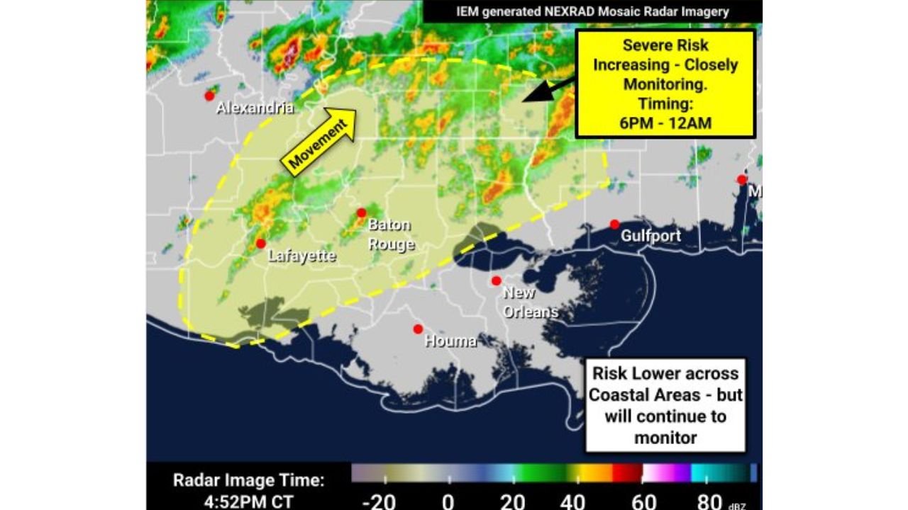
LOUISIANA — Forecasters are closely monitoring a strong to locally severe weather threat through the evening and overnight hours, with the highest risk expected between 6 PM and 12 AM, primarily impacting northern and western portions of Louisiana, Mississippi, and nearby areas of Alabama. Coastal locations are expected to see lower overall risk, though storms may still move through with heavy rain and gusty winds.
Where the Greatest Risk Is Tonight
According to radar trends and National Weather Service guidance, the most favorable environment for stronger storms is setting up north and west of the Interstate 10 corridor, where instability and wind energy are better aligned.
Areas of greatest concern include:
- Northern and western Louisiana
- Central and northern Mississippi
- Far western and northwestern Alabama
Coastal and southeastern areas may see weaker storms, but forecasters stress that conditions can change quickly overnight.
Primary Threats Identified
The current setup supports several potential hazards, including:
- Damaging wind gusts up to 60 mph
- One or two brief tornadoes
- Isolated flash flooding, especially where storms train over the same locations
Confidence in widespread severe weather remains medium, but the overnight timing increases the overall risk due to reduced visibility and people being asleep when warnings are issued.
Why Overnight Storms Are More Dangerous
Severe weather occurring at night is particularly dangerous because:
- Tornadoes are harder to see
- People may not receive warnings while sleeping
- Reaction time is often reduced
Meteorologists emphasize that having multiple ways to receive warnings that will wake you up is critical tonight.
Safety Steps Residents Should Take Now
Officials strongly recommend:
- Keeping a NOAA Weather Radio plugged in and active
- Ensuring Wireless Emergency Alerts (WEA) are turned on and phones are unmuted
- Charging phones and backup batteries in case of power outages
- Reviewing and being ready to activate your severe weather safety plan
If a warning is issued, move immediately to your safe location, such as a basement or interior room away from windows.
Bottom Line
A focused window for strong to severe storms is expected this evening through midnight, with the highest risk across northern and western parts of Louisiana and Mississippi, and a lesser but non-zero risk extending into Alabama. While coastal areas may see fewer severe impacts, everyone in the region should remain weather-aware and prepared to act quickly if warnings are issued.
Stay alert this evening and overnight, and continue following Waldron for timely updates as storms move across the region.