
East-Central Alabama and West-Central Georgia Placed Under Slight Risk for Severe Storms as SPC Flags Sunday Threat
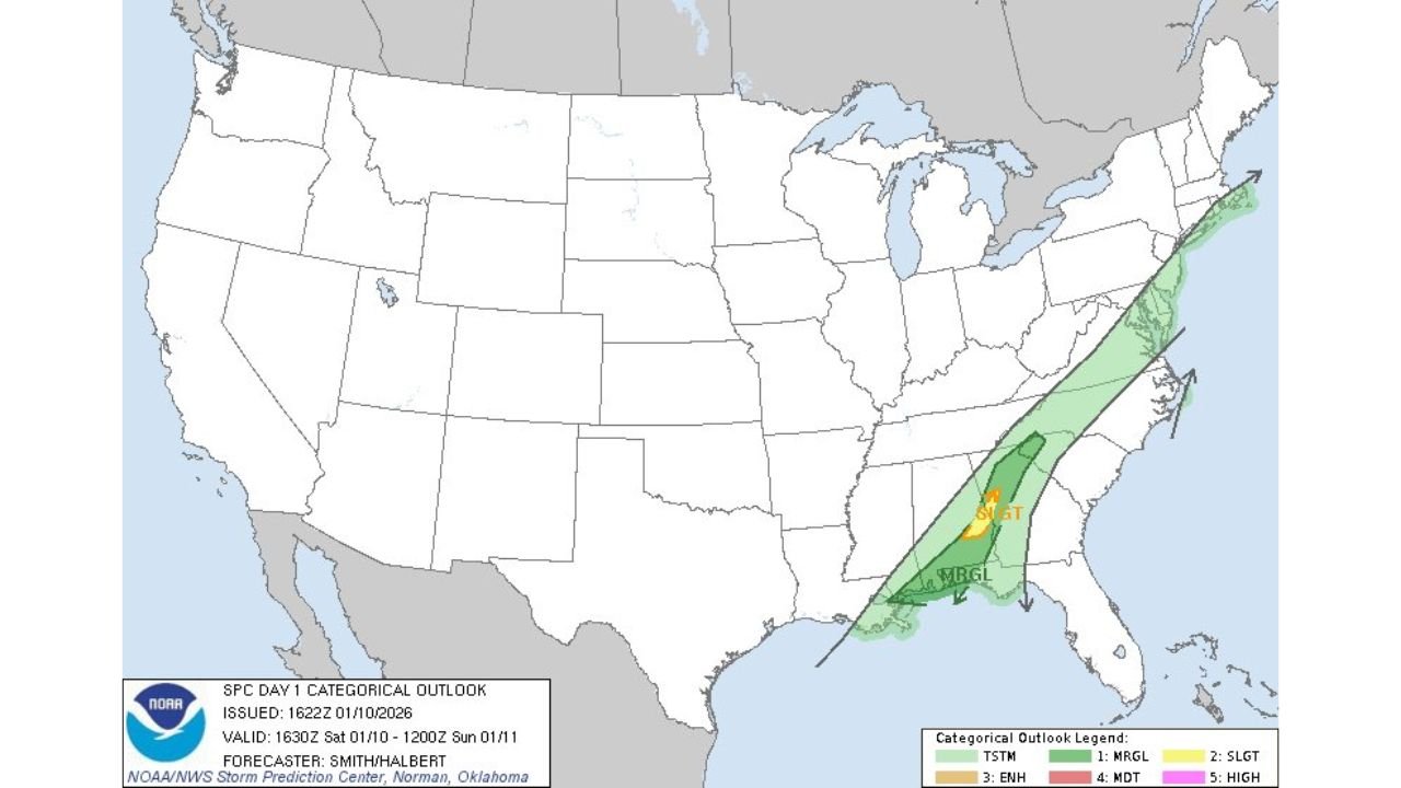
GEORGIA — Parts of east-central Alabama and west-central Georgia are under a Slight Risk for severe thunderstorms, according to the latest Storm Prediction Center (SPC) Day 1 Outlook issued Saturday morning. The designation highlights an elevated potential for damaging winds and isolated severe storms as a weather system moves across the Southeast through Sunday.
The SPC outlook covers a narrow corridor stretching from central Alabama into western portions of Georgia, with surrounding areas placed under a Marginal Risk, indicating a broader but lower-confidence severe threat.
What the Slight Risk Means for the Region
A Slight Risk does not guarantee severe weather everywhere, but it signals that organized storms capable of producing damaging impacts are possible. Forecasters are watching a developing line of showers and thunderstorms expected to strengthen as it moves eastward.
Primary threats identified by the SPC include:
- Damaging wind gusts
- Localized severe thunderstorms
- Brief heavy rainfall, which could reduce visibility during travel
At this time, the tornado threat appears low, but cannot be completely ruled out if storms intensify within the risk zone.
Timing and Areas Most Likely to Be Affected
The severe weather window is expected to develop late Saturday into early Sunday, with storms progressing east across Alabama and into Georgia during the day Sunday.
Communities most likely to be impacted include:
- East-central Alabama
- West-central Georgia
- Areas along and just north of the Gulf moisture axis feeding into the system
Storm coverage may be scattered, but any stronger storm could produce brief severe conditions, especially during peak heating hours.
Why Forecasters Are Monitoring This Setup
The SPC outlook indicates sufficient instability and wind energy to support stronger storms as a cold front moves through the region. While the system is not expected to produce a widespread outbreak, environmental conditions favor organized thunderstorm development, prompting the Slight Risk designation.
Meteorologists stress that wintertime severe weather in the Southeast often features fast-moving storms, giving residents less time to react when warnings are issued.
What Residents Should Do
Residents across the risk area are encouraged to:
- Stay updated on local forecasts and alerts
- Have a reliable way to receive weather warnings
- Secure loose outdoor items ahead of storms
- Use caution if traveling during periods of heavy rain or gusty winds
No watches have been issued yet, but conditions will continue to be monitored closely throughout the day.
Stay with Waldron News for continued updates as meteorologists track this evolving severe weather threat across Alabama and Georgia.