
Florida Faces a Marginal Severe Weather Risk as SPC Flags Southeast Peninsula for Wed–Thu Storm Threat
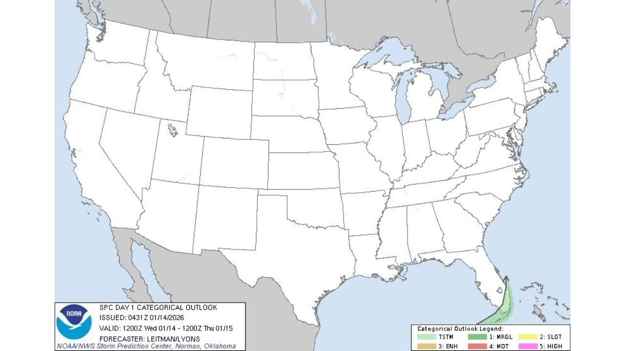
FLORIDA – A small but notable slice of the Southeast Florida peninsula is under a Marginal Risk (Level 1 of 5) for severe weather in the latest Storm Prediction Center (SPC) Day 1 Outlook, covering the period from Wednesday morning through early Thursday. The risk area is confined to the far southern/eastern part of the state, indicating that any stronger storms should be isolated, not widespread.
The outlook map shows no organized risk zones across the rest of the United States, keeping the primary focus on Florida’s southeast tip.
What the SPC “Marginal Risk” means for Florida
A Marginal Risk is SPC’s lowest severe category, but it still matters—especially in a place like South Florida where storms can quickly produce brief, localized hazards even when the overall setup isn’t strong.
In practical terms, a Marginal Risk usually signals:
- A few storms may become strong enough to produce isolated severe wind gusts
- A localized storm could briefly rotate, depending on conditions
- Frequent lightning and sudden downpours can still create travel issues even if storms are not technically “severe”
This is not a high-confidence outbreak signal. It’s a “keep an eye on it” forecast for a narrow part of Florida.
Where the risk is centered
Based on the highlighted area on the outlook map, the risk is focused on Southeast Florida, near the far southern end of the peninsula. That generally includes the corridor most residents associate with the Miami–Fort Lauderdale–West Palm Beach region and nearby coastal areas, depending on how storms evolve and where boundaries set up.
Because the risk zone is tight and coastal, small shifts in wind direction or storm placement can make a big difference in who sees the strongest cell.
Timing: Wednesday into early Thursday
The SPC outlook is valid from Wednesday (Jan. 14) through early Thursday (Jan. 15). For residents in the risk area, the main takeaway is that the window for stronger storms is not limited to just an afternoon pop-up—it extends into the overnight period.
Overnight storms are often more dangerous from a preparedness standpoint because people are less likely to see warnings in time, and visibility is reduced for drivers.
Main impacts to watch in Southeast Florida
Even with a Marginal Risk, Southeast Florida’s biggest real-world impacts typically come down to a few repeat trouble spots:
- Brief damaging wind gusts that can down small branches or push around unsecured outdoor items
- Lightning risk, especially near beaches, marinas, golf courses, and outdoor work sites
- Heavy rain bursts that can flood poor-drainage streets quickly
- Short-fuse travel issues, including slick roads and reduced visibility in downpours
If storms train over the same area, nuisance flooding can become the headline even without classic severe weather reports.
What to do now (simple, practical steps)
If you’re in Southeast Florida, this is a smart, low-effort checklist before Wednesday night:
- Turn on wireless emergency alerts on your phone
- Secure anything outdoors that can blow around (trash bins, patio items)
- If you commute early Thursday, plan for the possibility of rain bands lingering
- Avoid open water or exposed outdoor activities when thunder is nearby
Bottom line
The SPC’s Day 1 outlook places Southeast Florida in a Marginal Risk for severe storms from Wednesday into early Thursday, while the rest of the country remains quiet in the categorical forecast. Most locations won’t see severe weather, but one or two stronger storms could still produce localized wind issues, frequent lightning, and heavy rain in the risk zone.
Are you in Southeast Florida—Miami-Dade, Broward, or Palm Beach? Tell us what you’re seeing Wednesday night (rain bands, thunder, wind gusts), and keep following the Waldron website for the next update.