
Virginia, Maryland, Pennsylvania and New Jersey Face Elevated Risk for a High-Impact Winter Storm as Snow Probabilities Climb
UNITED STATES — A potentially high-impact winter storm is increasingly coming into focus for parts of Virginia, Maryland, Pennsylvania, and New Jersey, as new European ensemble guidance shows a meaningful risk for significant snowfall across the Mid-Atlantic and interior Northeast late this weekend into early next week.
The latest probability maps, based on 50 separate European model simulations, highlight a broad corridor where winter weather impacts are becoming increasingly likely, even though key details — especially the storm’s northern extent — remain unresolved.
What the Latest Probability Maps Are Showing
According to the European ensemble data, portions of the Mid-Atlantic region are now showing notable probabilities for at least 12 inches of snowfall, which is a meaningful threshold in winter forecasting.
Based on the current guidance:
- Central and southern Pennsylvania show roughly a 30–40% chance of at least 12 inches of snow
- Northern Virginia and central Maryland fall into a 40–50% probability zone
- Parts of southern Maryland and adjacent areas are highlighted with 50–60% odds, the highest probabilities currently shown on the map
- Coastal areas of New Jersey remain on the lower-confidence edge, but still within a broader impact zone
While these percentages do not guarantee snowfall totals, probabilities at this level several days out signal a setup that forecasters take seriously.
Why This Signal Matters
Ensemble probabilities help forecasters understand risk, not certainty. Seeing such elevated percentages this far in advance suggests the atmosphere is repeatedly favoring a storm track capable of producing heavy, impactful snow rather than a fringe or marginal event.
In simple terms:
This is not a one-off model run. It is a pattern repeatedly showing up across dozens of simulations.
That alone elevates confidence that some portion of the Mid-Atlantic will experience a significant winter storm, even if exact placement and totals are still in flux.
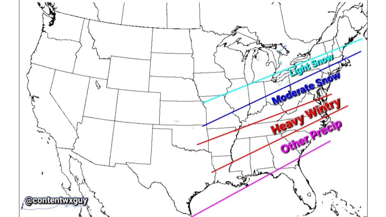
Storm Track Still Uncertain — Especially to the North
One of the biggest remaining questions is how far north the heavier snow band ultimately reaches.
Forecast guidance still shows:
- A light snow zone farther north
- A moderate snow corridor just south of that
- A heavy wintry precipitation zone cutting through the Mid-Atlantic states
- A separate zone of mixed or other precipitation farther south
Small shifts in storm track could dramatically change outcomes between heavy snow, lighter accumulations, or mixed precipitation, particularly near the northern edge of the system.
Why Forecasters Are Urging Patience
Despite the growing signal, this storm remains several days away, and probabilities will continue to evolve as:
- The storm track becomes clearer
- Timing is refined
- Thermal profiles sharpen
As forecasters note, choosing a fixed outcome too early — especially focusing on high-end totals — can be misleading. The correct takeaway right now is elevated risk, not guaranteed impact.
Historical Context Adds Weight to the Concern
The setup has drawn comparisons to past memorable Mid-Atlantic winter storms, including those that delivered double-digit snowfall totals and widespread disruption across Virginia, Maryland, Pennsylvania, and New Jersey.
While no two storms are identical, the presence of strong ensemble agreement at this range is one reason meteorologists are watching this system closely.
What to Watch Over the Next Few Days
Residents across the Mid-Atlantic should monitor updates for:
- Shifts in the heavy snow axis
- Changes in probability percentages
- Refinement of timing between Saturday night and Monday
Confidence will increase rapidly once the storm moves into the shorter-range forecast window.
Stay with Waldron News
This system is still evolving, and details will change. We’ll continue tracking the data, explaining what’s solid, what’s uncertain, and what it means for your area as confidence increases.