
Cyclone Targets Vancouver Island as Western Oregon and Washington Brace for Gusty Winds and Thunderstorms Across Pacific Northwest
VANCOUVER ISLAND, BRITISH COLUMBIA — A developing cyclone moving into Vancouver Island today is triggering gusty to locally strong winds and isolated thunderstorms across portions of western Oregon, Washington, and southwest British Columbia.
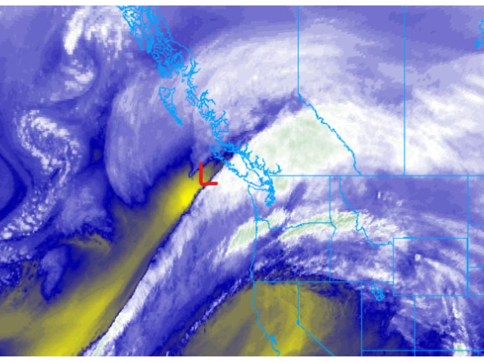
Satellite imagery shows a well-defined low-pressure center approaching the coast, with a broad plume of moisture and enhanced cloud bands wrapping inland. While the strongest dynamics remain focused closer to Vancouver Island, impacts are extending southward into the Pacific Northwest.
Gusty Winds and Isolated Thunderstorms Today
Communities across western Oregon and western Washington are experiencing breezy to occasionally gusty conditions as the system rotates inland. Embedded instability within the broader cloud shield is also supporting isolated thunderstorms, particularly in areas where colder air aloft overlaps with daytime heating.
Though not expected to be a widespread severe outbreak, localized heavier downpours and brief stronger wind gusts are possible under the most organized cells.
Forecasters note that if this system had tracked approximately 150 miles farther south, a significantly stronger wind event could have unfolded across Oregon and Washington. Instead, the primary low center remains farther north, limiting the most intense wind impacts.
Wednesday Brings Scattered Showers and Hail Potential
Conditions will shift on Wednesday as winds decrease from gusty to more of a general breeze. However, the atmosphere will remain unsettled through much of the day.
Colder air moving in aloft will create a more unstable environment, allowing scattered showers and thunderstorms to redevelop. In the strongest cells, hail and/or snow pellets will be possible, especially during the afternoon when instability peaks.
Residents across western Oregon, Washington, and southwest British Columbia should anticipate rapidly changing weather conditions Wednesday, including brief bursts of heavier precipitation.
Drier Pattern Returns Late Week
A transition to more stable conditions is expected beginning Thursday.
A ridge of high pressure building over the western United States will promote drying from Thursday through Saturday. This ridge will suppress widespread storm development and bring calmer, more settled weather to much of the Pacific Northwest.
The shift marks a temporary break from the active pattern associated with the incoming cyclone.
Bottom Line
The cyclone moving into Vancouver Island, British Columbia is bringing gusty winds and isolated thunderstorms to portions of western Oregon and Washington, with scattered showers and small hail possible Wednesday as colder air moves overhead. Winds ease tomorrow, and drier weather is expected to return Thursday through Saturday as high pressure builds over the western U.S.
Stay with WaldronNews.com for continued updates on regional storm systems and Pacific Northwest weather developments.