
Atmospheric River Streams from Vancouver, British Columbia Toward Great Salt Lake, Utah in Striking METEOR M2-3 Satellite Pass
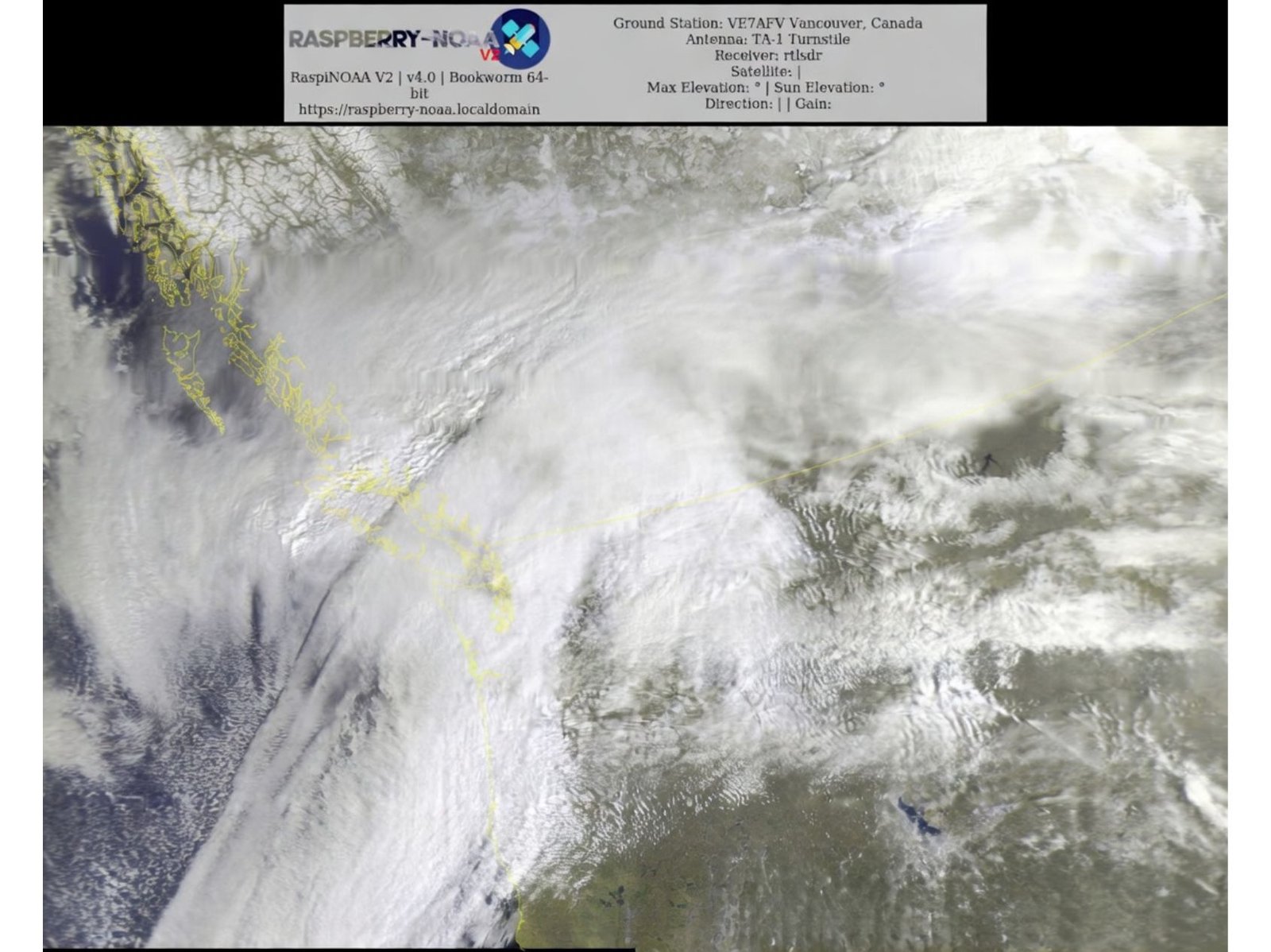
VANCOUVER, BRITISH COLUMBIA — A vivid satellite pass from the METEOR M2-3 just ahead of 11 a.m. captured a sharply defined atmospheric river stretching inland from the Pacific Ocean, flowing east of Vancouver and extending deep into the western United States — with the Great Salt Lake visible along the lower-right portion of the image.
The high-resolution satellite imagery highlights a classic “river” of moisture, marked by a dense, elongated plume of cloud cover arcing from the northeast Pacific across parts of British Columbia and into the Intermountain West.
Sharp Cloud Shelf Defines the Moisture Boundary
One of the most striking features in the imagery is the sharply defined upper boundary of the atmospheric river. The visible “shelf” or cloud-edge shadow creates a dramatic contrast between thicker cloud bands and comparatively clearer air to the north.
This boundary often marks the transition zone between the most concentrated moisture transport and drier air masses, giving the system a well-organized appearance from space.
The satellite pass clearly outlines:
- The British Columbia coastline
- The Pacific Northwest cloud shield
- Inland moisture streaming toward Utah
- The Great Salt Lake visible at lower right
The defined edge of the moisture plume underscores the structured nature of the system.
Atmospheric River Pattern Continues
The imagery suggests continued atmospheric river–type conditions impacting portions of western North America. These systems are known for transporting long corridors of Pacific moisture inland, often resulting in widespread precipitation depending on elevation and temperature profiles.
The cloud band’s southwest-to-northeast orientation aligns with a typical moisture feed pattern from the Pacific Ocean into the Pacific Northwest and further inland.
While the satellite image itself does not specify precipitation totals, atmospheric rivers commonly bring prolonged periods of rain or mountain snowfall to affected regions.
Captured from Vancouver Ground Station
The image was received via a ground station near Vancouver, British Columbia using a TA-1 turnstile antenna and satellite reception equipment. The timing of the pass — just before 11 a.m. local time — provided favorable lighting to accentuate the texture and shadowing within the cloud deck.
Sun angle and elevation appear to enhance the visible structure of the moisture band, helping define the cloud shelf and layered cloud formations.
Western North America in Focus
The pass provides a wide regional perspective, showing:
- Coastal British Columbia
- Parts of Washington and Oregon
- Inland terrain across the western United States
- Utah’s Great Salt Lake
The broad-scale perspective reinforces how expansive atmospheric river systems can be, often spanning hundreds of miles from ocean to interior basins.
Bottom Line
A METEOR M2-3 satellite pass east of Vancouver, British Columbia captured a sharply defined atmospheric river stretching inland toward the Great Salt Lake in Utah, showcasing a dramatic cloud-edge “shelf” along the system’s upper boundary. The imagery highlights the continued presence of Pacific moisture streaming into western North America.
Stay with WaldronNews.com for continued satellite analysis and regional weather coverage across the United States and western Canada.