
Northeast Indiana and Northwest Ohio Face Elevated Tornado Risk as Thursday Storms Cluster Across the Midwest
FORT WAYNE, INDIANA — A developing storm system expected to move across the Midwest on Thursday is drawing increasing attention from forecasters, with northeast Indiana and northwest Ohio highlighted as the areas with the highest tornado potential. Updated model guidance indicates weakening atmospheric capping and strengthening instability, raising concerns for potentially significant severe weather.
Early Morning Convection Expected but Limited Impact
Forecast models suggest scattered overnight and early morning convection across parts of Indiana, though these initial storms are not expected to significantly disrupt the afternoon severe weather setup. Instead, they may serve as a precursor to a more organized storm environment later in the day.
Meteorological analysis shows the atmospheric “cap” — a layer of warm air that can suppress storm development — has weakened compared to earlier forecasts. This change increases the likelihood that storms will intensify rapidly once daytime heating and stronger wind dynamics come into play.
Highest Tornado Potential Focused in Northeast Indiana and Northwest Ohio
The greatest concern centers on northeast Indiana and northwest Ohio, where environmental conditions appear most favorable for tornado development. Model soundings indicate sufficient instability, strong wind shear, and favorable storm-relative helicity, all ingredients supportive of rotating thunderstorms capable of producing tornadoes.
Forecasters note the potential for significant, intense tornadoes in this region if storms can become discrete before clustering into larger complexes.
Damaging Wind Threat Expands Across Northern Ohio
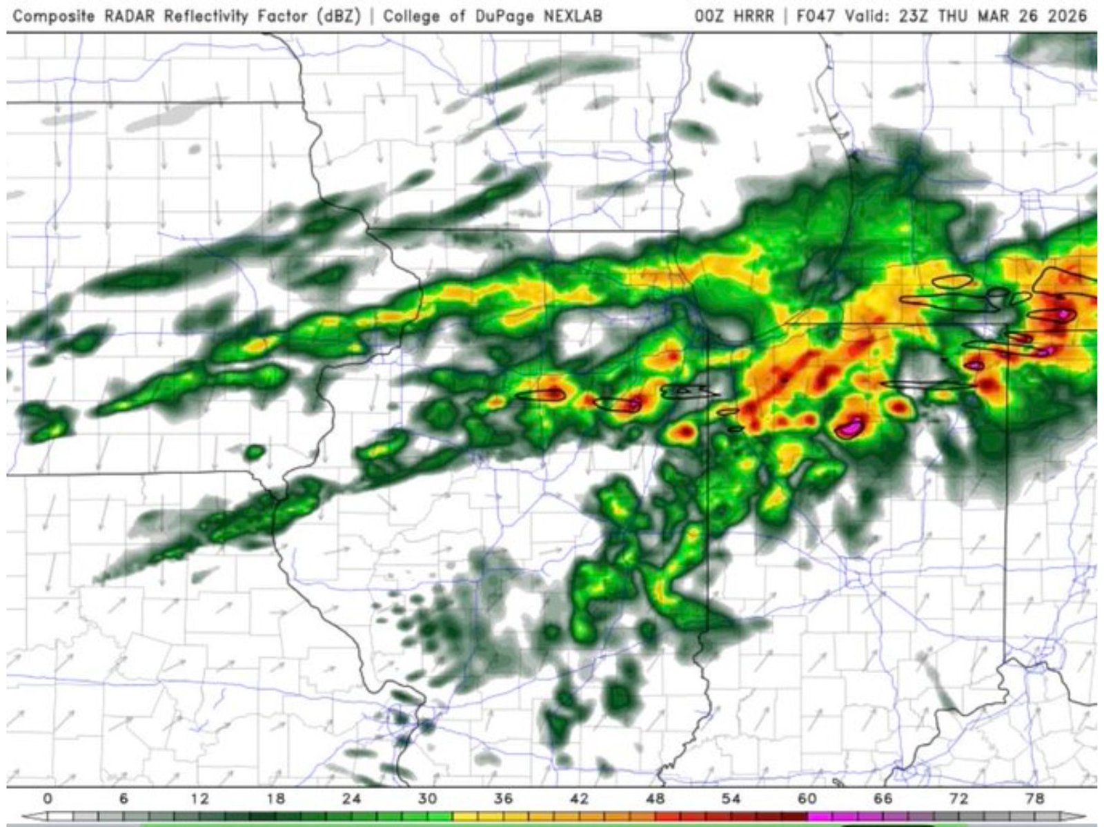
As storms mature and begin clustering, the primary threat is expected to shift toward damaging straight-line winds, especially across northern Ohio. High-resolution forecast models depict a line of storms extending eastward during the evening and overnight hours, bringing the potential for widespread wind damage.
The projected storm evolution includes:
- Discrete supercells capable of producing tornadoes early in the event
- Transition into clusters or a line of storms moving eastward
- Increasing damaging wind potential as storms organize and accelerate
Atmospheric Setup Supports Severe Weather Potential
Forecast soundings for Thursday evening reveal a favorable severe weather environment characterized by:
- Strong low-level wind shear and veering wind profiles
- Sufficient convective available potential energy (CAPE)
- Weak to moderate capping allowing storm initiation
- Enhanced storm-relative helicity supporting rotation
These parameters suggest an environment capable of supporting supercells, with tornado potential peaking during the afternoon and early evening hours.
Timing and Regional Impacts
Current projections indicate storms may begin developing during the afternoon across Indiana before moving into Ohio during the evening and overnight period. Residents across northeast Indiana, northwest Ohio, and northern Ohio should closely monitor forecasts as conditions evolve.
Although the overall threat remains dependent on storm development and storm mode, the potential for tornadoes, damaging winds, and heavy rainfall underscores the need for preparedness.
Bottom Line
Severe weather is expected to develop across the Midwest on Thursday, with northeast Indiana and northwest Ohio facing the highest tornado risk and northern Ohio likely experiencing a damaging wind threat as storms cluster and move eastward. Weakening capping and favorable atmospheric conditions may support significant severe weather, including the possibility of strong tornadoes.
Stay with WaldronNews.com for the latest severe weather updates, radar analysis, and real-time storm coverage across the Midwest.