
San Francisco Bay Area and Central Coast Brace for Widespread Beneficial Rain as Early-Week System Targets California
SAN FRANCISCO BAY AREA, CALIFORNIA — A developing weather pattern is expected to bring widespread rainfall across the Bay Area and Central Coast early next week, with forecasters signaling a largely beneficial system set to arrive around March 30 through April 1.
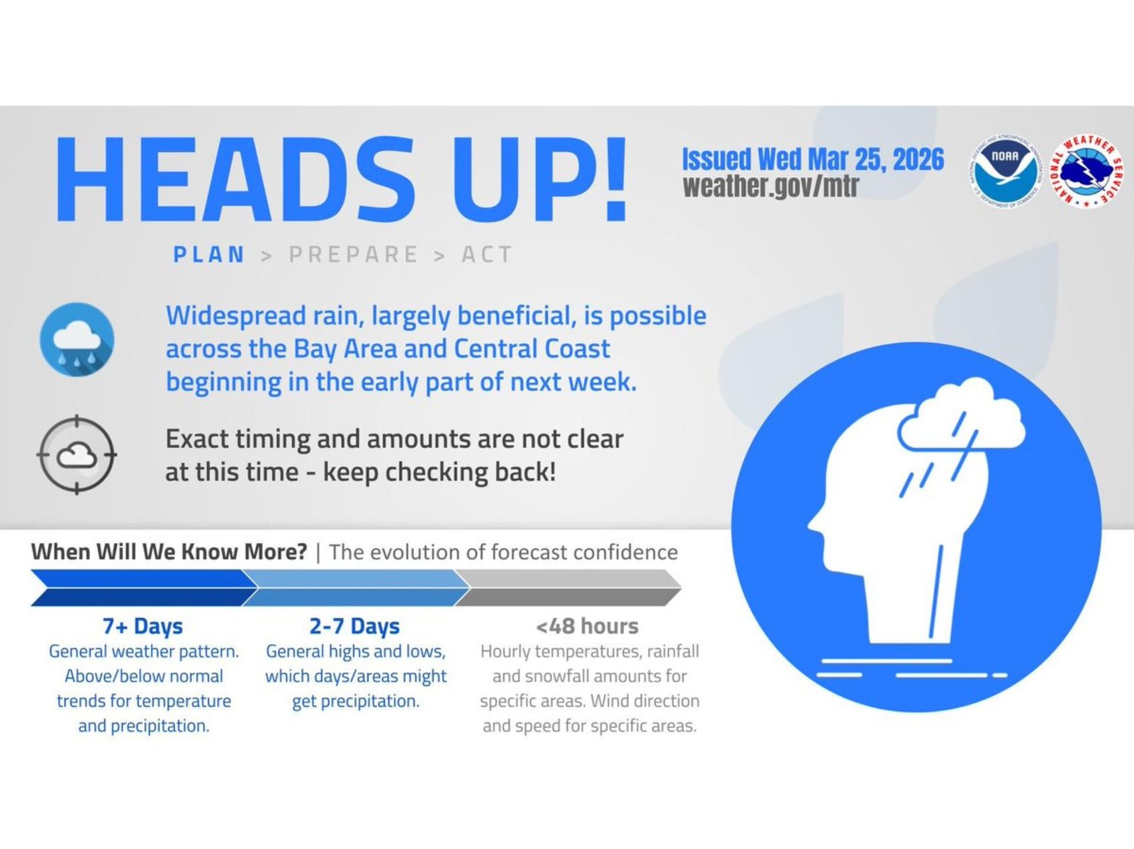
Current outlooks indicate that this incoming system will deliver steady rain across a broad stretch of coastal California, offering much-needed moisture while avoiding, at least for now, signals of extreme or damaging conditions.
Rainfall Expected to Spread Across Bay Area and Central Coast
The system is projected to move into the region during the early part of the week, with rain becoming increasingly widespread across cities including San Francisco, Oakland, San Jose, and extending southward along the Central Coast.
While exact rainfall totals are still uncertain, the overall pattern strongly supports region-wide precipitation coverage, suggesting that most communities in the Bay Area and coastal Central California will see measurable rainfall.
Forecasters emphasize that this event appears largely beneficial, meaning it could help improve soil moisture, support reservoirs, and ease dry conditions without immediately raising major flood concerns.
Timing and Rainfall Totals Still Unclear
Despite growing confidence in rainfall coverage, key details remain uncertain. The exact timing of when the heaviest rain bands arrive — as well as how much rain will fall in specific locations — is still being refined.
At this stage, the system falls within a medium-range forecast window, where general trends are clearer than precise impacts. As the event draws closer, more accurate data regarding rainfall intensity, duration, and localized effects will become available.
Residents are advised to continue monitoring updates, especially as forecasts enter the short-range period within 48 hours of arrival.
Forecast Confidence Increasing but Details Pending
Meteorologists describe the current stage as part of the evolving forecast confidence timeline:
- 7+ Days Out: Broad pattern recognition showing increased chances of precipitation
- 2–7 Days Out: Identification of likely regions to receive rain, including the Bay Area and Central Coast
- Within 48 Hours: Finalized details on rainfall totals, timing, and localized impacts
This means while confidence is high that rain will occur, specifics such as peak rainfall periods and exact accumulation amounts are still being determined.
No Immediate Signs of Severe Weather
At this time, there are no strong indications of severe storms or hazardous weather tied to this system. Instead, the focus remains on steady, widespread rainfall that could benefit water resources across the region.
However, minor travel slowdowns, slick roads, and reduced visibility during periods of rain are still possible, particularly during commute hours.
What Residents Should Watch Next
As the system approaches, updates will likely refine:
- Start and end times of rainfall
- Areas of heavier precipitation
- Potential for localized impacts
Residents across the Bay Area and Central Coast should stay informed as forecast confidence continues to improve over the coming days.
Waldron News will continue tracking this developing weather pattern and provide updates as more precise details emerge.