
Colorado Weather Flip Ahead as Two Snow Waves Target Mountains and Possible Denver Snow Emerges April 3–5
COLORADO — A major shift in weather patterns is expected across the state next week, as forecasters signal a transition from recent mild conditions to cooler temperatures and multiple rounds of mountain snow, with even a potential for snowfall in the Denver area by April 3–5.
The developing pattern could provide much-needed relief to Colorado’s struggling snowpack while marking a noticeable return to more typical late-season conditions.
Pattern Shift Brings Cooler Air Across the State
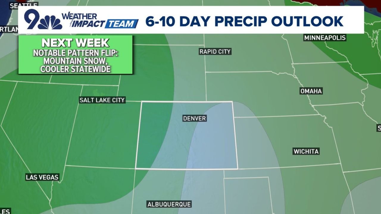
After a stretch of relatively warm and dry weather, a notable pattern flip is expected to take hold across Colorado heading into next week.
Forecast guidance shows:
- Cooler temperatures spreading statewide
- Increased cloud cover and moisture
- A transition toward more active storm systems
This change is expected to impact both the mountains and lower elevations, including the Front Range.
Two Waves of Mountain Snow Expected
Meteorologists are tracking two distinct waves of snowfall for Colorado’s high country:
- First wave: Expected Tuesday into Wednesday
- Second wave: Stronger system likely Friday into the weekend
These systems are expected to bring fresh snow to the mountains, helping to slow or temporarily reverse the recent decline in snowpack levels.
The second wave, in particular, appears more robust and could deliver more widespread and heavier accumulations.
Snowpack Relief Could Be Significant
The incoming storms arrive at a critical time, as Colorado’s snowpack has been under pressure due to recent warmth and limited precipitation.
These snowfall events could:
- Improve snowpack conditions in key basins
- Support water supply outlooks heading into spring and summer
- Reduce wildfire risk potential in the coming months
While not a complete recovery, the pattern shift is expected to provide at least short-term stabilization.
Denver Area Watching Late-Week Snow Potential
In addition to mountain snowfall, Denver and surrounding areas could see a chance of snow between April 3 and April 5, depending on how the second system evolves.
Forecast models indicate:
- Cooling temperatures late in the week
- Increasing precipitation chances
- Potential for rain changing to snow, especially during nighttime hours
At this stage, snowfall in the metro area remains uncertain, but the signal for colder and more unsettled weather is becoming clearer.
What the Forecast Models Show
Ensemble forecast data suggests:
- A gradual increase in precipitation probabilities late next week
- A peak in potential snowfall signals around the weekend timeframe
- Wide variability in exact totals, especially for lower elevations
This indicates that while confidence is growing in the pattern change, specific snowfall amounts and locations are still being refined.
What to Expect Moving Forward
Residents across Colorado should prepare for:
- A noticeable cooldown after recent mild conditions
- Snow-covered roads in mountain passes during both storm waves
- Possible travel impacts late next week if snow reaches lower elevations
For now, forecasters emphasize that the upcoming systems represent a return to active spring weather, with rapidly changing conditions likely.
Waldron News will continue to monitor updates as confidence increases in snowfall totals and potential impacts across Colorado.