
Central United States Residents Alerted As New Forecast Comparison Tool Highlights Severe Storm Patterns Across Plains and Midwest
UNITED STATES — A new weather analysis tool is drawing attention across the Central United States, including Kansas, Oklahoma, Nebraska, Iowa, and surrounding Plains and Midwest regions, as it reveals how past storm patterns compare to real-world severe weather events.
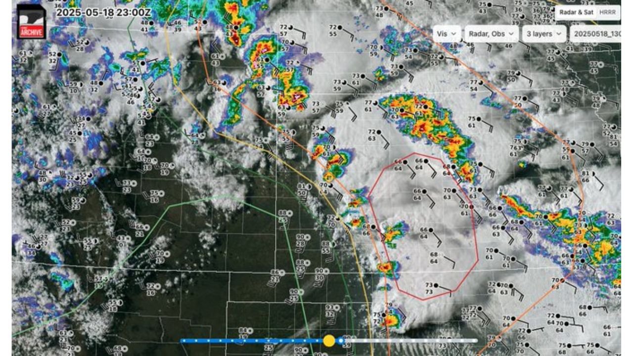
The newly available system allows users to analyze historical high-resolution forecast models alongside actual observed conditions, offering deeper insight into how dangerous storms develop and evolve.
New Tool Allows Direct Comparison Between Forecast and Reality
The platform now provides access to:
- Historical HRRR model runs dating from 2018 through 2026
- Side-by-side comparison with real radar and satellite observations
- The ability to track how storms were predicted versus how they actually formed
This comparison is especially valuable in regions like the Plains and Midwest, where:
- Storms can rapidly intensify
- Forecast accuracy is critical for early warnings
- Small changes in conditions can lead to major differences in storm outcomes
Storm Patterns Show Strong Similarities To Past Severe Events
Analysis of past cases displayed by the tool highlights:
- Clusters of thunderstorms forming along boundaries across Kansas and Oklahoma
- Development of organized storm lines and isolated supercells
- Clear alignment between forecasted storm zones and observed severe weather tracks
In several examples:
- Forecast models indicated discrete storm cells developing ahead of larger lines
- Observations later confirmed intense storms forming in those same regions
- This reinforces confidence in identifying high-risk areas before storms begin
Plains And Midwest Remain Focus Area For Severe Weather Analysis
The tool emphasizes regions frequently impacted by severe weather, including:
- Kansas and Oklahoma, where dryline setups often trigger supercells
- Nebraska and Iowa, where storm clusters can organize into larger systems
- Surrounding Midwest areas where storms track eastward
These regions benefit most from improved forecast comparison because of:
- Frequent severe weather outbreaks
- Rapid storm evolution
- High population exposure in storm corridors
Why This Matters For Residents
For people living across these states, this advancement means:
- Better understanding of how forecast models perform in real scenarios
- Increased ability to anticipate severe weather setups
- More informed decision-making during active weather events
By studying past events, forecasters and emergency planners can:
- Improve warning timing
- Identify patterns linked to tornado and hail outbreaks
- Enhance preparedness strategies
A Step Forward In Severe Weather Awareness
While this tool is primarily designed for analysis and forecasting improvement, it ultimately supports public safety across storm-prone regions.
Residents are still encouraged to:
- Follow real-time weather alerts
- Stay informed during severe weather days
- Use updated tools and forecasts to better understand risks
Technology Enhancing Storm Prediction And Preparedness
As severe weather continues to impact the Central United States each year, tools like this highlight how forecasting technology is evolving to better match real-world conditions.
With access to past storm data and comparisons, meteorologists and researchers now have a stronger foundation to predict and communicate future severe weather threats, helping communities stay one step ahead of dangerous conditions.