
Iowa Illinois and Wisconsin Residents Urged To Stay Alert As Developing Boundary Could Trigger Strong Tornadoes Thursday
IOWA — Residents across eastern Iowa, northwest Illinois, and southern Wisconsin are being strongly urged to stay alert as a complex and potentially dangerous severe weather setup begins to take shape for Thursday, with signals pointing toward a localized but significant tornado threat.
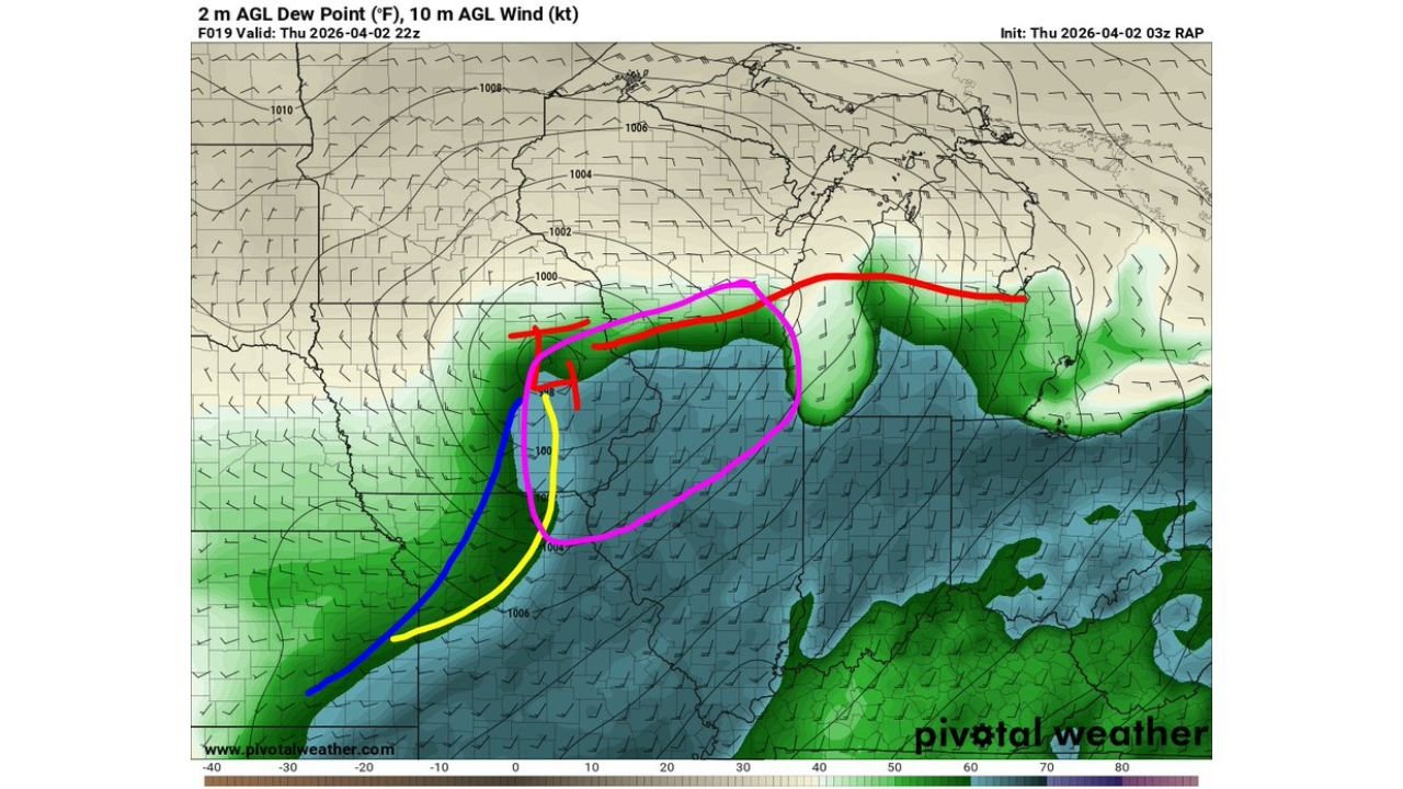
Forecast data indicates that a deepening surface low over Iowa may play a critical role in organizing storms, especially as a key boundary begins to form across the region.
Key Boundary Formation Raising Tornado Concerns
Meteorological analysis shows a developing setup featuring:
- A strengthening surface low centered over Iowa
- A pseudo dryline or wind shift boundary forming just ahead of a cold front
- A north-to-south oriented boundary positioned beneath the low
This boundary is particularly important because it can act as a focus point for storm development, allowing storms to remain more organized and potentially rotate.
Environment Favorable For Supercells and Tornado Development
Several atmospheric ingredients are expected to align across the region:
- Around 1500 SBCAPE, providing sufficient instability for storm growth
- Increasing wind shear, supporting storm rotation
- Strengthening streamwise vorticity, which enhances tornado potential
- Conditions supportive of semi-discrete supercells rather than a solid storm line
If storms remain isolated along this boundary, they could:
- Become more intense and longer-lived
- Increase the chance of strong tornado development, including the possibility of longer track events
Areas Of Greatest Concern Across Eastern Iowa Into Illinois and Wisconsin
The most closely watched corridor includes:
- Cedar Rapids and Iowa City
- Davenport and surrounding eastern Iowa communities
- Extending east into Rockford, Illinois
- Northward toward areas south of Madison, Wisconsin
These locations sit near the expected boundary placement, making them prime zones for storm initiation and intensification.
Uncertainty Remains With Cloud Cover and Surface Conditions
Despite the strong setup, a few limiting factors remain:
- Cloud cover and earlier rainfall could reduce instability
- Surface conditions must fully destabilize for storms to reach peak intensity
- If the boundary layer remains too stable, storms may struggle to maintain strength
This means the difference between a moderate event and a significant tornado threat could depend on how much clearing occurs during the day.
Potential For Localized But High Impact Event
Forecasters emphasize that:
- This is not expected to be a widespread outbreak everywhere
- Instead, the threat may be highly localized but intense where storms develop
- Any storm forming along the boundary could quickly become dangerous
Residents Advised To Closely Monitor Thursday Conditions
People across eastern Iowa, northwest Illinois, and southern Wisconsin should prepare ahead of time:
- Stay updated with weather alerts and forecast changes
- Identify a safe shelter location immediately
- Be ready for rapidly changing conditions during the afternoon and evening
- Do not ignore warnings, especially in areas near the boundary
Setup Could Quickly Escalate If Conditions Align
This developing weather pattern has the potential to produce significant severe storms in a narrow corridor, especially if atmospheric conditions fully come together.
With multiple high-risk ingredients aligning, Thursday could bring a serious but targeted severe weather event across parts of the Midwest, making awareness and preparation critical for those in the most vulnerable areas.