
Midwest and Great Lakes Weather Alert New Moisture Surge and Wind Pattern Signals Incoming Storm Zone Residents Should Stay Watchful
UNITED STATES — A new weather setup is beginning to take shape across parts of the country, as increasing moisture levels and shifting wind patterns near the surface signal a developing storm environment, particularly across portions of the Midwest and nearby regions.
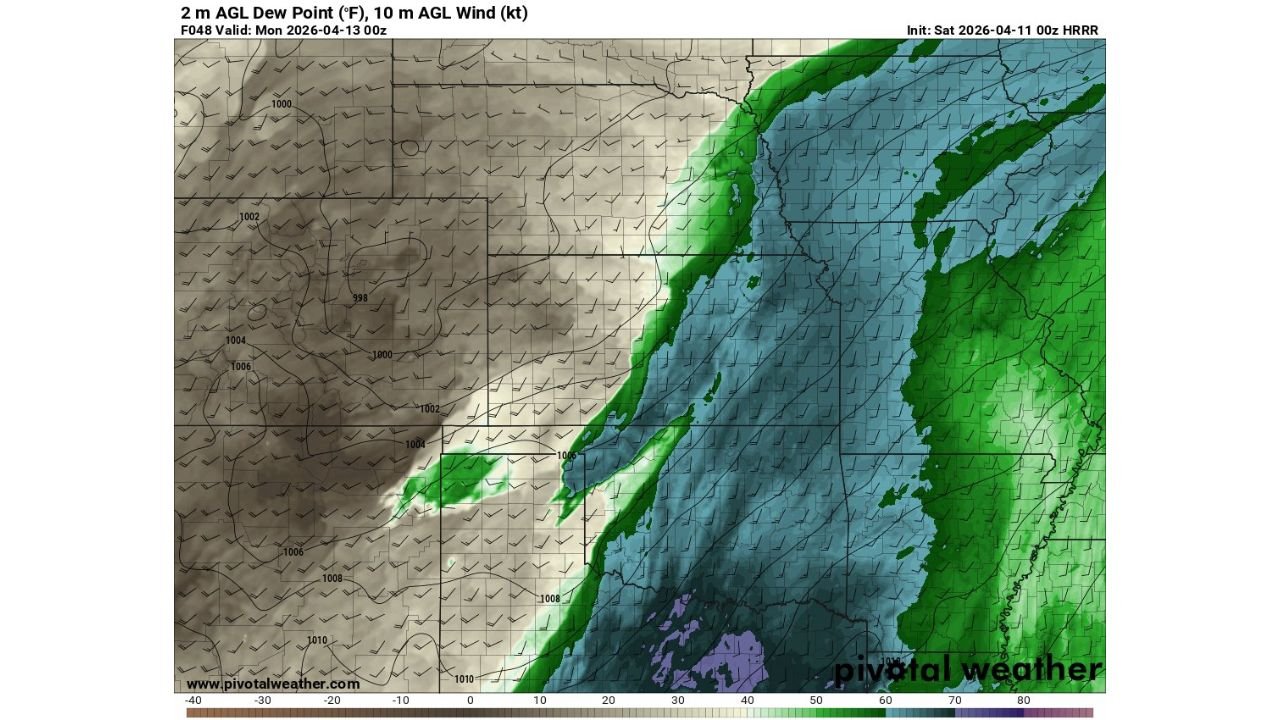
Moisture Levels Increasing Near Surface
The data highlights 2-meter dew point values rising, which is a key signal that:
- Moisture is building near ground level
- The atmosphere is becoming more supportive of storm development
- Humidity levels are increasing ahead of potential weather activity
Higher dew points often act as fuel for thunderstorms, especially when combined with other atmospheric triggers.
Wind Patterns Show Organized Flow
At the same time, 10-meter wind data indicates organized low-level wind flow, suggesting:
- Air is being transported efficiently across regions
- Moisture is likely being pulled northward or eastward
- Conditions are aligning for potential storm formation zones
This combination of moisture + wind alignment is often one of the early ingredients needed for more active weather.
What This Means for Affected Areas
While exact storm locations are not sharply defined in this dataset, the pattern suggests:
- A broad zone of unsettled weather potential
- Increasing chances for showers and thunderstorms
- Possible development of organized storm clusters if conditions continue to strengthen
This is not a single-location event, but rather a setup phase for wider regional impacts.
Early Stage Signal Not Final Outcome
It is important to note:
- This data reflects early atmospheric signals, not a finalized forecast
- Storm intensity and exact impact areas will depend on how the system evolves
- Small changes in wind direction or moisture placement can shift the risk zone
Why This Pattern Matters
Meteorologically, this type of setup often precedes:
- Thunderstorm development zones
- Potential severe weather outbreaks if instability increases
- A transition toward a more active weather pattern
Final Update
A developing moisture surge combined with organized low-level winds is now being observed across parts of the United States, signaling a potential increase in storm activity in the coming period.
While specific impacts are still uncertain, the atmospheric pattern suggests that residents across parts of the Midwest and surrounding regions should stay alert for upcoming weather updates.
Stay with WaldronNews.com for continued tracking as this developing weather pattern becomes clearer.