
Flash Flood Warnings Active Across Alabama Tonight Covering Cullman, Morgan, Marshall, Madison, and Jackson Counties in the North and Mobile and Baldwin Counties in the South With Isolated Tornado Possible
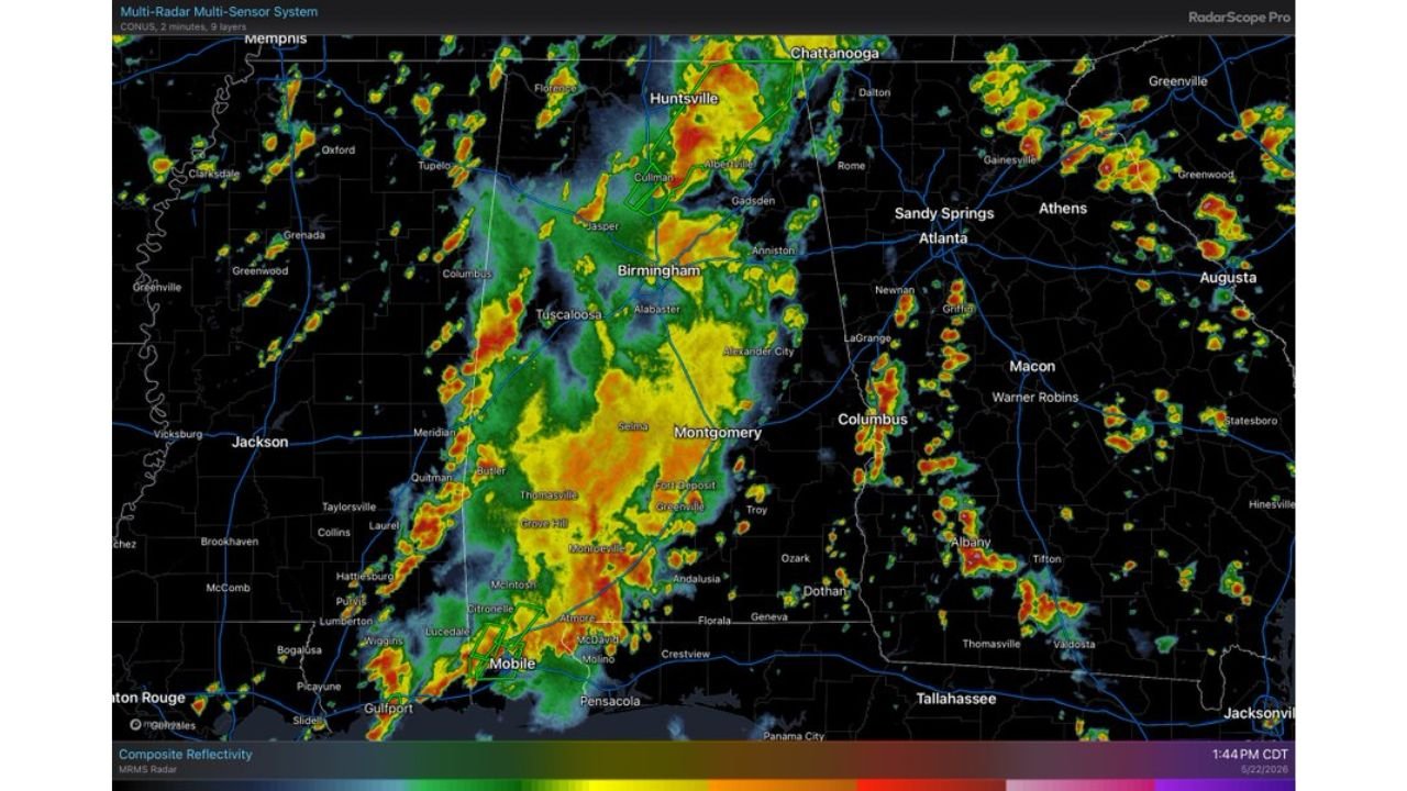
ALABAMA — Flash Flood Warnings are in effect across multiple Alabama counties on Friday, May 22, 2026, as the main threat through tonight shifts to flooding across both north and south Alabama. Radar captured at 1:44 PM CDT shows a large and active storm complex draped across the entire state from Huntsville and Cullman in the north through Birmingham and Montgomery to Mobile in the south. A brief and isolated tornado also cannot be ruled out with the stronger storm cells moving through the region.
Active Flash Flood Warning Counties Right Now
Flash Flood Warnings are currently in effect for two separate clusters of Alabama counties:
North Alabama:
- Cullman County
- Morgan County
- Marshall County
- Madison County
- Jackson County
South Alabama:
- Mobile County
- Baldwin County
Flooding Is the Primary Danger Tonight
With a widespread and slow-moving storm complex draped across Alabama from north to south, rainfall rates are producing flash flooding conditions across both the northern and southern portions of the state. Roads, low-lying areas, underpasses, and drainage channels across all seven warned counties are at immediate risk of dangerous flooding.
Never drive through flooded roads. Turn Around, Don’t Drown.
A Tornado Cannot Be Ruled Out
While flooding remains the dominant threat tonight, forecasters are also noting that a brief and isolated tornado cannot be completely ruled out with the stronger storm cells embedded in this system. Residents across Alabama should keep weather alerts active throughout the evening for any rapidly issued tornado warnings.
The Full Storm Coverage Across Alabama Right Now
Radar is showing widespread heavy rain and storm coverage stretching across virtually the entire state, with active cells visible near:
- Huntsville, Cullman, and Jasper in the north
- Birmingham and Tuscaloosa in the central corridor
- Montgomery and Selma in central Alabama
- Mobile and the Gulf Coast in the south
Stay with CabarrusWeekly.com for live flash flood warning updates and storm tracking across Alabama through tonight.