
Freezing Rain Threat Tonight as Sub-Freezing Temperatures Create Slick Travel Conditions Across New Jersey, New York City Metro, and Southern Connecticut
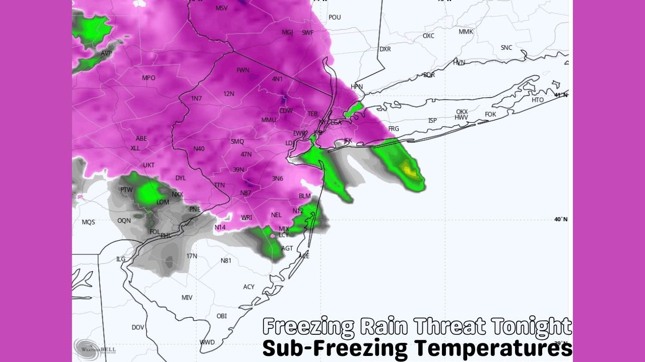
NEW YORK — A period of light freezing rain is expected Sunday evening across parts of northern New Jersey, the New York City metro area, Long Island, and southern Connecticut, as bands of rain move overhead while surface temperatures remain below freezing, forecasters warn.
Weather models show a thin but dangerous layer of ice developing on roads, bridges, sidewalks, and untreated surfaces, making travel conditions hazardous through the night.
Freezing Rain Likely as Temperatures Stay Below 32°F
High-resolution forecast guidance indicates rain falling into sub-freezing air at the surface, a setup favorable for freezing rain rather than snow. Even light precipitation could quickly freeze on contact, creating slick conditions.
Areas most at risk include:
- Northern and central New Jersey
- New York City and nearby suburbs
- Western and central Long Island
- Southern Connecticut
Forecasters stress that even minor icing can significantly increase accident risk, especially during nighttime travel.
Travel Impacts Expected to Increase Overnight
Because the freezing rain is expected during the evening and overnight hours, impacts may worsen as temperatures continue to drop.
Possible impacts include:
- Icy roads and bridges
- Slippery sidewalks and parking lots
- Reduced traction on untreated surfaces
- Higher risk of spin-outs and minor crashes
Drivers are urged to slow down, increase following distance, and avoid sudden braking. Pedestrians should use caution when walking on sidewalks and stairs.
Timing: Sunday Evening Through Late Night
Forecast models show freezing rain developing Sunday evening and continuing into the late night hours, before conditions gradually improve as temperatures rise or precipitation tapers off.
While widespread heavy icing is not expected, localized slick spots may persist into the early Monday morning commute, particularly in shaded or elevated areas.
Safety Officials Urge Caution
Emergency managers and meteorologists advise residents to:
- Limit unnecessary travel
- Check road conditions before heading out
- Use handrails and proper footwear when walking
- Allow extra time for overnight and early-morning travel
Even a thin glaze of ice can be enough to cause dangerous falls or vehicle accidents.
What Happens Next
Forecasters will continue monitoring temperature trends and precipitation coverage overnight. Any shift toward colder air could expand freezing rain impacts, while warmer temperatures would reduce icing concerns.
Residents in affected areas are encouraged to stay alert for updated advisories or short-term warnings as conditions evolve.
Stay Informed and Share Conditions
If you experience icy roads or hazardous conditions in your area, share what you’re seeing to help others stay safe. For continued weather updates, impact maps, and local alerts, follow WaldronNews.com and check back for the latest information.