
Kansas Sees Brief January Warmth Before Rain Thursday and Light Rain–Snow Mix Returns Friday Evening
KANSAS — After one more unseasonably warm and pleasant day, weather conditions across Kansas are set to shift back toward a more typical January pattern, according to the latest forecast data and National Weather Service outlooks. While confidence remains low on exact snow totals, any wintry precipitation late this week is expected to be light and generally under one inch.
Warm Conditions Peak Wednesday Before Pattern Change
Much of Kansas will see above-average temperatures Wednesday, with afternoon highs ranging from 61 to 66 degrees, especially across central and eastern parts of the state. This warmth marks the final mild stretch before a cooler, wetter system moves in.
Skies will remain partly sunny, making Wednesday the best day of the week for outdoor plans before unsettled weather returns.
Rain Spreads In Thursday as Cooler Air Arrives
By Thursday, a storm system moving across the Plains will bring widespread rain to Kansas. Temperatures will vary significantly, with highs ranging from the upper 40s to low 60s, depending on location.
- Southeast Kansas may remain relatively mild
- Northwest and north-central Kansas will cool more quickly behind the system
Rainfall will be light to moderate, with no flooding concerns expected at this time.
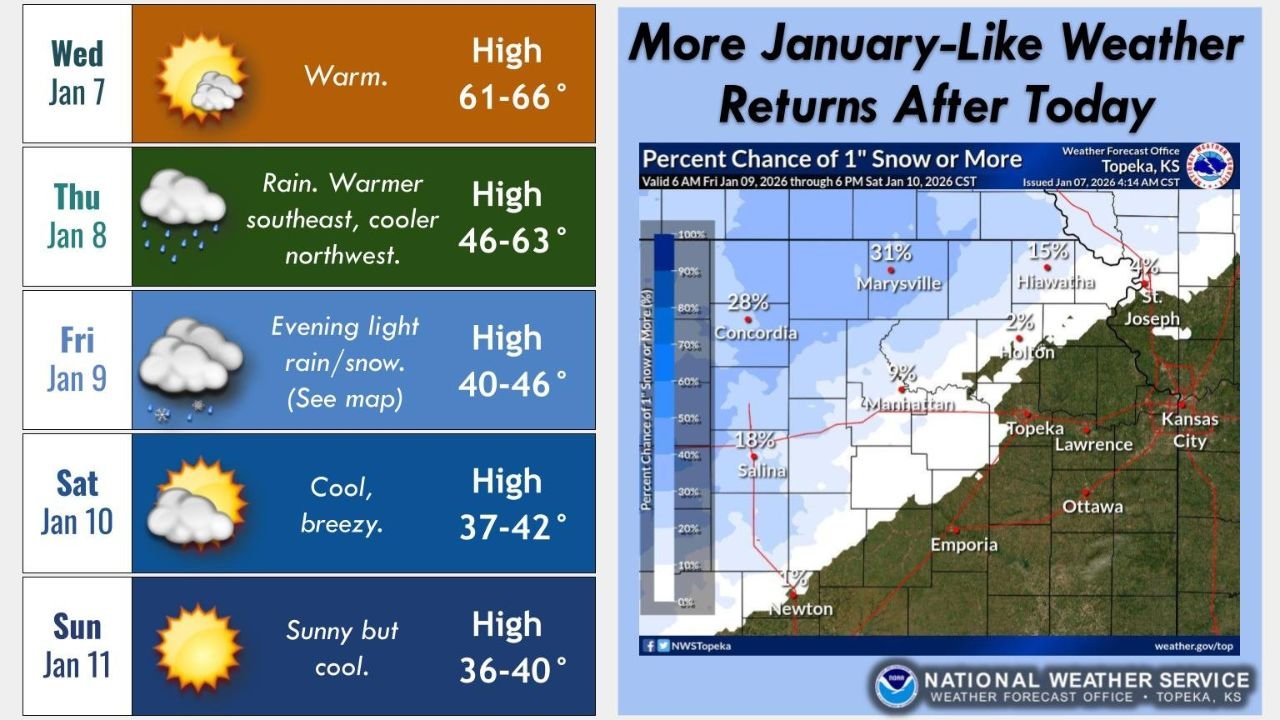
Light Rain-to-Snow Transition Possible Friday Evening
As colder air filters in late Friday, rain may briefly mix with or change to snow, particularly across north-central and northeast Kansas, including areas near Concordia, Marysville, Salina, and Manhattan.
Current probability data shows:
- Low chances (15–30%) of 1 inch of snow or more
- Most locations expected to see minor accumulations or just flurries
- Confidence remains low on exact placement and timing
Forecasters stress that regardless of snow occurrence, any accumulation should stay around or below one inch.
Cooler, Breezy Weekend Ahead
Behind the system, Kansas will settle into a cooler and more seasonable pattern:
- Saturday: Breezy and cool, highs in the upper 30s to low 40s
- Sunday: Dry and sunny but cold, highs near 36–40 degrees
No significant winter storms are expected over the weekend.
What to Know Right Now
- Enjoy Wednesday’s warmth — it won’t last
- Expect rain Thursday, with cooler air spreading in
- Light snow is possible Friday evening, but impacts look minimal
- Typical January cold returns for the weekend
Forecast confidence will improve over the next 24–48 hours as the system approaches.
For continued updates on Kansas weather, including snow chances and temperature changes, stay connected with WaldronNews.com and check back often as new data becomes available.