
Mississippi, Alabama, Arkansas, Tennessee, and Louisiana Placed Under 15% Severe Weather Risk as SPC Flags Potential Weekend Storm Setup
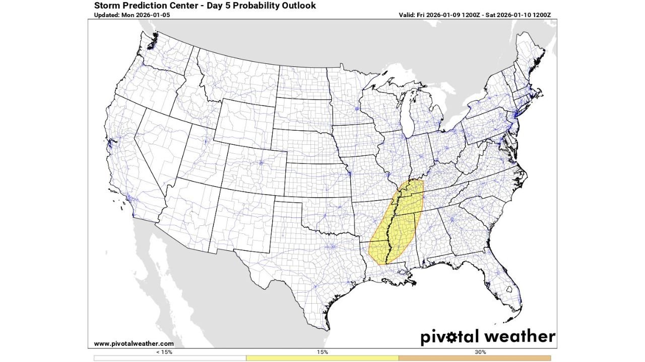
UNITED STATES — The Storm Prediction Center (SPC) has issued a 15% severe weather risk for parts of the Lower Mississippi Valley this weekend, highlighting portions of Mississippi, Alabama, eastern Arkansas, western Tennessee, and northern Louisiana as areas to watch for potential severe thunderstorms late Friday into Saturday.
According to the SPC Day 5 Probability Outlook, the highlighted zone indicates a growing signal for organized storms, though forecasters caution that the overall setup remains highly conditional and dependent on how the system evolves over the next several days.
What a 15% SPC Risk Means
A 15% risk at Day 5 typically signals that severe weather is possible but far from guaranteed. This category suggests that if storms develop and organize properly, damaging winds, isolated tornadoes, or severe hail could occur within the highlighted region.
However, meteorologists emphasize that not every 15% area results in a significant outbreak, especially when key ingredients such as instability, wind shear, and surface forcing are still uncertain this far out.
Regions Currently Highlighted by the SPC
The current risk zone stretches in a north–south corridor that includes:
- Central and northern Mississippi
- Western and central Alabama
- Eastern Arkansas
- Western Tennessee
- Far northern Louisiana
This placement suggests the SPC is monitoring a potential storm track along the Mississippi River Valley, where moisture return from the Gulf of Mexico could interact with a passing upper-level disturbance.
Why Confidence Remains Limited Right Now
Forecast guidance indicates that while wind energy may be sufficient, instability could be marginal, especially if cloud cover, weak surface heating, or poor moisture return limit storm strength. Small changes in timing or storm evolution could either enhance the severe risk or suppress it entirely.
Because of these uncertainties, forecasters urge the public not to focus solely on early model hype or single-run scenarios circulating online. Instead, the more reliable signal will come from trends over the next several forecast updates.
What Could Change Over the Next Few Days
If atmospheric trends become more favorable, the SPC could:
- Expand or shift the risk area
- Upgrade portions of the region to a higher severe category
- Introduce more specific hazards such as tornado or damaging wind probabilities
Conversely, if instability fails to materialize, the risk could be downgraded or removed entirely in later outlooks.
What Residents Should Do Now
While this is not an immediate threat, residents across the highlighted states should:
- Stay aware of updated SPC outlooks later this week
- Ensure severe weather alerts are enabled on mobile devices
- Be cautious of exaggerated social media forecasts that are not supported by official guidance
At this stage, the outlook is best described as “conditional but worth monitoring.”
Looking Ahead
Meteorologists will be watching whether this system trends toward something more organized or fades into a routine winter storm setup. The most important signals will emerge closer to the event as confidence improves.
For continued severe weather tracking, forecast updates, and clear explanations as conditions evolve, stay connected with WaldronNews.com.