
Pennsylvania Sees Return of Rain Showers as Milder Temperatures Move In, With Freezing Rain Risk in the Poconos and Snow Possible in Northwestern PA
PENNSYLVANIA — Rain showers are returning across much of the state as temperatures rise into the 30s, 40s, and even low 50s in some areas, ending the recent dry stretch and beginning a more unsettled pattern heading into mid-week.
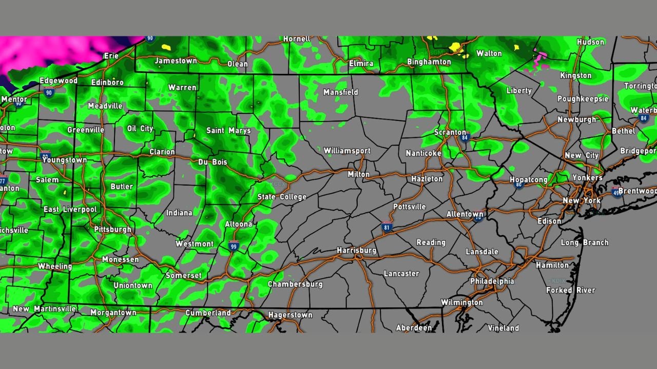
Forecast data shows a disturbance moving in from the northwest, spreading widespread rain showers across Pennsylvania Tuesday afternoon and evening, with most locations seeing plain rain. The system will also help wash lingering road salt off vehicles, but it may introduce travel concerns in higher elevations as colder air filters in later.
Rain Spreads Statewide as Temperatures Climb Above Freezing
Radar simulations indicate rain developing first across western and central Pennsylvania, including areas around Pittsburgh, State College, Altoona, and Williamsport, before expanding east toward Harrisburg, Reading, and the Philadelphia metro later in the day.
With surface temperatures remaining above freezing for most communities, rain will be the dominant precipitation type, especially across lower elevations and urban corridors.
Freezing Rain Possible in the Poconos and Higher Elevations
While most of the state remains mild, the highest elevations of the Pocono Mountains could briefly experience light freezing rain, particularly during the evening and overnight hours.
These areas may see surface temperatures hover near freezing while precipitation continues, allowing isolated slick spots on untreated roads, bridges, and elevated surfaces. Confidence remains low for significant icing, but residents in higher terrain should remain alert.
Northwestern Pennsylvania May Transition to Snow Late Tuesday Night
As colder air pushes in behind the system, parts of northwestern Pennsylvania, including areas near Erie, Warren, and Meadville, may see rain change over to snow late Tuesday night.
Any snowfall is expected to be light, but brief visibility reductions and slick road conditions are possible, especially on secondary roads.
What to Expect Over the Next 24 Hours
• Widespread rain showers across most of Pennsylvania
• Milder temperatures statewide during the day
• Isolated freezing rain risk in the Poconos
• Possible rain-to-snow changeover in northwestern PA late Tuesday night
Rainfall amounts appear manageable at this time, and no widespread flooding concerns are indicated based on current data. However, travel conditions may change quickly in higher elevations as temperatures fluctuate.
Stay weather-aware and continue checking updates as this system moves through the region. For continued Pennsylvania weather coverage and timely updates, keep following WaldronNews.com.