
Texas and Oklahoma Face Marginal Severe Weather Risk as Storm System Targets West and North Texas Into Thursday
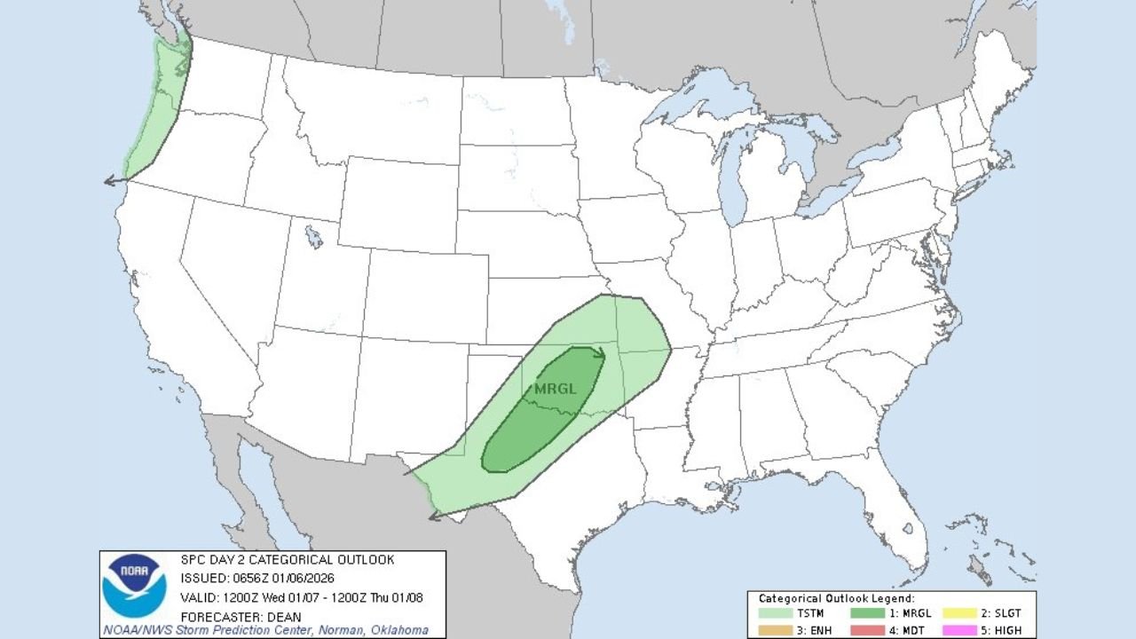
WALDRON, AR — A developing storm system is expected to bring a marginal risk of severe weather to parts of west and north Texas, extending into central and southern Oklahoma, according to the latest SPC Day 2 Outlook issued early Wednesday morning. While widespread severe weather is not anticipated, conditions may become favorable for isolated strong storms from Wednesday afternoon into early Thursday.
What the Day 2 Marginal Risk Means
A marginal risk (Level 1 of 5) indicates that isolated severe thunderstorms are possible. These events are typically limited in coverage but can still produce briefly damaging wind gusts, small hail, and locally heavy rainfall, especially in areas where storms are able to organize along frontal boundaries.
Areas Most Likely to Be Impacted
Based on the outlook map and storm placement, the primary risk zone includes:
- West Texas — including portions of the Permian Basin and South Plains
- North Texas — stretching toward the Red River region
- Oklahoma — mainly central and southern sections, particularly near the Texas border
Communities within this corridor should remain alert for rapidly changing weather conditions, especially during the late afternoon and evening hours when atmospheric instability peaks.
Primary Weather Threats
Forecasters highlight the following potential hazards:
- Gusty winds capable of downing small tree limbs or causing minor damage
- Small hail in stronger storm cells
- Heavy downpours, which could briefly reduce visibility on roadways
The overall severe threat remains limited, but a few storms could briefly intensify, especially where surface heating and upper-level support align.
Timing and Confidence
Storm development is most likely Wednesday afternoon through Wednesday night, with activity gradually shifting eastward or weakening by early Thursday. Forecast confidence is moderate, and updates are expected as higher-resolution data becomes available.
Residents are encouraged to monitor local forecasts, especially if outdoor plans or travel are scheduled during the risk window.
What to Do Now
- Stay weather-aware and check updates from trusted local sources
- Secure lightweight outdoor items that could be blown around by gusty winds
- Be prepared for brief travel delays during heavier downpours
Weather conditions can change quickly in marginal setups, and even isolated storms can still cause localized impacts.
Have you experienced recent unusual weather where you live, or are you preparing for storms this week? Share your thoughts and stay updated with the latest regional weather coverage at WaldronNews.com.