
Texas, Oklahoma, Arkansas, Louisiana, and Mississippi Face Marginal Severe Storm Risk as SPC Flags Southern Plains to Lower/Mid Mississippi Valley
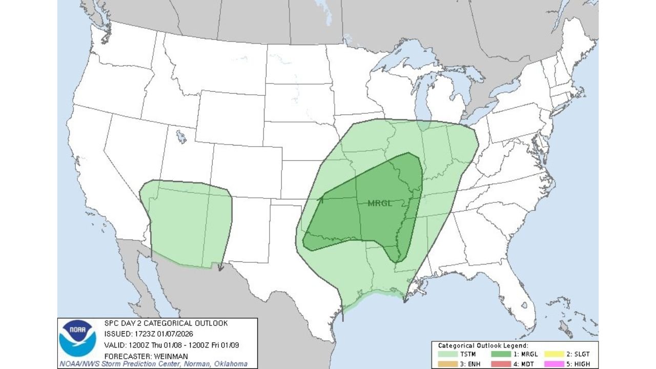
UNITED STATES — Parts of the Southern Plains and the Lower to Mid Mississippi Valley are under a Day 2 Marginal Risk for severe weather, according to the latest outlook issued by the Storm Prediction Center (SPC). The risk area stretches from Texas and Oklahoma eastward into Arkansas, Louisiana, and Mississippi, signaling the potential for isolated strong storms as a developing weather system moves through the region late Wednesday into Thursday.
What the SPC Day 2 Marginal Risk Means
A Marginal Risk is the lowest level on the SPC’s severe weather scale, but it still highlights areas where isolated severe thunderstorms are possible. In this setup, storms may remain scattered, yet a few could become strong enough to produce damaging wind gusts, brief hail, or localized downpours.
Forecasters emphasize that not everyone in the shaded area will see severe weather, but conditions will be favorable for at least a few stronger storms to develop.
Areas Included in the Risk Zone
Based on the SPC outlook map, the primary states and regions of concern include:
- North and Central Texas
- Oklahoma
- Arkansas
- Northern and Central Louisiana
- Mississippi
- Portions of the Lower and Mid Mississippi Valley
The highest focus is centered over parts of Texas, Oklahoma, and Arkansas, where atmospheric instability and wind shear overlap most effectively.
Timing and Storm Setup
The marginal risk is valid from Wednesday into early Thursday, as a developing storm system pushes east from the Southern Plains. Warm, moist air from the Gulf will interact with an advancing disturbance, allowing thunderstorms to form ahead of a cold front.
While widespread severe weather is not expected, any storm that intensifies could briefly turn strong, particularly during the evening and overnight hours.
Main Threats to Watch
If storms strengthen, the primary hazards may include:
- Gusty to locally damaging winds
- Small to isolated hail
- Heavy rainfall, which could briefly reduce visibility and cause ponding on roads
Tornado potential appears very low at this time, consistent with a marginal-risk pattern.
What Happens Next
Forecast confidence will improve as the system gets closer. Residents across the risk area are encouraged to monitor local forecasts and weather alerts, especially if outdoor travel or overnight plans are involved.
Even marginal setups can produce surprise impacts, particularly with fast-moving storms or nighttime activity.
Stay weather-aware and follow ongoing updates from WaldronNews.com as this forecast evolves.