
Texas, Oklahoma, Arkansas, Louisiana, and Mississippi May See a Developing Severe Weather Setup as Southern Jet Stream Intensifies Around January 9–10
TEXAS — A strengthening southern branch of the jet stream is drawing increased attention from forecasters as new model data points to a potentially favorable environment for organized thunderstorms across parts of the Mid-South during the January 9–10 time frame. While details remain uncertain, multiple atmospheric signals suggest a setup worth close monitoring.
Southern Jet Stream Finally Activates After a Quiet Start to Winter
For much of the early winter season, storm systems across the United States have been dominated by northern-stream clippers, limiting moisture return and keeping severe weather threats low across the southern states. Recent ECMWF-AIFS guidance, however, shows a marked shift in the upper-level pattern.
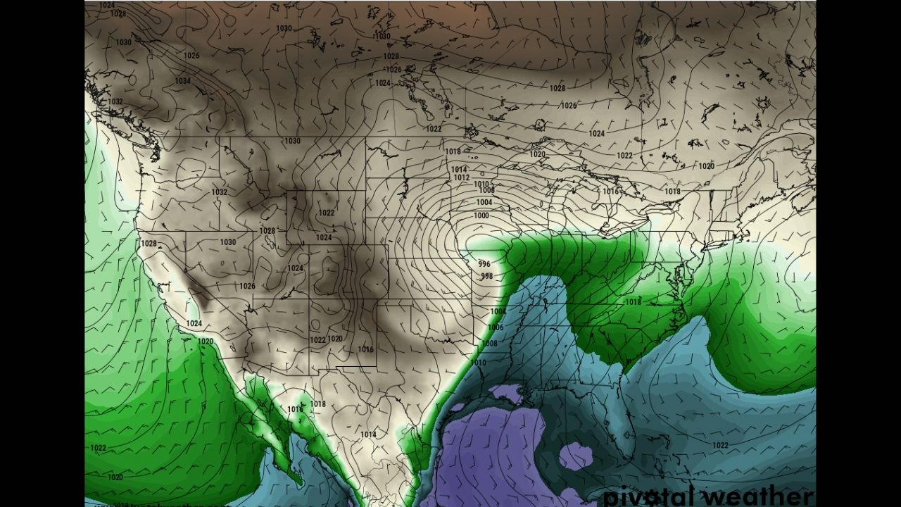
500-mb height and wind fields indicate a strong trough digging into the central United States, accompanied by a powerful jet streak exceeding 100 knots stretching from Texas through the Lower Mississippi Valley. This southern jet activation is a key ingredient often missing from earlier winter systems.
Upper-Level Support Signals Organized Storm Potential
At the mid and upper levels of the atmosphere, model data highlights strong cyclonic curvature and increasing divergence aloft, particularly across Texas, Oklahoma, Arkansas, and Louisiana. These features support rising motion in the atmosphere and can enhance thunderstorm organization when other ingredients align.
The 850-mb wind fields show a robust low-level jet developing from the Gulf of Mexico, signaling an improving moisture feed northward. Dew point guidance confirms this trend, with surface moisture surging into the Lower Mississippi Valley, a notable change from recent dry setups.
Moisture Return and Wind Shear Create a Favorable Background
Near-surface dew point maps show deepening Gulf moisture pushing inland, especially across eastern Texas and Louisiana. This moisture, combined with strengthening winds at multiple levels, produces increasing vertical wind shear, an essential ingredient for rotating storms.
Forecast soundings suggest moderate instability developing, along with strong directional and speed shear through the lowest several kilometers of the atmosphere. While instability values are not extreme at this stage, the overall wind profile favors organized convection, including the potential for supercell structures if storms can fully develop.
Uncertainty Remains, but Signals Are Trending Upward
It is important to note that this scenario remains several days out, and model solutions continue to evolve. Some guidance still shows variability in storm placement and timing, and moisture availability will be a critical factor in determining whether storms can reach severe thresholds.
However, the consistent upward trend in severe weather favorability across multiple model runs suggests this is not a one-off solution. Forecasters emphasize that phasing between the northern and southern jet streams will be the key factor in determining the final outcome.
What This Means Going Forward
If current trends hold, parts of Texas, Oklahoma, Arkansas, Louisiana, and Mississippi could experience the first meaningful severe weather setup of 2026. Potential hazards could include damaging winds, isolated tornadoes, and heavy rainfall, though no specific threats can be pinned down yet.
Residents across the Mid-South are encouraged to stay weather-aware heading into mid-January, as further model refinement over the coming days will clarify the level of risk.
Weather patterns across the southern United States are clearly changing, and this evolving setup may mark the start of a more active winter storm track as January progresses.
Stay tuned to Waldron for continued updates as new data becomes available.