
Virginia, West Virginia, North Carolina, Tennessee, and Kentucky Face Increasing Winter Weather Signal as Jet Stream Turns Active Ahead of MLK Weekend
VIRGINIA — An active winter weather pattern is beginning to take shape across parts of the Mid-Atlantic and southern Appalachians, with forecasters monitoring multiple systems that could influence temperatures and precipitation through the middle and latter part of January. While no single major storm is locked in, the overall pattern supports colder air, periodic snow chances, and increasing uncertainty heading toward the MLK Day weekend.
Sunday Cold Front Brings Windy and Colder Conditions
A cold front moving through the region on Sunday is expected to bring gusty winds and a noticeable drop in temperatures. Snow showers or brief snow squalls are possible, particularly in higher elevations and areas favored by northwest flow.
Accumulations should remain spotty and generally light, but even minor snowfall combined with wind could lead to slick travel conditions, especially during early morning and nighttime hours.
Midweek System Shows Low Confidence but Remains on the Radar
Forecast guidance for Wednesday into Thursday shows several pieces of energy moving through the jet stream that could attempt to merge. If this occurs, some areas may see a wet snow or wintry mix, though current data suggests cold air availability is limited.
Because small temperature differences will determine precipitation type, confidence remains low. Forecasters caution that minor shifts in timing or track could significantly change impacts, which is why this system continues to be closely monitored.
MLK Day Weekend Carries a Stronger Winter Weather Signal
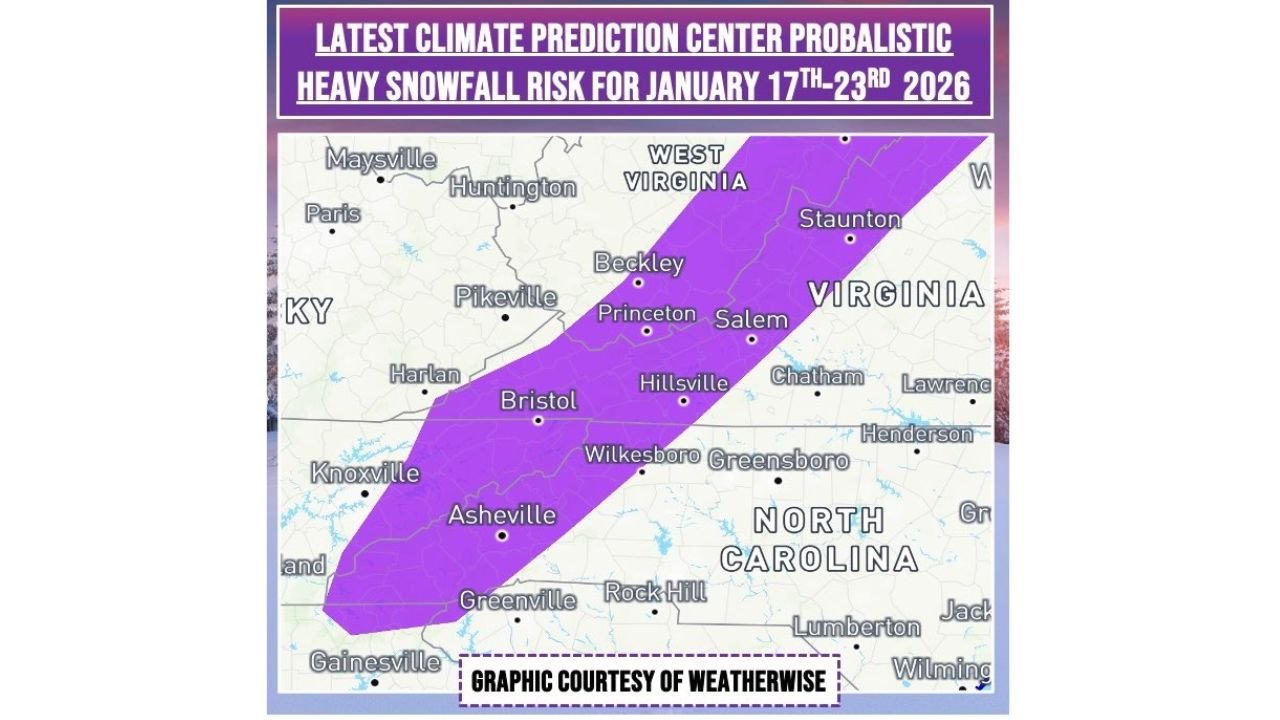
Looking further ahead, the Martin Luther King Jr. Day weekend stands out as a higher-interest period. The Climate Prediction Center has highlighted a slight risk for heavy snowfall between January 17 and January 23, extending across parts of Tennessee, North Carolina, Virginia, and West Virginia.
This does not guarantee a major snowstorm, but it does indicate a more favorable setup if cold air and storm energy align correctly. At this stage, no specific storm track or snowfall totals can be determined.
Why This Region Is Difficult to Forecast
Meteorologists consistently note that the Appalachians and Mid-Atlantic corridor are among the most challenging regions in the country for winter forecasting. Terrain effects, coastal temperature gradients, and jet-stream positioning often result in sharp cutoffs between rain and snow.
In some scenarios, systems may track offshore with little impact inland. In others, just enough cold air could arrive to support accumulating snow. These fine margins explain why forecasts will continue to evolve.
What Residents Should Expect and Prepare For
Residents across Virginia, North Carolina, Tennessee, Kentucky, and West Virginia should remain weather-aware through the coming week, especially if travel or outdoor plans are scheduled during the mid-January timeframe.
While no immediate major winter storm is confirmed, the pattern supports continued cold shots, occasional snow chances, and the possibility of stronger systems later. Forecast clarity is expected to improve as newer data becomes available over the next few days.
Stay tuned to Waldron for continued updates as this winter pattern develops and confidence increases.