
Maryland Faces Dangerous Freeze After Baltimore Metro Snow as Falling Temperatures and Strong Winds Create Ice
BALTIMORE, MARYLAND — A picturesque snowfall across the Baltimore metro area early Sunday is giving way to dangerous winter conditions as temperatures fall sharply and winds strengthen. Weather data shows that what melts late in the morning will refreeze by afternoon, turning roads, sidewalks, and parking lots across central Maryland into slick ice.
Forecasters warn that the most hazardous part of this winter event begins after the snow ends, not during it.
Snowfall Ends, but the Most Dangerous Conditions Are Still Ahead
Although snow has tapered off across Baltimore City and surrounding counties, the risk to residents is increasing rather than decreasing.
As one local weather message cautioned:
“Don’t wait until the afternoon to shovel. Temps will drop into the mid-20s and it will freeze into ice.”
Any slush or wet pavement left untreated will rapidly harden as temperatures fall, making travel and walking treacherous.
Temperatures Fall Into the 20s as Wind Increases
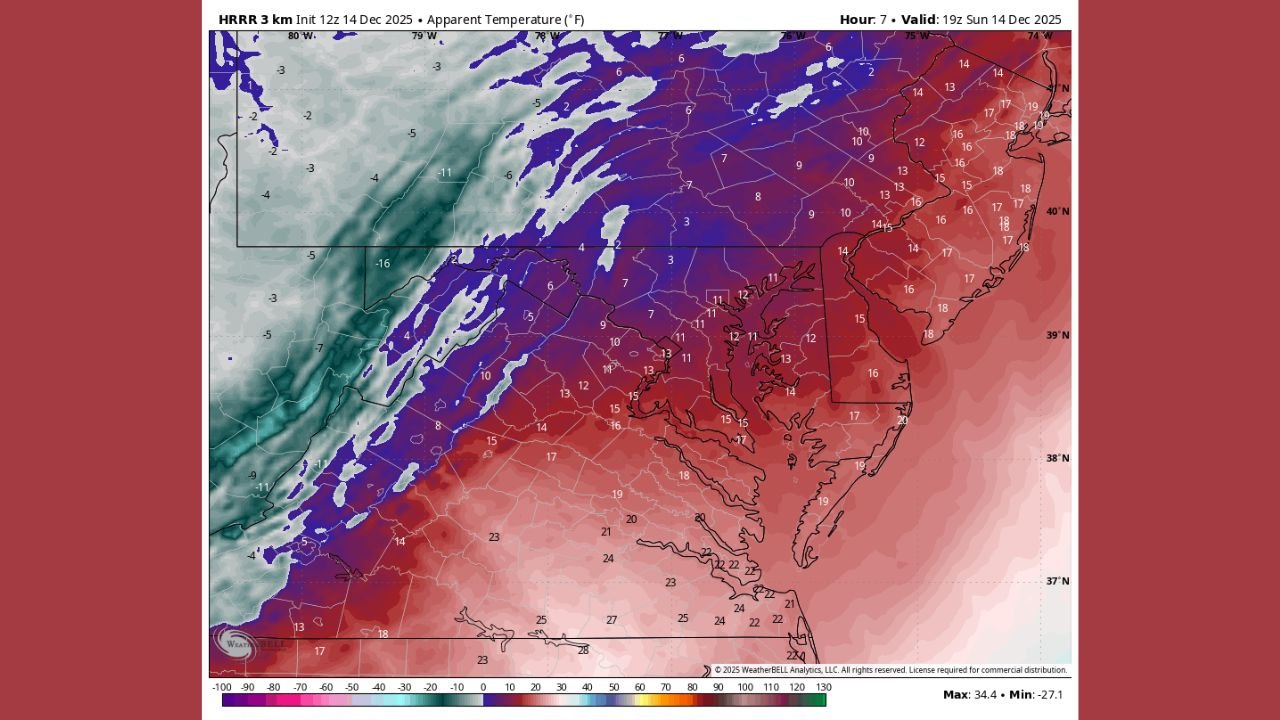
By early afternoon, air temperatures are expected to fall into the mid-20s, while northwesterly winds pick up across the region. High-resolution forecast models show the colder air deepening quickly behind the departing snow.
This sharp temperature drop will:
- Lock moisture into ice
- Make snow removal significantly harder
- Increase strain for anyone working outdoors
Wind Chills Drop Near 10 Degrees by Late Afternoon
The strengthening wind will dramatically worsen how cold it feels. Apparent temperatures (wind chills) are forecast to fall near or below 10 degrees by late afternoon and early evening.
Meteorologists note:
“The wind chill late in the day will likely be around 10 degrees.”
These conditions raise concerns for frostbite during prolonged exposure, especially for anyone shoveling snow or traveling on foot.
Blowing Snow and Falling Ice Add to Safety Concerns
As winds increase, snow trapped in trees and on rooftops will begin to blow loose, potentially falling onto sidewalks, vehicles, and roadways.
Residents may notice:
- Sudden bursts of blowing snow
- Reduced visibility in open areas
- Snow drifting back onto cleared surfaces
This can undo earlier cleanup efforts and create renewed slick spots even on treated pavement.
Travel Conditions Worsen Across Central Maryland
Drivers across Baltimore City, Baltimore County, Anne Arundel County, Harford County, and Howard County should prepare for rapidly deteriorating travel conditions, particularly during the afternoon and evening.
Key trouble spots include:
- Bridges and overpasses
- Side streets and residential roads
- Parking lots and driveways
Pedestrians are urged to move carefully, as thin ice may be difficult to see but extremely slippery.
Officials Urge Early Cleanup and Limited Exposure
Safety officials recommend completing snow removal as early as possible and limiting time outdoors once temperatures drop.
Winter safety reminders include:
- Dress in warm, layered clothing
- Wear gloves and insulated footwear
- Check on elderly neighbors and vulnerable individuals
- Secure loose outdoor items before winds increase
As one winter safety reminder puts it:
“Winter storms don’t end when the snow stops — ice and wind are often the biggest threat.”
WaldronNews.com will continue tracking conditions across Maryland. If you’re seeing icy roads, blowing snow, or hazardous conditions in your area, share your local update with WaldronNews.com to help keep others informed.