
Texas Winter Weather Alert: Cold Front Brings Sharp Temperature Drop and Possible Snow to West Texas on Monday
WEST TEXAS — A significant shift to winter-like conditions is expected across West Texas early next week as a strong cold front moves through the region Sunday night, bringing sharply colder temperatures and the potential for snow developing on Monday, according to the National Weather Service office in NWS Midland/Odessa.
Forecasters say the setup could lead to widespread precipitation across the region, with snow becoming increasingly possible as colder air settles in behind the front. While exact snowfall amounts remain uncertain, officials caution that travel impacts are possible, especially in higher elevations and areas west of Midland–Odessa.
What Meteorologists Know So Far
Forecast graphics released Friday evening show a storm system arriving late Sunday night into Monday, pulling much colder air south into West Texas and southeast New Mexico.
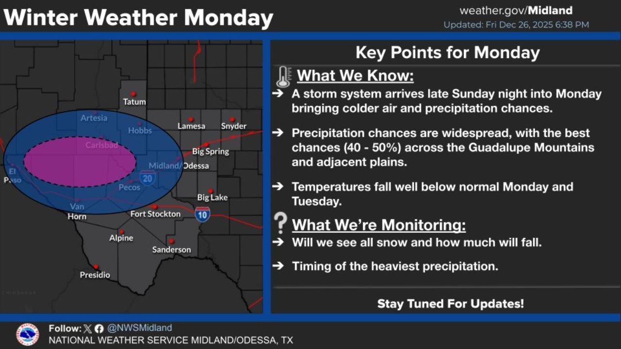
Key points from the forecast include:
- Widespread precipitation chances developing Monday
- Best chances (40–50%) across the Guadalupe Mountains and adjacent plains
- Temperatures falling well below normal Monday and continuing into Tuesday
The cold air arriving behind the front increases the likelihood that precipitation may fall as snow rather than rain in parts of the region.
Areas Most Likely to See Snow
The highest probability for snow currently centers on:
- Guadalupe Mountains
- Areas near Carlsbad, Pecos, Van Horn, and portions of the surrounding plains
- Elevated terrain west and southwest of Midland–Odessa
Lower elevations farther east may see a mix of rain and snow or remain primarily rain, depending on how quickly temperatures drop.
Forecast Uncertainties Still Being Monitored
While confidence is growing that winter weather will impact West Texas, forecasters emphasize that several details are still being refined.
Meteorologists are closely monitoring:
- Whether precipitation will fall entirely as snow
- How much snow may accumulate, if any
- The timing of the heaviest precipitation, which could influence travel conditions
Small changes in temperature or storm track could significantly affect snow coverage and totals.
Travel and Safety Considerations
Residents and travelers are encouraged to begin preparing now, especially those planning to travel through mountainous areas or rural highways.
Officials recommend:
- Monitoring forecast updates through the weekend
- Preparing for slick roads and reduced visibility Monday
- Allowing extra travel time if snow develops
- Checking road conditions before heading out, particularly in higher elevations
Even light snow can create hazardous driving conditions when combined with rapidly falling temperatures.
What Happens Next
Additional forecast updates are expected over the weekend as meteorologists gain more clarity on the storm’s evolution. Advisories or warnings could be issued if confidence increases in impactful snow or travel disruptions.
Stay with WaldronNews.com for continued updates on this developing Texas winter weather system, including refined snowfall forecasts, temperature trends, and any alerts that may be issued ahead of Monday’s cold snap.