
California Weather Pattern Shifts as Heavy Rain Targets Southern Counties and Santa Ana Winds Bring Gusts Up to 55 MPH Early Next Week
CALIFORNIA — A dynamic and potentially disruptive weather pattern is taking shape across California heading into the final days of 2025, with rounds of heavy rain expected from Santa Barbara to San Diego around New Year’s Eve and New Year’s Day, preceded by a brief but strong Santa Ana wind event Monday into Tuesday that could bring wind gusts as high as 55 mph in wind-prone areas.
Forecasters say the pattern will keep California unusually active through the holiday period, with Southern California once again emerging as the primary focus for impacts.
Southern California Braces for More Rain Through New Year’s
After already experiencing periods of heavy rainfall, Southern California is expected to see additional moisture funnel directly from the central Pacific, setting the stage for another soaking period around New Year’s Eve and New Year’s Day.
Rainfall projections indicate:
- Los Angeles to Santa Barbara counties remain the most likely bull’s-eye
- Additional rainfall totals of 1.5 to 2.7 inches are possible in parts of Southern California
- The wet pattern could extend beyond New Year’s Day, keeping soils saturated
With ground conditions already compromised in some areas, even moderate rainfall could increase the risk of localized flooding, runoff issues, and mudslides, especially near burn scars and steep terrain.
Santa Ana Winds to Develop Before Rain Arrives
Before the next round of rain moves in, forecasters expect a moderate but potentially impactful Santa Ana wind event to develop Monday into Tuesday.
Wind impacts may include:
- Gusts of 44–55 mph in and below mountain passes and canyons
- Strongest winds near Camarillo, the Oxnard Plain, western and eastern San Fernando Valley, Santa Clarita Valley, and Simi Valley
- Peak winds likely early Monday morning through Tuesday midday
Given the recent flooding rains, forecasters warn that trees with weakened root systems could be more easily uprooted, increasing the risk of downed trees and power outages during periods of stronger gusts.
Why the Winds Will Be Strong
The Santa Ana setup is being driven by a weak upper-level high over Northern Nevada combined with a departing surface low over Yuma, Arizona. This pressure difference is expected to create a strong offshore gradient, accelerating winds through Southern California’s mountain gaps and passes.
Upper-level support may further enhance wind speeds, particularly during the Monday morning to midday timeframe.
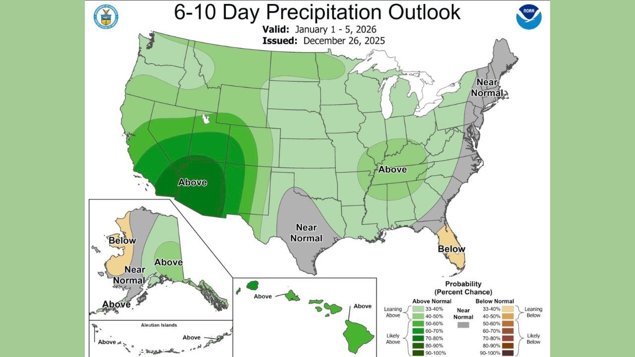
Rainfall Outlook Extends Into Early January
Longer-range outlooks continue to favor above-average precipitation across much of California into early January, especially across the southern half of the state.
Forecast signals suggest:
- Continued storm systems capable of producing periodic heavy rain
- Limited drying time between systems
- Elevated risk for runoff-related issues if rainfall concentrates over short periods
Northern California may also see periods of rain, though Southern California remains the most consistently favored region for heavier totals.
What Residents Should Watch For
Officials encourage Californians to remain weather-aware through the holiday period, particularly in Southern California.
Key concerns include:
- Downed trees or power lines during Santa Ana winds
- Flood-prone roads and poor drainage areas during heavy rain
- Travel disruptions around New Year’s celebrations
- Increased risk near hillsides and burn scars
Residents are urged to secure loose outdoor items, avoid unnecessary travel during peak wind or rain periods, and stay updated on the latest forecasts.
WaldronNews.com will continue tracking California’s evolving holiday weather pattern and provide updates as new forecast details become available.