
Severe Thunderstorm Risk Returns to Georgia and South Carolina as Quiet Weather Pattern Breaks Friday Afternoon
GEORGIA — A break in the recent quiet weather pattern is expected on Friday afternoon, as strong to potentially severe thunderstorms develop across southeast Georgia and spread into coastal South Carolina, according to the latest forecast guidance. The setup brings a renewed risk for damaging wind gusts, heavy rain, and isolated severe storms, especially from mid-afternoon into the evening hours.
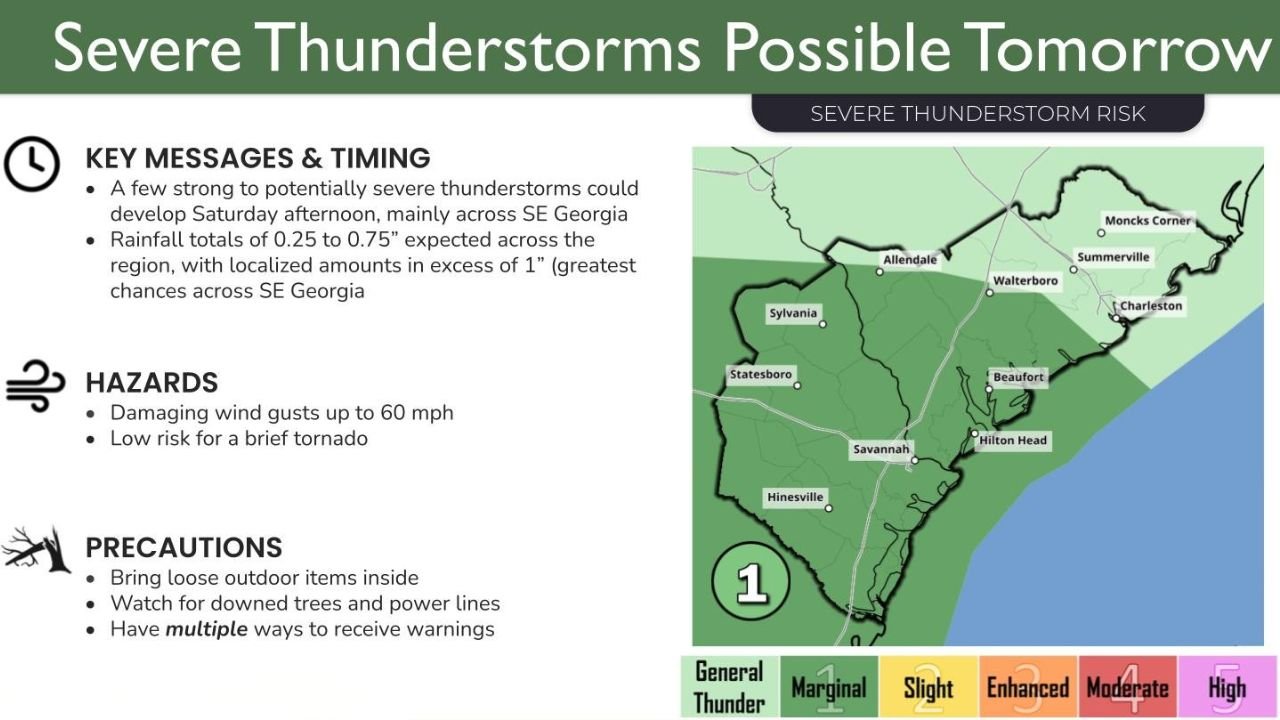
What’s Driving the Severe Weather Threat
After several days of relatively calm conditions, a disturbance moving into the Southeast will provide the lift needed for thunderstorms to develop. Warmer air near the surface combined with increasing moisture will allow storms to strengthen as they move east and southeast during the afternoon.
Forecast guidance indicates that southeast Georgia will see the earliest storm development, with activity expanding toward the Georgia coast and coastal South Carolina, including areas near Savannah, Hilton Head, and Charleston later in the day.
Primary Hazards to Watch For
Meteorologists say the main threats from Friday’s storms include:
- Damaging wind gusts up to 60 mph, capable of downing trees and power lines
- Heavy rainfall, with totals generally between 0.25 and 0.75 inches, but localized amounts over 1 inch possible in stronger storms
- A low but non-zero risk of a brief tornado, particularly in the strongest cells
While widespread severe weather is not expected, any storm that intensifies could produce hazardous conditions quickly, especially during peak travel hours.
Timing and Areas Most at Risk
Storm chances will increase Friday afternoon, mainly after lunchtime, with the highest risk window from mid-afternoon through early evening. The greatest concentration of stronger storms is expected across:
- Southeast Georgia, including inland and coastal counties
- Coastal South Carolina, from Hilton Head northward toward Charleston
Farther inland, storms may weaken but could still produce gusty winds and brief heavy rain.
Safety and Preparedness Tips
Residents across Georgia and South Carolina are urged to stay weather-aware and take basic precautions ahead of the storms:
- Secure loose outdoor items that could be blown around by strong winds
- Watch for downed trees and power lines if storms move through your area
- Have multiple ways to receive weather warnings, including phone alerts and local broadcasts
Conditions can change rapidly, so staying informed will be critical as storms develop.
As this active weather pattern unfolds, continue checking WaldronNews.com for the latest updates, local impacts, and additional weather coverage as new information becomes available.