
Severe Thunderstorm Warning Issued for Lincoln, Montgomery and Warren Counties in Missouri as 60 mph Winds and Quarter-Size Hail Hit Bellflower Saturday Night
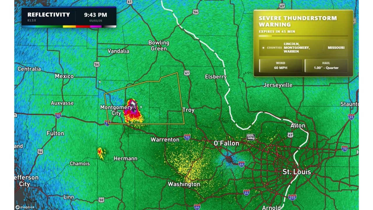
BELLFLOWER, Missouri — A Severe Thunderstorm Warning was active Saturday night, May 3, 2026 at 9:43 PM for Lincoln, Montgomery and Warren Counties in Missouri as a dangerous hailstorm exploded over Bellflower and pushed toward the broader St. Louis region. The warning carried threats of 60 mph wind gusts and 1.00 inch quarter-size hail, with residents near St. Louis urged to protect vehicles immediately.
What the Warning Covered
The active Severe Thunderstorm Warning, set to expire in 45 minutes from the time of the radar capture, covered three Missouri counties directly in the storm’s path:
- Lincoln County
- Montgomery County
- Warren County
The storm’s radar core was centered near Montgomery City and Bellflower, with the most intense reflectivity — deep red, pink and purple returns — concentrated in a tight and rapidly intensifying cell moving east-northeast toward Troy, Warrenton and eventually the St. Louis metro.
The Threats Inside This Storm
Two specific hazards were confirmed inside the warning:
60 mph wind gusts — strong enough to down trees, snap power lines and cause structural damage to poorly built structures
1.00 inch quarter-size hail — large enough to dent vehicles, damage roofs, shatter windows and injure anyone caught outdoors without shelter
St. Louis Area on Watch
While the warning itself covered Lincoln, Montgomery and Warren Counties, the broader isolated storm threat was expected to continue over the next few hours across the St. Louis region. Anyone parking vehicles outdoors near St. Louis, O’Fallon, Troy or Warrenton was advised to move them into covered parking before the storm arrived.
A secondary area of lighter precipitation was also visible on radar near Washington, Missouri and pushing toward the southern St. Louis suburbs.
WaldronNews.com will continue tracking severe storm activity across Missouri and will provide updates as conditions develop through Saturday night.