
Eastern Pacific Tropical Development Area Flagged for Mid-May as Above Average Water Temperatures Support Early Season Activity Off Central America
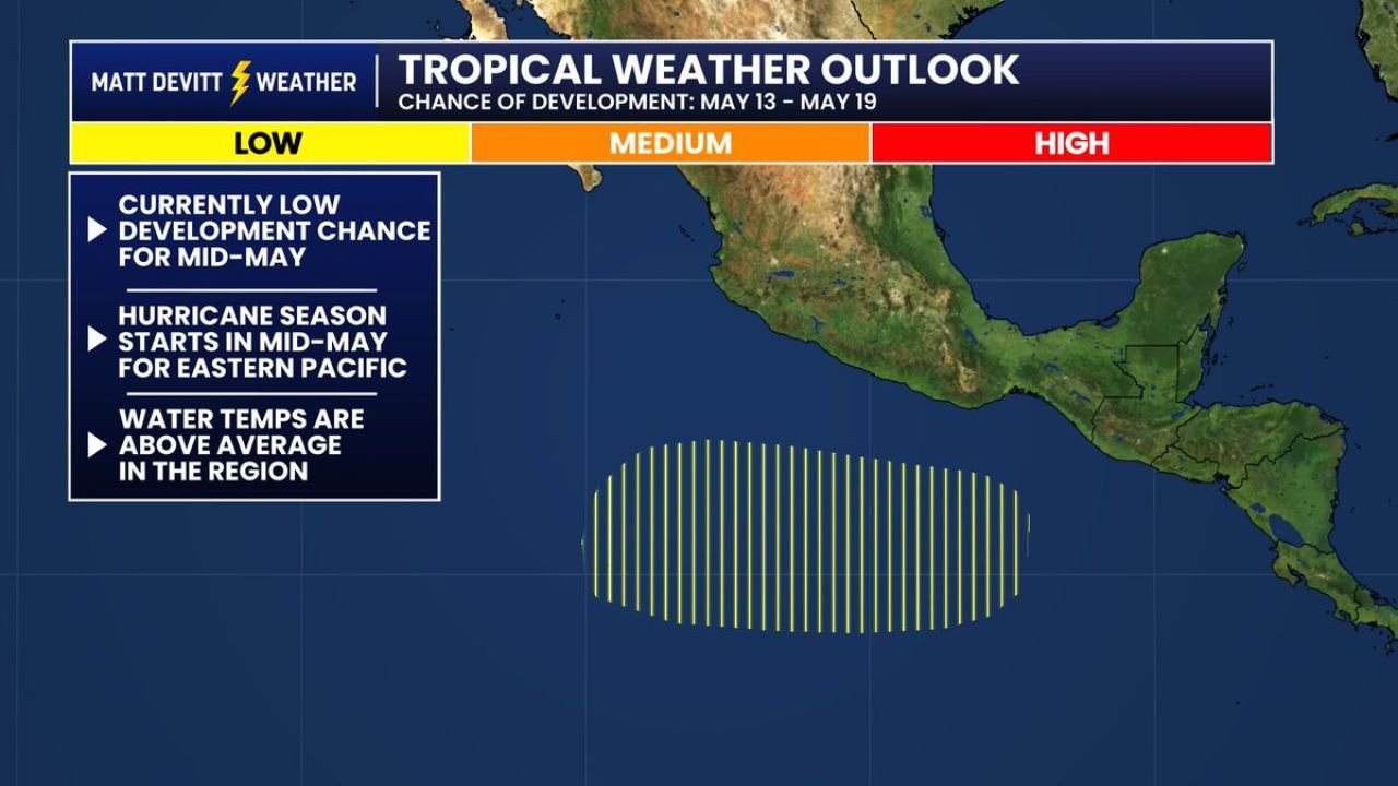
MIAMI, Florida — The Eastern Pacific Hurricane Season does not officially begin until May 15, and already the Climate Prediction Center has flagged a potential area of tropical development for the mid-May window. The disturbance area, shown in the tropical weather outlook valid May 13 through May 19, carries a currently low chance of development but sits over waters running above average in temperature — precisely the condition that allows early season Eastern Pacific systems to develop faster than historical climatology would suggest.
The Atlantic basin remains quiet at this time.
What the CPC Has Flagged
The hatched oval on the tropical weather outlook is positioned in the Eastern Pacific south of Mexico and off the coast of Central America, the primary genesis region for Eastern Pacific tropical systems. This area is not currently showing organized convection or a defined surface circulation, which is why the development chance sits at the low end of the probability scale. What makes it worth watching is the combination of:
- Above average sea surface temperatures across the genesis region, providing the oceanic heat content that tropical systems need to develop and sustain themselves
- Timing that aligns with the season’s opening week, when the Eastern Pacific climatologically begins its most active tropical weather period
- CPC attention at this lead time, indicating that the large-scale atmospheric pattern through mid-May is at least conditionally supportive of development attempts even if confidence in a specific system remains low
Why the Eastern Pacific Season Starts May 15
The Eastern Pacific Hurricane Season officially opens May 15 for a reason that is directly tied to the oceanographic and atmospheric conditions that develop across this basin during late spring. As the Intertropical Convergence Zone shifts northward through April and May, it draws increased convective activity into the Eastern Pacific genesis region. Sea surface temperatures in this basin warm rapidly through May as solar heating increases, and the atmospheric wind patterns that support tropical development become more consistently favorable.
Historically, the Eastern Pacific is the most active tropical cyclone basin in the world on a per-unit-area basis. It generates more named storms per square kilometer of ocean than the Atlantic, and early season systems in the Eastern Pacific can develop quickly given the warm waters that characterize this basin even in May.
The Above Average Water Temperature Signal
The most significant detail in this forecast is not the low development probability — it is the above average water temperatures already present in the development area. Sea surface temperatures running above normal heading into the opening week of the Eastern Pacific hurricane season create a more favorable thermodynamic environment for any disturbance that does attempt organization.
Above average water temperatures mean:
- More oceanic heat content available to fuel convective development within a disturbance
- A lower threshold for convective organization, meaning weaker atmospheric disturbances can sustain tropical development than would be possible over cooler waters
- Greater potential for rapid intensification if a system does develop, as the warm water reservoir below the storm surface is deeper and more energetic than climatological averages
This same dynamic — above average sea surface temperatures in the Eastern Pacific genesis region — has been noted in the extended outlook context as a factor that could make the 2026 Eastern Pacific season more active than average if the warm water signal persists through the summer months.
Atlantic Basin Status
All is currently quiet in the Atlantic basin. No areas of development are being tracked by the National Hurricane Center at this time, and the large-scale pattern across the Atlantic through mid-May does not support tropical development. The cold trough dominating the eastern United States and the associated high pressure pattern over the Atlantic are suppressive for any tropical activity in that basin through at least the first several weeks of May.
What to Watch Through Mid-May
- Monitor the CPC and NHC tropical weather outlooks beginning May 13 for any upgrade in the Eastern Pacific development area probability
- The low development chance can rise quickly if a well-defined surface low forms within the hatched area and upper-level winds remain favorable for organization
- Water temperatures in the Eastern Pacific genesis region through mid-May will be the key environmental indicator of how conducive the basin is for early season activity
- The Atlantic basin quiet period is expected to persist through the opening weeks of the official Atlantic hurricane season, which begins June 1
WaldronNews.com will continue monitoring Eastern Pacific and Atlantic tropical development potential through May and provide updates as the Eastern Pacific Hurricane Season officially opens and any disturbances attempt organization.