
Connecticut Faces Light Snow and Slick Travel Risk From Sunday Morning Into Monday Evening
CONNECTICUT — A weak but persistent winter system is expected to bring flurries Sunday morning followed by steadier light snow Monday afternoon into Monday evening, creating the potential for slick roads and minor travel disruptions, especially during the Monday evening commute, according to the latest regional forecast data.
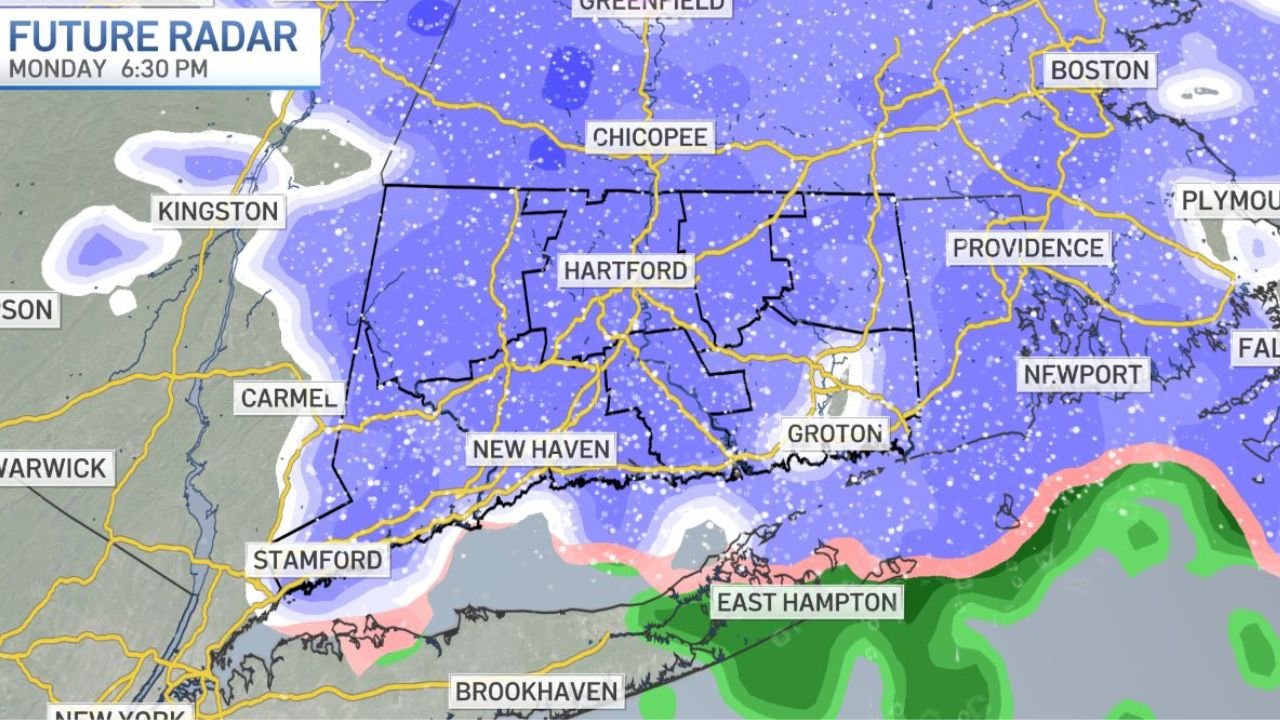
Forecast graphics show most of Connecticut receiving up to 1 inch of snow, with localized totals of 1–2 inches in parts of northwestern Connecticut, including higher elevations. While overall accumulation is expected to remain modest, timing and road temperatures could still lead to hazardous travel conditions.
Flurries Begin Sunday, Snow Becomes Steadier Monday
Forecast timelines indicate scattered flurries developing Sunday morning, mainly producing little to no accumulation. Conditions remain relatively quiet through early Monday before steadier snow spreads across the state Monday afternoon.
Snowfall is expected to intensify slightly into Monday evening, coinciding with peak travel hours. This timing raises concern for slick spots on untreated roads, bridges, and overpasses, even though snow totals remain on the lower end.
Snowfall Totals Remain Modest but Uneven
Snowfall forecast maps show a clear gradient across the state:
- Up to 1 inch for much of central and southern Connecticut, including Hartford and New Haven
- 1–2 inches possible across northwestern Connecticut
- Coastal areas may see mixed precipitation nearby, but most inland locations remain snow-dominant
Because snowfall rates are expected to be light, compaction and melting will limit total accumulation, but even light snow can create hazardous conditions when temperatures hover near freezing.
Monday Evening Commute Poses Highest Risk
The greatest travel concern is expected late Monday afternoon through Monday evening, when snowfall overlaps with commuter traffic. Even minor accumulation during this window can lead to slippery road surfaces, reduced visibility, and slower travel speeds.
Drivers are urged to use caution, particularly in higher elevation towns and secondary roads that may not be treated as quickly as major highways.
No Major Winter Storm, But Caution Still Advised
This system does not qualify as a major winter storm, and widespread disruptions are not expected. However, forecasters emphasize that light snow events can still cause problems, especially when snow falls steadily for several hours.
Residents should monitor local updates, allow extra travel time Monday evening, and remain cautious as conditions evolve.
Stay with WaldronNews.com for continued weather updates and local impact coverage as this system moves through Connecticut.