
Pennsylvania, New York, New Jersey, Maryland, and Virginia Could See a Developing Winter Storm Signal Between January 12–16 as East Coast Trough Takes Shape
UNITED STATES — ECMWF ensemble guidance continues to highlight the January 12–16 timeframe as a period to monitor closely, with a strong western ridge and a deepening East Coast trough beginning to align. While this does not currently signal a major winter storm, the evolving pattern supports cyclogenesis potential along the East Coast and light snow chances across parts of the Midwest, Great Lakes, and Northeast.
Upper-Level Pattern Supports a Colder Turn in the East
500-mb height anomaly data shows above-normal heights across the western United States and a pronounced negative anomaly developing over the eastern U.S. This configuration favors colder air pressing southward into the Ohio Valley, Mid-Atlantic, and Northeast while creating a favorable environment for storm development near the East Coast.
The trough structure shown in the ensembles is notable, but still subject to change, especially with timing and depth.
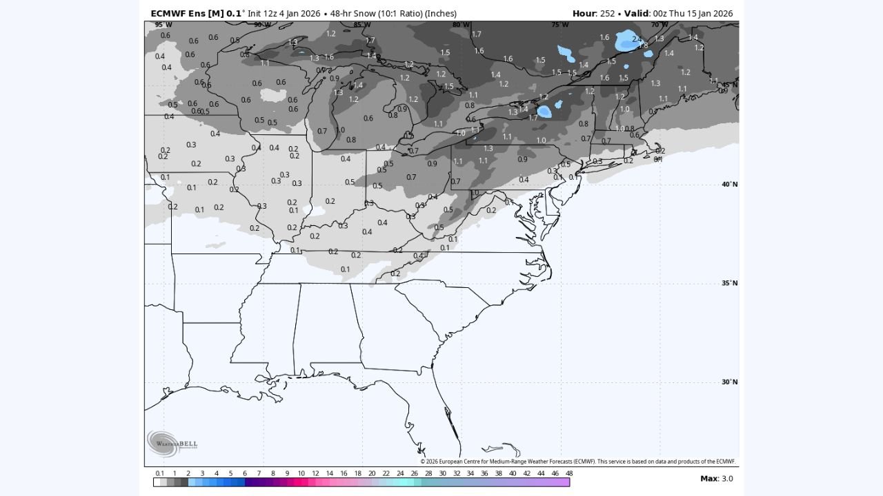
Snowfall Signals Remain Limited at This Stage
ECMWF ensemble snowfall output currently suggests minor accumulations, reinforcing that this is not a high-impact winter storm signal at this time. Expected ranges based on current data include:
- Great Lakes & Upper Midwest: Generally 0.5 to 1.5 inches, with localized higher amounts possible in lake-enhanced zones
- Ohio Valley & Interior Northeast: Spotty dustings up to around 1 inch
- Mid-Atlantic & Coastal Areas: Mostly rain or minimal snow unless colder air arrives faster than projected
These totals may shift as ensemble spread tightens over the coming days.
Why Confidence Is Still Low
Despite improving large-scale signals, model inconsistency remains, particularly with:
- Exact trough placement
- Timing of Arctic air delivery
- Whether surface low pressure strengthens offshore
Because of this, snowfall coverage and intensity could still change notably.
Mid-January Remains a Climatologically Active Window
Historically, January 15 through late February is the most active winter period for the eastern United States. Even if this system stays modest, upper-air signals suggest winter may reload, with additional opportunities for snow later in the month.
If you’re tracking winter weather closely, keep watching updates over the next several days as model confidence improves and details become clearer.