
Pennsylvania, New York, New Jersey, and New England States Could See Renewed Cold and Light Snow Threat as Mid-January Pattern Shift Emerges
UNITED STATES — Long-range ensemble guidance from the ECMWF is signaling a notable pattern change between January 12 and January 16, with atmospheric signals pointing toward renewed cold shots across the eastern United States and a low-confidence but monitor-worthy East Coast storm setup. While this does not appear to be a major winter storm at this time, the evolving pattern supports below-normal temperatures and the potential for light snow or wintry precipitation, particularly across parts of Pennsylvania, New York, New Jersey, and interior New England.
Large-Scale Pattern Shift Begins Over Alaska and Canada
Mid-level height anomaly data shows a positive EPO (Eastern Pacific Oscillation) phase early, allowing milder Pacific air to flood much of the U.S. in the short term. However, ensembles indicate a transition toward a Hudson Bay vortex (+TNH) combined with neutral to negative EPO conditions as mid-January approaches.
This shift opens the door for cross-polar flow, a setup that allows colder Arctic air to spill southward into the eastern half of the country, similar to what was observed during colder periods in December.
Eastern U.S. Cold Risk Increases After January 12
As the trough deepens over the eastern United States, temperature anomalies turn increasingly negative from the Midwest into the Northeast, with the strongest signal centered over the Ohio Valley, Mid-Atlantic, and interior Northeast.
This pattern favors:
- Below-average temperatures
- Increased frost and freeze risk
- Renewed snow chances where moisture overlaps cold air
While southern states remain largely outside the core cold pool, northern Appalachians, Pennsylvania, upstate New York, and interior New England sit squarely in the favored zone for colder impacts.
Potential East Coast Storm Signal Remains Low Confidence
Ensemble guidance also hints at possible cyclogenesis along the East Coast, supported by:
- A western ridge
- A deep eastern trough
- A NAO phase trending from negative toward neutral or positive
These ingredients can support coastal storm development, but forecast confidence remains low. Current ensemble snowfall output suggests light accumulations (generally under 2 inches) across parts of:
- Pennsylvania
- New York
- Northern New Jersey
- Interior New England
At this stage, this is not a high-impact winter storm signal, but rather a pattern worth monitoring as model clarity improves later this week.
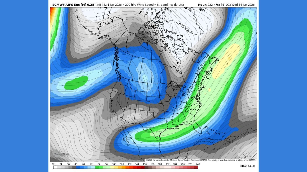
Southern Jet Stream Trends Add Uncertainty
Upper-level wind forecasts show signs of a strengthening southern jet, a key ingredient for East Coast storm development. However, this feature has been inconsistent in recent months, and models must confirm that it does not revert back to northern-jet dominance.
Because this is day-10 ensemble guidance, small changes in jet placement could significantly alter impacts.
What This Means Right Now
- Cold shots are increasingly likely across the eastern U.S. after mid-month
- Light snow or wintry precipitation is possible, mainly inland
- No major storm confirmed — monitoring phase only
- Confidence will increase as the timeframe moves closer
Residents across the Northeast and Mid-Atlantic should stay alert to forecast updates, especially if travel plans fall between January 12 and January 16.
Stay with Waldron News for continued updates as confidence increases and the mid-January weather pattern becomes clearer.