
SPC Upgrades Northern Mississippi and Northern Alabama to 5% Tornado Risk as Large Hail and Damaging Winds Threaten the Region Today
MISSISSIPPI — The Storm Prediction Center has upgraded parts of northern Mississippi and northern Alabama to a 5% tornado risk for today, signaling increasing concern that a few tornadoes could develop as severe storms move across the region.
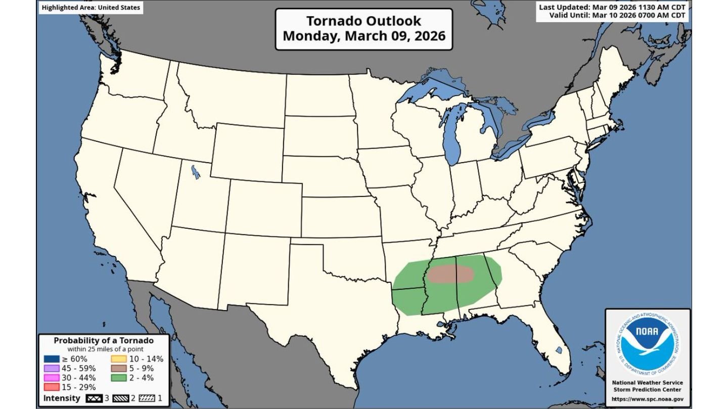
The updated tornado outlook highlights a corridor stretching across northern Mississippi into northern Alabama, where atmospheric conditions are becoming more favorable for rotating storms.
What the 5% Tornado Risk Means
A 5% tornado probability indicates that within 25 miles of any point inside the highlighted area, there is a measurable risk of tornado development. While not an extreme category, it reflects enough confidence in the setup for forecasters to warrant public attention.
Northern Mississippi and northern Alabama sit within the upgraded zone, where ingredients for tornadic storms are aligning through the afternoon and evening hours.
Main Threat: Large Hail
Although the tornado risk has been upgraded, large hail remains the primary concern across the region. Strong updrafts within severe thunderstorms are expected to support hailstones capable of causing:
- Damage to vehicles
- Broken windows
- Roof and siding damage
Hail-producing supercells may develop ahead of any larger storm complex, particularly during peak heating.
Damaging Winds Also Expected
In addition to hail and the tornado threat, damaging straight-line winds are likely with stronger storm clusters.
Wind gusts capable of downing trees and power lines could develop, especially as storms organize or transition into lines later in the day. Even outside of tornadic circulations, severe wind gusts may pose a significant hazard.
Tornado Potential: A Few Cannot Be Ruled Out
Forecasters emphasize that while tornadoes are not expected to be widespread, the environment supports the development of at least a few tornadoes within the risk area.
Storm mode will be critical. Any discrete storm that becomes established in the right wind shear environment could briefly rotate and produce a tornado before storms merge into larger clusters.
Communities across:
- Northern Mississippi
- Northern Alabama
should remain alert through the afternoon and evening hours.
Timing and Preparedness
The tornado outlook is valid through early Tuesday morning, with the greatest concern centered on the afternoon and early evening period.
Residents in the highlighted area should:
- Have multiple ways to receive weather alerts
- Review tornado safety plans
- Identify safe shelter locations in advance
Severe weather can escalate quickly, especially in early spring setups across the Deep South.
WaldronNews.com will continue monitoring updates as storms begin to intensify across northern Mississippi and northern Alabama. Stay weather-aware and prepared throughout the day.