
United States Severe Weather Pattern Pauses as High Pressure Shuts Down Storms Through Late March Before Possible Comeback Toward Month End
UNITED STATES — After an active stretch of storms across the country, a noticeable shift in the weather pattern is now underway as strong high pressure builds in, bringing a temporary shutdown of significant severe weather activity across much of the United States. This calmer period is expected to last for about a week, offering a break from recent storm threats before conditions may turn active again toward the end of March.
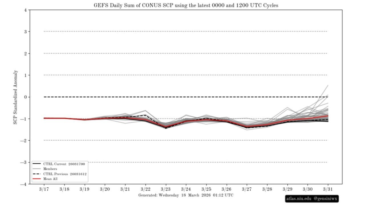
High Pressure Takes Control Across the Country
Forecast data shows a dominant high-pressure system settling over large portions of the U.S., leading to:
- Suppressed storm development
- Reduced atmospheric instability
- A much quieter weather pattern overall
This setup is effectively limiting the ingredients needed for severe weather, especially across the Plains, Midwest, and South — regions that had recently been more active.
Severe Weather Activity Drops Below Normal
Model guidance tracking severe weather parameters indicates that activity levels are trending below normal for this time of year.
- Severe weather signals remain muted through much of the upcoming week
- Storm potential stays limited across key regions
- Overall risk remains low compared to recent weeks
This aligns with expectations during periods dominated by stable atmospheric conditions.
A Break After Weeks of Active Storms
The quieter pattern comes after multiple rounds of storms impacted various parts of the country earlier in March.
Now, this transition provides:
- A temporary break from severe weather threats
- More stable and predictable conditions
- Reduced risk of widespread storm impacts
For many areas, this will be a welcome pause.
Signs of Change Toward the End of March
While the current pattern is quiet, it may not last long.
Forecast trends suggest:
- Gradual increase in storm signals toward the end of March
- Potential return of more active weather patterns
- Increasing uncertainty as the atmosphere begins to shift again
Some model projections hint at rising instability late in the period, which could reintroduce storm chances.
What This Means Going Forward
For now, the focus is on a calm stretch of weather across much of the country. However, this should be viewed as a temporary lull rather than a long-term shift.
- Short term → Quiet and stable conditions dominate
- Late March → Possible return of severe weather activity
This kind of pause is common during seasonal transitions.
Enjoy the Calm Before the Next Shift
The current setup offers a brief opportunity to recover from recent storms, but attention will quickly shift back to monitoring conditions as the end of March approaches.
As patterns begin to evolve again, the potential for renewed severe weather will likely come back into focus.
Stay with WaldronNews.com for continued updates as the next phase of the severe weather season develops across the United States.