
Indiana, Ohio and Kentucky See Snow on Radar That Never Reaches Ground as Dry Air Causes Overnight “Virga” Event Around Indianapolis, Cincinnati and Louisville
INDIANAPOLIS, INDIANA — Early morning radar scans lit up portions of Indiana, Ohio and Kentucky in shades of blue, suggesting snow was falling across the region. But at the surface, many communities woke up to dry pavement and quiet skies.
The reason? A classic case of virga — precipitation that evaporates before it ever reaches the ground.
Blue on Radar, But Nothing at the Surface
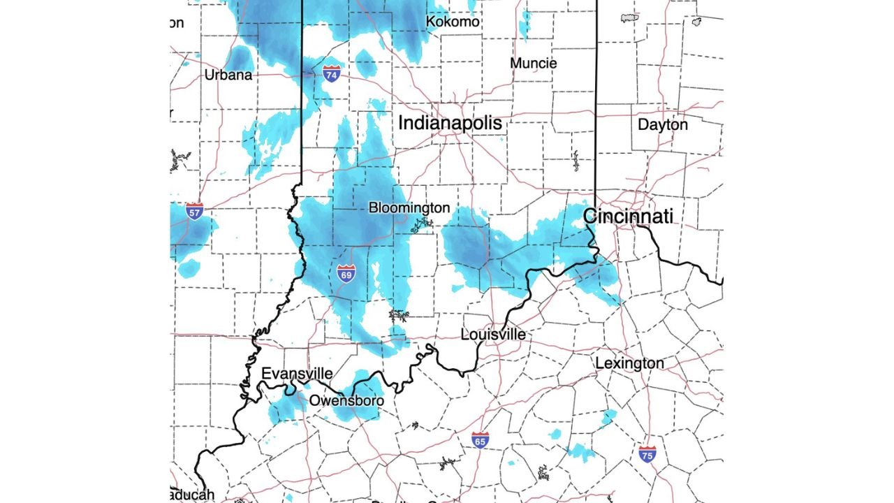
As of around 3:51 a.m. Eastern Time, radar imagery showed snow echoes stretching across:
- Indianapolis and surrounding central Indiana communities
- Bloomington and areas along Interstate 69
- Portions of southwest Indiana near Evansville
- The Cincinnati metro area in southwest Ohio
- Northern Kentucky, including areas near Louisville and Owensboro
The radar presentation clearly indicated snow aloft. However, surface observations confirmed that much of it was not making it to ground level.
What Is Happening?
This setup occurs when:
- Snow forms in a layer of colder air aloft
- The lower atmosphere remains very dry
- Falling snowflakes pass through dry air and evaporate before reaching the surface
Meteorologists look for this specific radar signature — light blue returns with little or no ground reports — to confirm the presence of virga.
In this case, dry air in the lowest few thousand feet of the atmosphere prevented measurable snowfall in many locations.
Why It Happens Frequently in Early Spring
Transitional seasons like late winter and early spring often feature:
- Dry continental air masses
- Shallow surface cold layers
- Weak precipitation systems
That combination allows radar to detect hydrometeors in the mid-levels, while the surface remains dry.
Communities around:
- Indianapolis
- Bloomington
- Cincinnati
- Louisville
- Evansville
likely observed overcast skies or streaks in the distance, but little accumulation.
What This Means for Drivers
Even when snow doesn’t reach the ground, radar can appear concerning.
However:
- Road conditions remain dry in most virga events
- No accumulation occurs
- Visibility impacts are minimal at ground level
Still, in rare cases, evaporative cooling can moisten and cool the lower atmosphere enough for precipitation to eventually begin reaching the surface. That does not appear widespread in this setup.
A Good Reminder About Radar Interpretation
Seeing blue on radar does not automatically mean accumulating snow.
Meteorologists rely on:
- Surface observations
- Temperature and dew point data
- Vertical atmospheric profiles
to determine whether precipitation is reaching the ground.
In this case, the dry air layer won.
For now, central Indiana, southwest Ohio and northern Kentucky remain largely dry despite the radar display.
Stay with WaldronNews.com for continued updates as weather conditions evolve across the Midwest and Ohio Valley.