
Monday Morning Storms Hold the Key to Monday Night Severity Across the Midwest as Two Possible Outcomes Separate a Quiet Evening From Very Large Hail and Tornadoes
CHICAGO, Illinois — The entire forecast for Monday night across the Midwest comes down to a single question that only Monday morning can answer: how much do early storms consume the atmosphere before evening arrives. Forecasters have laid out two possible outcomes, and the difference between them is not minor. One leads to a lower severe threat Monday night. The other leads to a volatile atmosphere capable of very large hail and tornadoes.
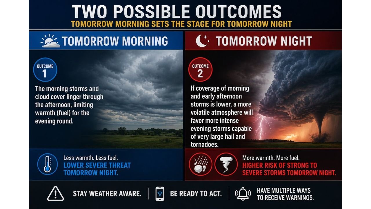
How Tomorrow Morning Sets the Stage for Tomorrow Night
The atmospheric fuel available for evening storm development — primarily surface warmth and instability — is directly controlled by what happens during the morning and early afternoon hours. Storms and cloud cover are not neutral events. Every hour that clouds block the sun and morning convection churns through the atmosphere is an hour that surface temperatures fail to rise and CAPE (Convective Available Potential Energy) fails to recover. By the time the evening storm window opens, the fuel tank is either full or partially drained — and morning activity determines which.
Outcome 1 — Morning Storms Linger, Evening Threat Stays Lower
If morning storms and cloud cover persist through the afternoon:
- Surface heating is suppressed across the risk zone
- Warmth and atmospheric fuel remain limited heading into the evening hours
- The evening storm round develops in a less unstable environment
- Result: Lower severe threat Monday night — storms remain possible but lack the fuel to reach their most dangerous potential
This is the more contained scenario. Severe weather is not eliminated, but the ceiling on storm intensity is significantly lower when the atmosphere has not had time to recover and reload through afternoon heating.
Outcome 2 — Morning Coverage Stays Low, Evening Becomes Volatile
If coverage of morning and early afternoon storms is lower and skies clear by midday:
- Afternoon sunshine drives rapid surface heating
- Warmth and instability build through the afternoon, loading the atmosphere with fuel
- The evening storm round fires into a volatile, highly unstable environment
- Result: Higher risk of strong to severe storms Monday night — capable of producing very large hail and tornadoes
This is the high-end scenario. A morning that stays relatively quiet and clears efficiently hands the evening storms a fully loaded atmosphere, and the ingredients already in place — deep moisture, strong shear and a well-defined frontal boundary — are sufficient to support intense, long-tracked supercells.
What Separates These Two Outcomes in Plain Terms
| Outcome 1 | Outcome 2 | |
|---|---|---|
| Morning storms | Widespread, lingering | Isolated, clearing early |
| Afternoon cloud cover | Persistent | Clearing by midday |
| Surface heating | Suppressed | Rapid and strong |
| Evening fuel | Less warmth, less CAPE | More warmth, more CAPE |
| Evening severe threat | Lower | Higher — hail and tornadoes |
What Every Resident Needs to Do Regardless of Outcome
The forecast uncertainty does not change the preparation requirements. Both outcomes still carry a severe weather threat Monday night — only the magnitude differs. Forecasters are explicit on three actions every resident in the risk zone should take now:
- Stay weather aware — monitor forecasts through the morning hours Monday for which outcome is materializing
- Be ready to act — when warnings are issued Monday evening, the time to move to shelter is immediately, not after watching the storm approach
- Have multiple ways to receive warnings — a weather app alone is not sufficient; a NOAA weather radio, phone alerts and a reliable local broadcast source together ensure no warning goes unheard, particularly if storms arrive after dark
What to Watch Monday Morning
The outcome determination window is Monday morning into early afternoon. Key signals:
- Widespread rain and thunder still ongoing across Illinois and Indiana by 10 AM points toward Outcome 1 — adjust expectations for a more limited evening threat
- Isolated or clearing activity by late morning with sunshine returning points toward Outcome 2 — treat the evening hours as a high-end severe weather window and have shelter plans finalized before afternoon
- Surface dewpoints holding at 68°F or above through the afternoon confirm the moisture axis is intact regardless of morning storm coverage, keeping the evening threat elevated in either scenario
WaldronNews.com will continue tracking Monday’s evolving severe weather setup and provide updates on which outcome is materializing as morning conditions become clear.
The feature image used in this article was created with the assistance of artificial intelligence.