
Colorado, Kansas and Nebraska Face Scattered Supercells Wednesday Afternoon as Hail and High Winds Target the High Plains
DODGE CITY, Kansas — Widely scattered severe thunderstorms are expected to develop across the High Plains Wednesday afternoon, with Colorado, Kansas, and Nebraska in the primary zone as storm-supporting dew points of 57–62°F surge into the region by 3 PM MDT.
While this is not a widespread outbreak, any storms that do get going will carry real threats — large hail and damaging high winds are the primary dangers for anyone caught outdoors across the central High Plains Wednesday afternoon and evening.
States and Areas in the Wednesday Afternoon Storm Zone
The scattered storm threat is focused along a north-south corridor through the central Plains:
- Nebraska: Central and southwestern Nebraska in the storm initiation zone where dew points reach the upper 50s
- Kansas: Western and central Kansas facing the highest storm probability as moisture and instability converge around 3 PM MDT
- Colorado: Eastern Colorado on the western edge of the moisture axis with storm potential increasing through the afternoon
- Oklahoma: Northern Oklahoma on the southern fringe as dew points push into the low 60s
- Texas: Texas Panhandle and northwestern Texas may see isolated storm activity late Wednesday
Primary Threats
Storms that develop Wednesday afternoon will pack dangerous conditions despite being scattered:
- Large hail — dew points of 57–62°F combined with sufficient instability create favorable hail growth conditions in any storm that organizes
- Damaging high winds — the storm environment supports wind-producing convection, with gusts capable of causing property damage and dangerous driving conditions
- Supercell potential — the low pressure system tracking nearby provides enough wind shear for a few storms to take on supercell characteristics, increasing tornado potential in isolated cases
Why This Matters for Kansas and Nebraska
Dodge City, Kansas sits directly in the moisture convergence zone where Wednesday afternoon storms are most likely to fire. Dew points jumping from the dry 30s and 40s of the western High Plains into the upper 50s and low 60s across central Kansas mark the exact boundary where storm initiation becomes possible — and Dodge City sits right on that line.
The key detail here is the 3 PM MDT timing. This is a late-afternoon heating-driven event. As afternoon temperatures peak and low-level moisture surges in from the south, the atmosphere destabilizes quickly. Storms that fire along this moisture boundary can intensify fast, especially with the supporting low pressure nearby keeping wind fields favorable.
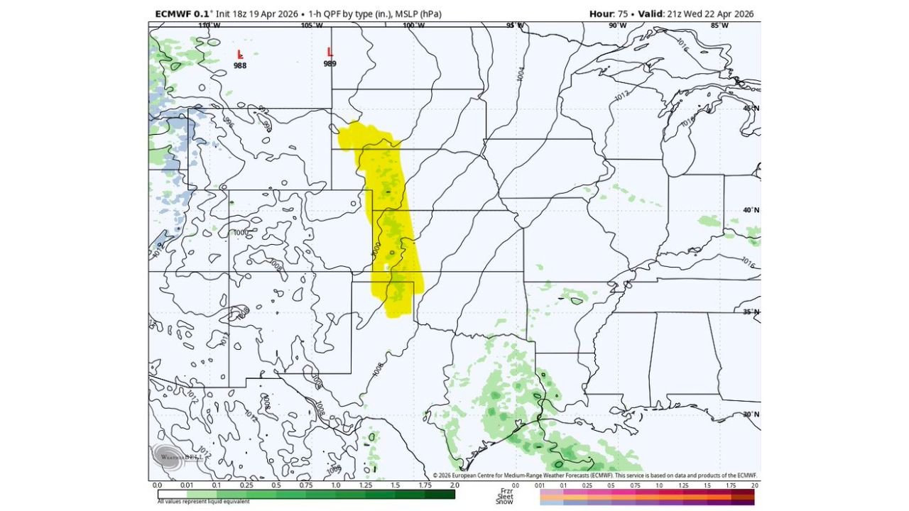
For Nebraska, the moisture axis shown on the dew point map pushes dew points into the mid-to-upper 50s across central and southwestern parts of the state by Wednesday afternoon — enough to support storm development even without a deeply juicy moisture return. The QPF forecast shows the heaviest storm activity focused along a north-south corridor from central Nebraska into western Kansas around 3 PM MDT.
The scattered nature of this setup actually increases the danger in some ways — isolated storms have access to all available instability without competition from neighboring storms, allowing individual cells to grow stronger.
Multi-Day Pattern
Wednesday’s scattered High Plains storms are the opening act of a much larger severe weather pattern. The same low pressure system responsible for Wednesday’s activity deepens and tracks northeast, setting up a major severe weather event for Thursday and Friday across Iowa, Illinois, Wisconsin, and surrounding states. Wednesday is a warm-up; Thursday is the main event.
For the High Plains, conditions return to a quieter pattern by Thursday as the low pulls away to the northeast and drier air filters back in from the west.
What to Watch Next
- Storm initiation timing Wednesday near 3 PM MDT across western Kansas and southwestern Nebraska
- Whether any storms organize into supercells with tornado potential along the moisture boundary
- Hail reports Wednesday afternoon from the Dodge City and Liberal, Kansas area
- The low pressure position Wednesday evening as it begins accelerating toward the Midwest
- Thursday’s major outbreak setup for Iowa and Illinois as this same system deepens
Residents across western Kansas, central Nebraska, and eastern Colorado should keep a close eye on the sky Wednesday afternoon and have a plan ready if storms approach. Hail can develop quickly with little warning when the atmosphere is loaded like this.
WaldronNews.com will continue tracking Wednesday’s High Plains storm threat and Thursday’s major Midwest outbreak as both events approach.