
Colorado, Kansas, Missouri, Illinois, Indiana, Michigan, and Florida Face Tuesday Severe Storm Threat With Damaging Winds and Hail From Central Plains to Midwest and Florida Peninsula
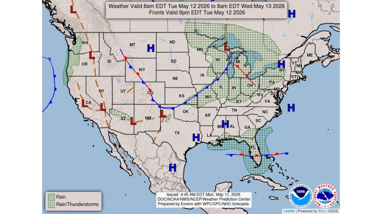
UNITED STATES — A developing weather system is expected to bring scattered strong to isolated severe thunderstorms on Tuesday, stretching from parts of the central Plains into the Midwest, while a separate zone of storms targets the Florida Peninsula with additional wind threats.
Central Plains to Midwest: Isolated Severe Storms Expected
A frontal boundary extending from the Rockies into the central U.S. will act as the primary trigger for storm development. Areas most at risk include:
- Colorado
- Kansas
- Missouri
- Illinois
- Indiana
- Michigan
Storms are expected to develop along and ahead of this boundary and push northeast through the day.
Main Threats in This Region
- Strong to damaging wind gusts
- Hail with stronger storm cores
- Locally intense thunderstorms, especially during peak heating hours
While the severe threat is currently categorized as isolated, any storm that strengthens could quickly become impactful, particularly in parts of Missouri, Illinois, and Indiana, where better moisture and instability are present.
Upper Midwest and Great Lakes Also Under Storm Zone
A broader region from Wisconsin into Michigan and surrounding Great Lakes areas is expected to see widespread showers and thunderstorms, though not all storms will reach severe levels.
However, embedded stronger cells could still produce:
- Gusty winds
- Brief heavy rainfall
- Localized thunderstorm clusters
Florida Peninsula: Separate Storm Threat Develops
At the same time, a different setup will bring additional thunderstorm activity across eastern Florida, particularly along the peninsula.
Florida Storm Risks Include:
- Damaging wind gusts
- Frequent lightning
- Fast-moving thunderstorms during the afternoon and evening
Moisture-rich conditions combined with local boundaries will allow storms to develop quickly, especially in central and eastern Florida regions.
Weather Pattern Driving the Setup
The overall pattern shows:
- A cold front pushing from the Rockies into the Midwest
- Multiple low-pressure systems embedded along the boundary
- Warm, unstable air ahead of the front fueling storm development
This setup supports scattered but potentially strong storms across multiple regions simultaneously.
Timing Breakdown
- Morning: Storms begin forming across the central Plains
- Afternoon: Stronger storms develop and move into Missouri, Illinois, and surrounding areas
- Evening/Night: Storms continue into Indiana and Michigan
- Florida: Peak storm activity expected during afternoon into evening hours
What Residents Should Watch
- Sudden strong wind gusts with developing storms
- Hail potential in stronger cells across the Plains and Midwest
- Quick-moving storms in Florida capable of localized damage
- Rapid weather changes along the frontal boundary
This is not a widespread high-end outbreak, but rather a multi-region, scattered severe setup where localized impacts could still be significant.
Stay with WaldronNews.com for continued updates as this Tuesday storm system evolves across the central and eastern United States.