
First Tropical Activity Signal of 2026 Appears in Southwest Atlantic Around May 23 as Hurricane Season Approaches Florida and the Southeast Coast
MIAMI, Florida — For the first time in 2026, a computer model is showing a low-probability signal for tropical development in the southwest Atlantic, with the potential activity appearing in the 8 to 10 day timeframe around Saturday, May 23, 2026. While the probability is low and only a handful of ensemble model runs are showing anything, it marks a notable milestone as the Atlantic hurricane season draws closer.
This is not a forecast for a storm. It is a first flicker of tropical signal in 2026 and a sign that the season is quite literally around the corner.
What the Model Is Showing
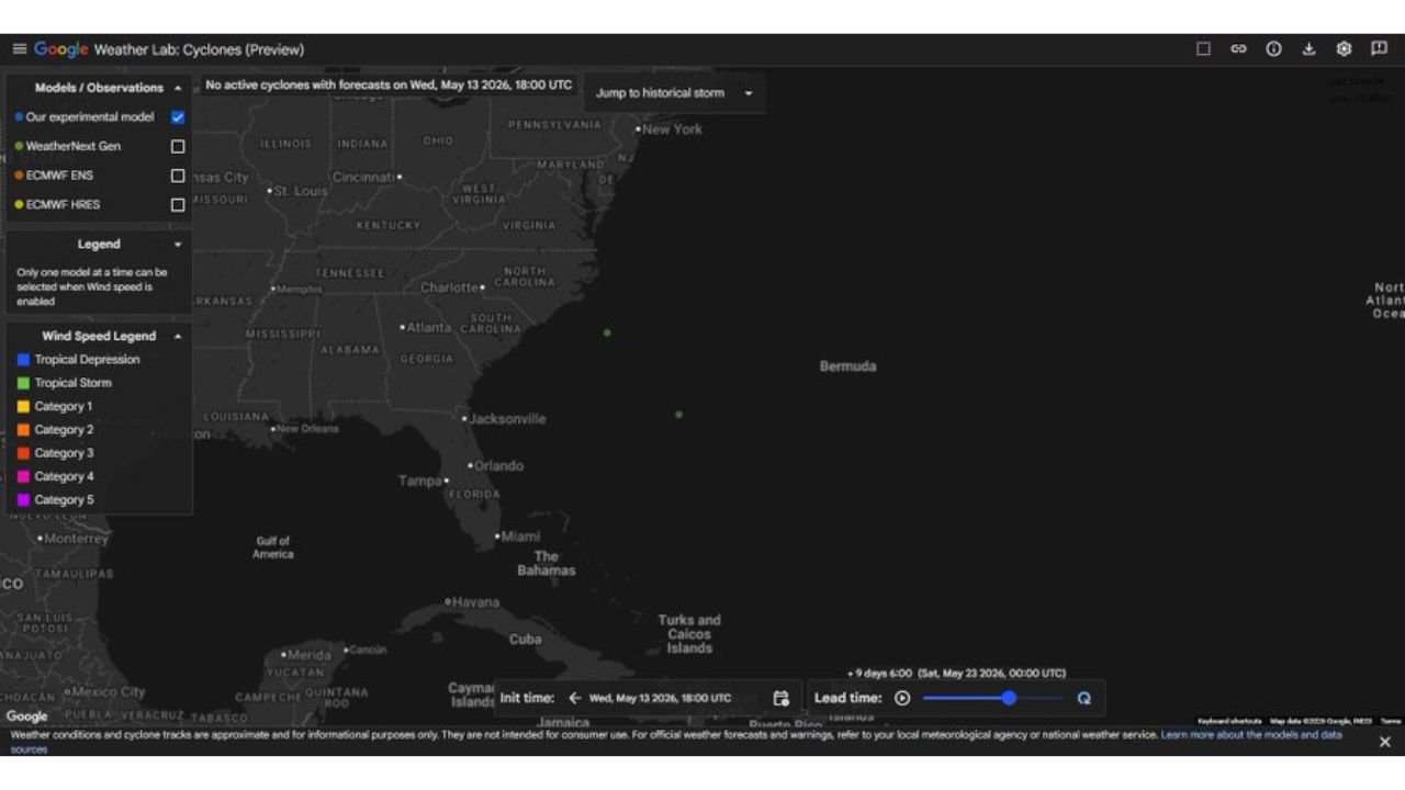
The Google AI experimental cyclone model valid Wednesday, May 13, 2026 at 18:00 UTC with a lead time of 9 days points to a possible area of tropical interest in the southwest Atlantic around Saturday, May 23:
Only a handful of ensemble members are showing any tropical signal at this range. The model dots visible on the map near the southwest Atlantic are classified at the tropical depression level on the wind speed legend, meaning the signal is weak and disorganized rather than anything approaching a named storm. Other models are also showing something similar skirting out to sea, but confidence is extremely low at this 8 to 10 day range.
The most likely outcome is that nothing develops. But the appearance of any tropical signal this early in 2026 is worth noting.
Why This Matters Even at Low Probability
This is the first time in 2026 that any major modeling system has flagged even a marginal tropical signal in the Atlantic. That alone makes it worth paying attention to for two reasons.
First, it signals that the atmosphere is beginning to show the type of patterns that can support tropical development, even if this specific signal amounts to nothing. Second, the official Atlantic hurricane season begins June 1, which is now less than 3 weeks away. Pre-season tropical development is not unusual historically, and a signal appearing in the southwest Atlantic in late May is consistent with early-season activity patterns.
The low-probability nature of this signal means Florida, Georgia, South Carolina and North Carolina residents should not be alarmed. But they should take note that the background environment is beginning to support the types of discussions that will become much more frequent over the coming months.
What Residents Along the Southeast Coast Should Do Now
The arrival of even a low-probability tropical signal is a good reminder for residents along the Florida, Georgia, South Carolina and North Carolina coastlines to use the remaining weeks before June 1 to get hurricane-ready:
Review your hurricane evacuation zone and know your route before the season begins. Assemble or restock your emergency supply kit now including water, non-perishable food, medications, flashlights, batteries and important documents. Ensure your homeowner or renter insurance policy is current and that you understand what is and is not covered for hurricane and flood damage before any storm threatens.
The time to prepare is now, before any active storm is in the forecast, not after one develops.
The Season Outlook Context
As noted in earlier reporting this season, below-normal sea surface temperatures across the main tropical development zone from the Gulf of Mexico to the Coast of Africa are expected to limit overall 2026 Atlantic hurricane season activity compared to recent years. However, any storms that do form are expected to recurve northward due to above-normal sea surface temperatures in the North Atlantic, which could still bring impacts to the East Coast even in a quieter overall season.
One quiet season or a low-probability signal does not mean zero risk. It only takes one storm making landfall near your community to cause catastrophic damage regardless of what the overall seasonal forecast says.
WaldronNews.com will continue tracking this low-probability tropical signal in the southwest Atlantic and will provide updates as the May 23 timeframe approaches and model confidence in any tropical development near Florida and the Southeast Coast develops.