
Illinois, Kansas, Oklahoma, Iowa and Missouri Face Growing Tornado and Severe Storm Threat in Late May as Gulf Moisture and Stronger Troughs Signal an Active Pattern Return
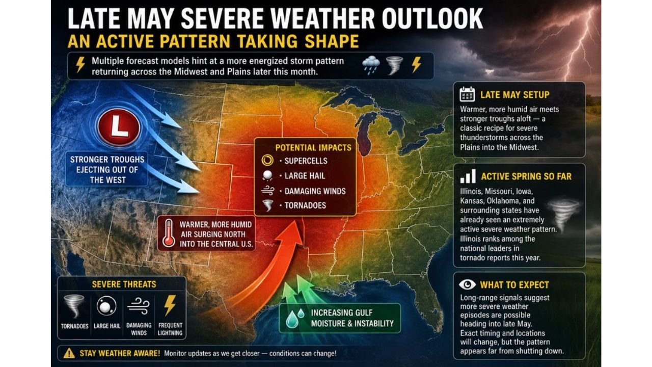
CHICAGO, Illinois — The end of May is shaping up to bring a significant return of severe weather across the Plains and Midwest, with multiple long-range signals pointing toward warmer and more humid air surging northward into the central United States while stronger troughs eject out of the western United States — a classic recipe for supercells, large hail, damaging winds and tornadoes across the Plains into the Midwest. Illinois, Missouri, Iowa, Kansas and Oklahoma have already seen an extremely active spring, with Illinois currently ranking among the national leaders in tornado reports for 2026. The atmosphere appears far from shutting down heading into the final week of May.
What the Late May Pattern Is Setting Up
The late May severe weather setup is being driven by two converging factors:
- Warmer and more humid air surging north from the Gulf of Mexico into the central United States — increasing instability and moisture that fuel explosive thunderstorm development
- Stronger troughs ejecting out of the western United States — these upper-level disturbances provide the wind shear and lift needed to organize storms into supercells capable of all severe hazard types
When these two ingredients combine across the Plains and Midwest in late May, the result is historically one of the most productive severe weather setups of the entire year. The pattern currently showing up in long-range guidance matches this description closely.
Potential Impacts Across the Region
- Supercells — discrete rotating thunderstorms capable of producing all severe hazard types simultaneously
- Large hail — organized supercells in this environment will produce hail as a primary threat
- Damaging winds — both within supercells and along any squall lines that develop
- Tornadoes — the combination of Gulf moisture and western troughs creates the shear environment needed for significant tornado potential
- Frequent lightning — widespread convection across the entire corridor
Who Has Already Been Hit Hard This Spring
The current spring season has been exceptionally active across the central United States:
- Illinois ranks among the national leaders in tornado reports for 2026 — the state has been hit repeatedly through April and May
- Missouri, Iowa, Kansas and Oklahoma have all seen extremely active severe weather patterns through the spring
- The atmosphere across this corridor has shown no signs of a sustained quiet period and the late May signals suggest continued activity rather than a seasonal slowdown
What to Watch as Late May Approaches
- Illinois, Missouri and Iowa face continued elevated tornado risk into late May on top of an already historic spring season
- Kansas and Oklahoma sit in the primary zone where Gulf moisture and western troughs will clash — watch these states closely for the first organized outbreak days as the pattern firms up
- Increasing Gulf moisture is the key ingredient to monitor — when dewpoints surge into the upper 60s and lower 70s across the Plains, severe weather outbreaks become increasingly likely
- Exact storm days and target areas will shift as the pattern gets closer — long-range signals are reliable for identifying active periods but not for pinpointing specific outbreak dates more than 5 to 7 days out
- Stay weather aware through the entire final week of May — multiple severe weather episodes are possible across the Plains and Midwest as the energized pattern takes shape
WaldronNews.com will continue monitoring the late May severe weather pattern across Illinois, Kansas, Oklahoma, Iowa and Missouri and will provide updates as specific threat days come into focus over the coming week.