
Southeast United States, Southwest United States and Northern Great Plains Face Severe Storms, Critical Fire Weather and Moderate Heat Risk Monday May 11
ATLANTA, Georgia — A combination of severe thunderstorms, critical fire weather and elevated heat risk is affecting large portions of the United States today, Monday, May 11, 2026, creating multiple simultaneous hazards from the Southeast to the Southwest and across the northern Great Plains.
Isolated severe thunderstorms capable of locally damaging wind gusts and hail are possible across parts of the Southeast United States today, while critical fire weather conditions are developing across the northern Great Plains.
Severe Storm Threat Across the Southeast
Isolated severe thunderstorms are possible Monday across parts of the Southeast United States. These storms have the potential to produce locally damaging wind gusts and hail.
Residents across the Southeast should monitor local forecasts through the afternoon and evening hours and be prepared to take shelter quickly if warnings are issued.
Critical Fire Weather in the Northern Great Plains
Elevated to critical fire weather conditions are forecast Monday across much of the northern Great Plains. Gusty winds and low relative humidity are the primary drivers of this dangerous combination.
- Gusty winds paired with low humidity can cause any fire to spread rapidly and make it extremely difficult for firefighters to contain.
- Residents across the northern Great Plains should avoid any outdoor burning today and report any smoke or fire immediately.
- Any sparks from equipment, vehicles or debris burns can escalate into a major wildfire under these conditions.
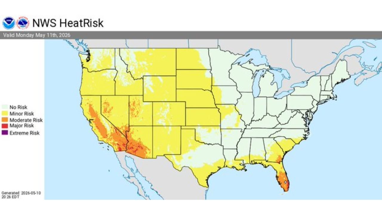
Heat Risk Across the Southeast and Southwest
Above normal temperatures across the Southeast and Southwest United States are producing moderate to isolated major Heat Risk levels Monday, May 11:
- Moderate Heat Risk is in place across portions of the Southwest, including areas shown in orange on the Heat Risk map, meaning heat-related illness is possible especially for those working or exercising outdoors.
- Major Heat Risk is affecting isolated areas of the Southwest, shown in deeper orange, where dangerous heat conditions can cause heat exhaustion or heat stroke without adequate hydration and rest.
- Minor Heat Risk covers large portions of the Southeast, the central Great Plains and parts of the Northwest, shown in yellow, where above normal temperatures will be noticeable but manageable for most healthy individuals.
Safety Tips for Today
Anyone spending time outdoors Monday, May 11 across the affected regions should take the following precautions:
- Drink water consistently throughout the day and avoid outdoor exertion during peak afternoon heat if you are in a Moderate or Major Heat Risk zone.
- If you are in the Southeast, keep a close eye on weather alerts this afternoon as severe storms can develop quickly with little warning.
- If you are in the northern Great Plains, do not start any outdoor fires today under any circumstances given the critical fire weather conditions in place.
WaldronNews.com will continue tracking severe storm chances, critical fire weather and heat risk conditions across the Southeast United States, Southwest United States and northern Great Plains and will provide updates as storm and fire weather conditions develop through Monday, May 11.