
Washington D.C. Snaps a Nine-Day Cold Streak Monday Before Temperatures Crash Back to 60 Degrees by Wednesday After a Brief Mid-80s Warmup
WASHINGTON, D.C. — After nine consecutive days of below-average temperatures, Washington D.C. is getting one brief window of warmth this week before the cold returns just as quickly as it left. Temperatures today are running close to the seasonal average for the first time in over a week, with Tuesday expected to surge into the mid-80s before a sharp pattern reversal drops highs back to around 60 degrees by Wednesday, a swing of more than 20 degrees in 48 hours.
Nine Days Below Normal, Then a One-Day Reprieve
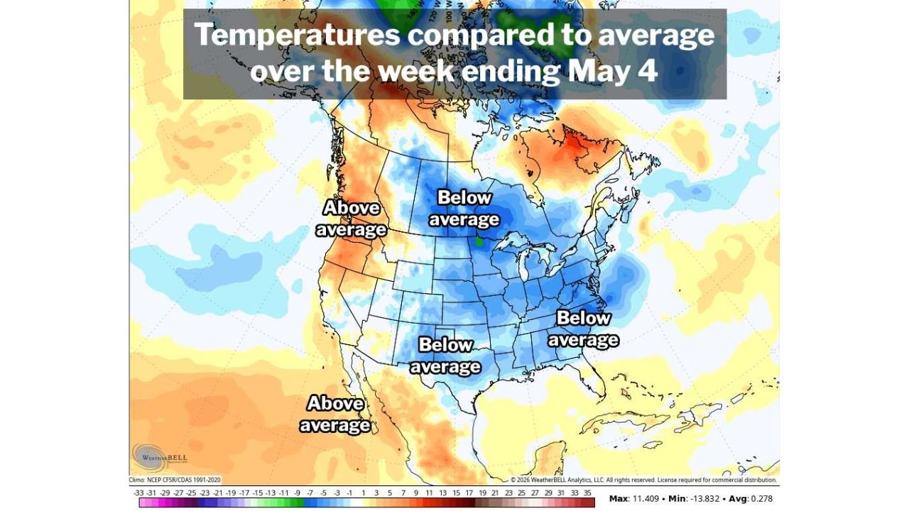
The temperature departure map covering the week ending May 4 shows a dominant below-average pattern blanketing the entire central and eastern United States, with the blue shading stretching from the Northern Plains south through Texas and east through Washington D.C. and the Mid-Atlantic.
For D.C. specifically, the past nine days have run solidly cold against a seasonal backdrop where:
- Average high for this date: 74 degrees
- Average low for this date: 54 degrees
- Warmest reading over the stretch: 77 degrees
- Coldest reading over the stretch: 51 degrees
Despite the cold run, the year overall is still running just 0.1 degree above normal through yesterday, meaning the nine-day streak has not yet dragged the annual average into negative territory.
What the Next 48 Hours Look Like
The temperature pattern over the next two days in Washington D.C. is unusually dramatic for early May:
Today (Monday): Near normal, close to the average high of 74 degrees
Tuesday: Highs surge toward the mid-80s, a significant warmup driven by a brief southerly flow ahead of an approaching cold front
Wednesday: Highs crash back to around 60 degrees as the front pushes through, a drop of roughly 20 to 25 degrees in a single day
That kind of temperature swing in 48 hours in early May is a sharp reminder that the cold pattern has not broken, it is simply pausing for one day before reasserting itself across the region.
The Broader Pattern
The temperature departure map tells the story clearly. The western United States and Mexico are running above average, with warm orange and red shading across the Pacific Northwest, California and the Southwest. Everything from the central Plains eastward through D.C. and into the Northeast remains locked in a below-normal temperature regime that has dominated the eastern half of the country for the better part of two weeks.
Until the large-scale pattern shifts and allows persistent warm air to build from the south, Washington D.C. and much of the eastern United States should expect continued episodes of below-normal temperatures interrupted by only brief warm breaks like the one arriving Tuesday.
WaldronNews.com will continue tracking temperature trends across Washington D.C. and the eastern United States and will provide updates as the pattern evolves through the week.