
California Bomb Cyclone Triggers 1,000-Mile Stretch of High Wind Warnings From San Diego to Washington State
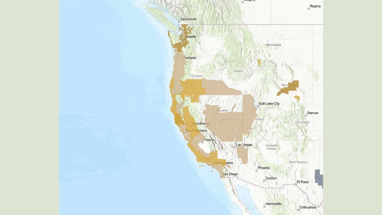
CALIFORNIA — A rapidly intensifying bomb cyclone offshore of the West Coast is driving a widespread and dangerous wind event, prompting High Wind Warnings, Wind Watches, and Wind Advisories along more than 1,000 miles of coastline from Southern California through the Pacific Northwest.
Forecast maps show expanding warning coverage along coastal and inland zones as the powerful low-pressure system strengthens over the eastern Pacific, tightening pressure gradients and accelerating winds across multiple states.
California Coast Faces the Core of the Wind Threat
The most significant impacts are expected across California, where coastal counties from San Diego through Los Angeles, the Central Coast, and the San Francisco Bay Area are under wind-related alerts.
Wind-prone terrain, including coastal headlands, mountain passes, and canyon corridors, is expected to experience strong to damaging gusts, increasing the risk of:
- Downed trees and power lines
- Power outages
- Travel disruptions on coastal highways
- Hazardous conditions for marine and high-profile vehicles
Northern and Central California appear especially vulnerable as the cyclone deepens offshore and pulls stronger winds inland.
Oregon and Washington See Expanding Warnings
Farther north, Oregon and Washington are also seeing widespread advisory and warning coverage, particularly along:
- The Oregon Coast
- The Willamette Valley
- Western Washington including Puget Sound and the Seattle metro area
Forecast guidance indicates winds strengthening as the system lifts northward, with exposed coastal and elevated locations most likely to see advisory- to warning-level gusts.
Interior West Also Impacted by Strong Gradient Winds
While the coastal states face the most direct impacts, the tightening pressure field is also extending inland, bringing gusty winds into parts of Nevada, Utah, Idaho, and Wyoming.
These areas may not see coastal-level wind speeds, but strong downslope and gap winds could still cause localized travel issues and blowing dust in exposed regions.
Why This System Is Unusually Large
Meteorologists are highlighting the exceptional scale of this event. The wind alerts span more than 1,000 miles, a sign of how expansive and intense the pressure gradient has become as the bomb cyclone rapidly strengthens offshore.
Such systems are capable of producing long-duration wind events, meaning impacts may persist over multiple forecast periods rather than peaking briefly.
What Residents Should Do Now
Officials urge residents across affected regions to:
- Secure loose outdoor items
- Prepare for possible power outages
- Use caution when driving, especially in high-profile vehicles
- Monitor local National Weather Service updates for changes to warnings
Conditions may evolve quickly as the storm continues to intensify offshore.
WaldronNews.com will continue tracking this developing West Coast storm system and provide updates as warnings expand or conditions worsen. Stay with us for the latest regional weather coverage.