
Alabama, Georgia, North Carolina, South Carolina, and Tennessee Face Prolonged Warm and Snow-Free Pattern as 10-Day Outlook Shows No Winter Storm Signals
UNITED STATES — A persistent warm and dry weather pattern is expected to dominate much of the Southeast over the next 10 days, with no meaningful cold air or snowfall showing up in reliable forecast guidance for states including Alabama, Georgia, North Carolina, South Carolina, and Tennessee, according to blended model data and long-range outlooks.
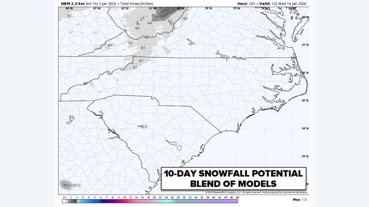
Forecast graphics analyzing 10-day snowfall potential show near-zero accumulation across nearly the entire Southeast, reinforcing concerns that winter weather lovers may have to wait longer for any cold-season disruption. The same pattern is also intensifying dry conditions, raising additional drought concerns across the region.
No Snow or Cold Signals Appearing in 10-Day Model Blends
Blended snowfall guidance extending through mid-January indicates little to no snow accumulation across the Southeast. The maps show mostly blank or trace-level totals, meaning even light wintry precipitation chances are minimal during this period.
Meteorologists caution against relying on single deterministic model runs that occasionally show dramatic cold or snow events circulating on social media. Instead, pattern recognition and ensemble consistency strongly support a continued warm and snow-free setup.
This reinforces the idea that outlier model runs should not be treated as forecast certainty, especially when broader data sets fail to support them.
Warm and Dry Pattern Dominates the Southeast
The lack of snow is being driven by a persistent warm pattern, which has kept temperatures above seasonal averages while limiting moisture availability. Not only has the region avoided cold outbreaks, but rainfall has also been scarce, compounding concerns about worsening drought conditions.
Meteorological commentary notes that this is not just a warm stretch — it is a dry one, which has important implications for agriculture, water resources, and wildfire risk moving forward if the pattern persists.
Drought Concerns Grow as Winter Moisture Remains Absent
While winter typically provides opportunities for soil moisture recovery, the current setup is doing the opposite. With limited precipitation expected, existing drought conditions are likely to worsen across parts of the Southeast if the pattern holds.
This is especially concerning given that winter is one of the best times for gradual drought relief, as cooler temperatures reduce evaporation and allow precipitation to soak in more efficiently. Without rain or snow, that opportunity is being missed.
Winter Is Not Over, but Patience Will Be Required
Despite the discouraging short-term outlook for snow lovers, forecasters emphasize that there is still plenty of winter left. Pattern changes can and do occur later in the season, and a more favorable setup for cold or snow could still develop later.
However, for now, there are no reliable signs of a winter storm pattern emerging in the Southeast, and expectations should remain grounded in the broader data rather than isolated forecast graphics.
Stay with WaldronNews.com for continued weather pattern analysis, long-range outlook updates, and clear explanations that cut through model hype and social-media misinformation as the winter season continues to evolve.