
Northeast Tennessee and Southwest Virginia Buried by Intensifying Winter Storm as Snow Totals Surge Past Forecasts
NORTHEAST TENNESSEE — A powerful winter storm continues to intensify across parts of Northeast Tennessee and Southwest Virginia, producing heavy, persistent snowfall that is already exceeding earlier expectations and shows no signs of letting up as the system continues to evolve overnight.
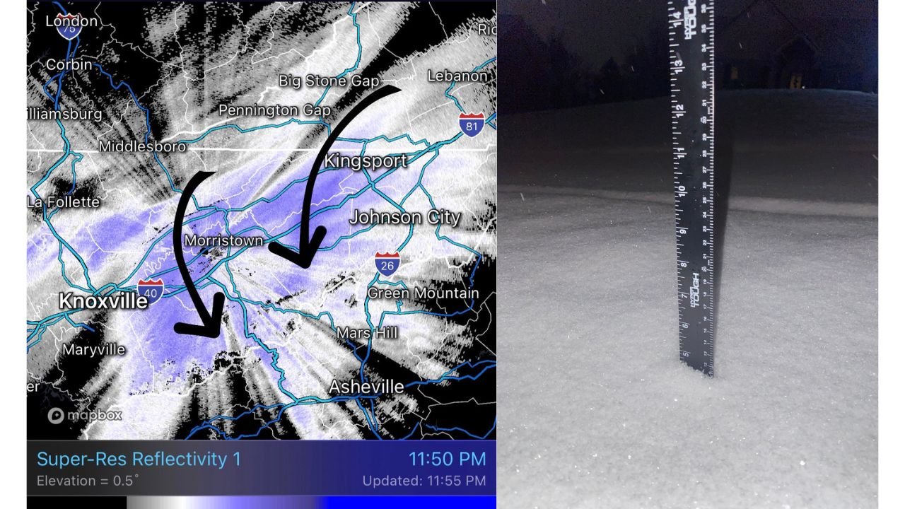
As of 12:20 a.m., observers report 4.5 inches of snow in Johnson City, Tennessee, with snowfall rates still increasing. Across much of Northeast Tennessee, snow totals are widely ranging between 4 and 6 inches, with some locations pushing higher under persistent heavy bands.
Snow Totals Rapidly Increasing Across the Region
Reports indicate:
- Johnson City, TN: 4.5 inches and climbing
- Widespread Northeast Tennessee: 4 to 6 inches reported
- Lebanon, Virginia: Up to 10 inches observed
Forecasters note that Lebanon had been expected to top out near 10 inches for the entire storm, meaning some locations are now meeting or exceeding projected maximums earlier than anticipated.
Radar Shows Powerful Snow Bands Setting Up Along I-81 Corridor
Radar imagery confirms strong, well-organized snow bands stretching from Knoxville through Morristown, Johnson City, and into Southwest Virginia, with the most intense snowfall currently favoring areas west of Interstate 81.
However, meteorologists warn that this setup is about to change.
Heaviest Snow Expected to Shift East Overnight
As the storm’s low-pressure system begins transferring toward the East Coast, the axis of heavy snow is expected to pivot eastward, placing areas east of I-81 under increasingly intense snowfall overnight and into Saturday.
With temperatures locked in the teens, snow will accumulate efficiently, even during lighter bursts. Forecasters say another 15 hours or more of steady snowfall is likely, raising the risk for significantly higher totals by the time the storm finally winds down.
Why This Storm Is So Impactful
Meteorologists monitoring the system describe it as performing at a level rarely seen in this region, driven by:
- Strong lift within the storm’s core
- Persistent banding that refuses to weaken
- Very cold surface temperatures allowing near-instant accumulation
This combination has created ideal conditions for rapid snow buildup, making travel extremely dangerous and increasing the likelihood of power outages and road closures.
What Residents Should Expect Next
Residents across Northeast Tennessee and Southwest Virginia should prepare for:
- Continued heavy snow through Saturday
- Rapidly deteriorating road conditions
- Difficult or impossible travel in mountainous and rural areas
- Snow totals that may continue to exceed earlier forecasts
Officials urge people to remain off roads unless absolutely necessary and to closely monitor local emergency alerts as conditions evolve.
Stay With WaldronNews
WaldronNews will continue providing overnight snowfall updates, radar trends, and regional impact reports as this high-impact winter storm continues to unfold across the southern Appalachians.